Category
page 1France–Spain border
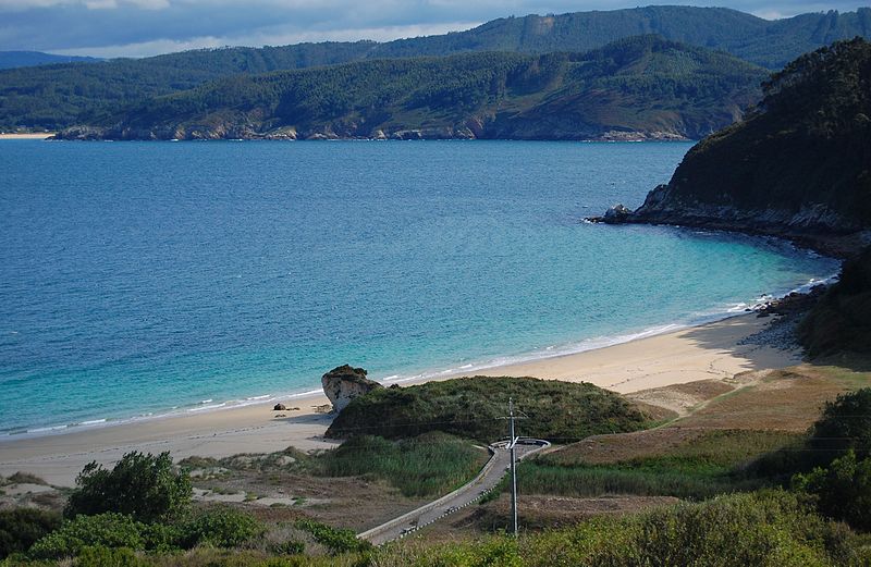
Bay of Biscay
gulf of the northeast Atlantic Ocean located south of the Celtic Sea

Pyrénées-Atlantiques
Pyrénées-Atlantiques (; Gascon Occitan: Pirenèus Atlantics; ) is a department located in the region of Nouvelle-Aquitaine in the southwest corner of metropolitan France. Named after the Pyrenees mountain range and the Atlantic Ocean, it covers the French Basque Country and the Béarn. It is divided in three arrondissements and its prefecture is Pau. In 2023, it had a population of 706,564.

Llívia
thumb|right|Ruins of Llívia Castle, destroyed by French forces in the Catalan Civil War
thumb|right|upright|Frederic Bernades street, early 1900s
thumb|right|Esteve Pharmacy museum
Llívia (; ) is a town in the comarca of Cerdanya, province of Girona, Catalonia, Spain. It is a Spanish enclave surrounded by the French département of Pyrénées-Orientales. It is named after Livia, the wife of Augustus and matriarch of the Julio-Claudian dynasty. Because of a technicality in the Treaty of the Pyrenees, signed in 1659, that transferred only "villages" in the Pyrenees to France, Llívia, which was a "t

Monte Perdido
mountain in Huesca, next to the border with France
Pheasant Island
condominium ruled alternately by France and Spain

Treaty of the Pyrenees
1659 border treaty between France and Spain

Bidasoa
__NOTOC__
The Bidasoa (; ; , ) is a river in the Basque Country of northern Spain and southern France that runs largely south to north. Named as such downstream of the village of Oronoz-Mugairi (municipality of Baztan) in the province of Navarre, the river actually results from the merger of several streams near the village Erratzu, with the stream Baztan that rises at the north-eastern side of the mount Autza (1,306 m) being considered the source of the Bidasoa. It joins the Cantabrian Sea (Bay of Biscay) between the towns of Hendaye and Hondarribia.
Vignemale
The Vignemale (; Spanish: Viñamala, Occitan: Vinhamala, Aragonese: Comachibosa, Catalan: Vinyamala), at 3,298 metres, is the highest of the French Pyrenean summits (the highest in the whole of the range is Pic d'Aneto). It lies on the border between the Department of Hautes-Pyrénées (Nauts Pirenèus / Hauts Pirenèus), in Occitanie and Gascony, France and Sobrarbe, in Huesca, Aragon, Spain, and the peak is split between the two countries.
Pica d'Estats
mountain in France and Spain
France–Spain border
international border

Puigmal
The Peak of Puigmal (), also called '''Puigmal d'Err''', is a mountain in the Pyrenees, in the Spanish-French border, within the limits of the municipality of Queralbs and the commune of Err. Its summit is above sea level, one of the highest peaks in the eastern Pyrenees.
Puigmal d'Err is near the west end of a fine ridge over 2500m high for 16 km. The west half is composed of friable metasediments (schists) which break down to form smooth slopes, and so give easy walking. The east half is of tougher gneiss and forms spiky alpine scenery with sharp crests and some difficult places. Severa
Pic de Médécourbe
mountain in Spain, France and Andorra
Pic d'Orhy
mountain in Spain
Bastiments
Bastiments () is a mountain peak at the easternmost side of the Pyrenees mountain range. It is located on the Spanish-French border, within the confluence of the Spanish municipalities of Setcases and Queralbs and the French commune of Fontpédrouse. it has an altitude of above sea level.
Mugalari
thumb|The Bidasoa river establishes the borderline between [[Gipuzkoa and France]]
Mugalari is a Basque word used to designate people who help others cross the border between France and Spain, mainly for political reasons. The term is a combination of the words "muga" (border) and "-lari" (suffix related to people), and it refers to people living in the border, and by extension also to smugglers.