Category
page 1Historical regions of Iran

Mesopotamia
Mesopotamia is a historical region of West Asia situated within the Tigris–Euphrates river system, in the northern part of the Fertile Crescent. It corresponds roughly to the territory of modern Iraq. Just beyond it lies southwestern Iran, where the region transitions into the Persian plateau, marking the shift from the Arab world to Iran.

Bactria
Bactria (; Bactrian: , ), or Bactriana, was an ancient Iranian civilization in Central Asia, located in the area south of the Oxus River (modern Amu Darya) and north of the Hindu Kush mountains, within modern-day Afghanistan, Tajikistan and Uzbekistan. Bactria was strategically located south of Sogdia and west of the Pamir Mountains. These mountain ranges acted as "walls" protecting Bactria from three sides, with the Pamir mountains to the north and the Hindu Kush to the south forming a junction, and the Karakoram range towards the east.

Balochistan
Balochistan is a historical region in West and South Asia, located in the Iranian plateau's far southeast and bordering the Indian plate and the Arabian Sea coastline. This arid region of desert and mountains is primarily populated by ethnic Baloch people. Balochistan is very significant because of its strategic location, mineral wealth, long coastline along the Arabian Sea, the Gulf of Oman and potential for discoveries of oil and gas.

Khwarazm
Khwarazm or Chorasmia is a large oasis region on the Amu Darya river delta in western Central Asia, bordered on the north by the (former) Aral Sea, on the east by the Kyzylkum Desert, on the south by the Karakum Desert, and on the west by the Ustyurt Plateau. It was the center of the Iranian Khwarezmian civilization until the 9th century, when Turkic tribes moved into and ruled the lands. A series of kingdoms such as the Afrighid dynasty and the Anushtegin dynasty, whose capitals were (among others) Kath, Gurganj (now Konye-Urgench) andfrom the 16th century onKhiva. Today Khwarazm belongs part

Azerbaijan
region in northwestern Iran

Khorasan
Khorasan is a historical eastern region in the Iranian Plateau in West and Central Asia that encompasses western and northern Afghanistan, northeastern Iran, the eastern halves of Turkmenistan and Uzbekistan, western Tajikistan, and portions of Kyrgyzstan and Kazakhstan.
Greater Iran
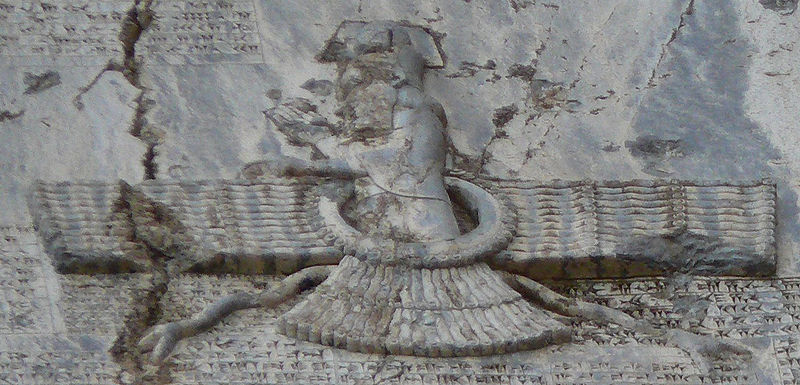
Denotes a wide socio-cultural region comprising parts of West Asia, the South Caucasus, Central Asia, South Asia, and East Asia, all of which have been affected, to some degree, by the Iranian peoples and the Iranian languages
.%20Tanlesmos.%20Circa%2080-40%20BC.%20AR%20Drachm%20(21mm%2C%203.60%20gm).%20A%20Parthian%20drachm%20of%20Orodes%20II%20with%20addition%20TANLHC%20around%20head%20left%20wearing%20leather%20cap.jpg)
Sistan
Sistān (), also known as Sakastān (, , current name: Zabol) and Sijistan (), is a historical region in south-eastern Iran, and extending across the borders of south-western Afghanistan, and south-western Pakistan. Mostly corresponding to the then Achaemenid region of Drangiana and extending southwards of the Helmand River not far off from the city of Alexandria in Arachosia. Largely desert, the region is bisected by the Helmand River, which empties into the Hamun Lake, located in Zabol, that forms part of the border between Iran and Afghanistan.

Media
Ancient region of north-western Iran

Parthia
Parthia ( Parθava; Parθaw; Pahlaw) is a historical region located in northeastern Greater Iran. It was conquered and subjugated by the empire of the Medes during the 7th century BC, was incorporated into the subsequent Achaemenid Empire under Cyrus the Great in the 6th century BC, and formed part of the Hellenistic Seleucid Empire after the 4th-century BC conquests of Alexander the Great. The region later served as the political and cultural base of the Eastern Iranian Parni people and Arsacid dynasty, rulers of the Parthian Empire (247 BC – 224 AD). The Sasanian Empire, the last state of pre-
.jpg)
Makran
thumb|The Central Makran Range in Pakistan and Iran.

Persis
Persis, also called Persia proper, is a historical region in south-western Iran, roughly corresponding with Fars province. Iranian speaking peoples, also known as Iranic speaking peoples, are thought to have initially migrated either from Central Asia or, more probably, from the north through the Caucasus giving rise to the ethnic group later known as Persians. They would then have migrated to the current region of Persis in the early 1st millennium BC.

Shirvan
thumb|250px|Safavid conquest of Shirvan|The battle between the young Safavid ruler, [[Ismail I, and Farrukh Yasar, last independent ruler of Shirvan. Unknown artist (1541), Persian miniature currently preserved in the British Library, London.]]
thumb|250px|Location of Shirvan from a geographic map of the Caucasus by German cartographer Johann Christoph Matthias Reinecke (1804), [[Bibliothèque nationale de France, Paris.]]

Tabaristan
thumb|300px|Map of northern Iran during the Iranian Intermezzo. The borders represent the traditional geographical boundaries of each region.
Tabaristan or Tabarestan (; ; from , ) was a mountainous region located on the Caspian coast of northern Iran. It corresponded to the present-day province of Mazandaran, which became the predominant name of the area from the 11th century onwards.
Arran
region located in modern-day Azerbaijan, historically in Iran

Deylam
thumb|Nature of Deylaman
thumb|The historical region of Dailam on the Caspian Sea. The present-day Iranian provinces of Gilan (left) and Mazandaran (right) are highlighted in color.
Daylam (), also known in the plural form Daylaman () (and variants such as Dailam, Deylam, and Deilam), was the name of a mountainous region of inland Gilan, Iran. It was so named for its inhabitants, known as the Daylamites.
Persian Iraq
historical region of Persia

Jibal
thumb|An 1886 map of the 10th-century Near East showing the province of Jibal
Jibāl (), also al-Jabal (), was the name given by the Arabs to a region and province located in western Iran, under the Umayyad and Abbasid Caliphates.
Ariana
In the Greco-Roman world, Ariana was a geographical term referring to a general area of land between Central Asia and the Indus River. Situated far to the east in the Achaemenid Empire, it covered a number of satrapies spanning what is today the entirety of Afghanistan, the easternmost parts of Iran, and the westernmost parts of Pakistan. "Ariana" is Latinized from [region]; [demonym]. The Greek word, in turn, is derived from the term () in Avestan.

Quhistan
thumb | right
Quhistan () or Kohistan (, "mountainous land") was a region of medieval Persia, essentially the southern part of Khurasan. Its boundaries appear to have been south of Khorasan to north, Yazd to West, Sistan to South, Afghanistan to East. Quhistan was a province in old days with a rich history in Persian literature, art and science. Notable historical towns include Tun (modern-day Ferdows), Qa'in, Gunabad, Tabas, Birjand, Turshez (modern-day Kashmar), Khwaf, Taybad, and Zawah (modern-day Torbat-e Heydarieh).
It is home to famous castles. Safron, berberies (Zereshk) and jujube (Ann
Carmania Satrapy
Persian region
Gharchistan
Gharjestan (also Gharchestan, Gharshistan, Gharchegan, Garshestan) was historical region comprising large mountainous land located between Herat and Kabul. The area comprised the lands later known as Hazarajat.

Chaghaniyan
thumb|Ambassador from Chaganian named Pukarzate (identification of the forehead), visiting king [[Varkhuman of Samarkand. An adjoining inscription reads: "I am Pukarzate, the dapirpat (chancellor) of Chaganian. I arrived here from Turantash, the lord of Chaganian". 648-651 CE. Afrasiyab murals, Samarkand.]]
Chaghaniyan (Middle Persian: Chagīnīgān; Chaghāniyān), known as al-Saghaniyan in Arabic sources, was a medieval region and principality located on the right bank of the Oxus River, to the south of Samarkand.
Qumis
a region of ancient and medieval Persia
Caspiane
Caspiane or Kaspiane (, Kaspkʿ) was the land populated by the tribe of Caspians, after whom it received its name. Originally a province of the Medes in the 3rd-2nd centuries BC, the land of the Caspians was conquered in the 2nd century BC, then passed to Caucasian Albania under Sassanid Persian suzerainty in the 5th century, and later became an independent state. In the 2nd century AD, it became known as Paytakaran, and after 387 AD became a part of the Caucasian Albanian larger region of Balasakan.
It roughly corresponded to the modern Mugan plain and Qaradagh regions.
Zamakhshar
Torshiz
alt=|thumb|Imamzadeh Hamzeh, Kashmar of the remnants of the Safavid era.
Turshiz, also known as Turaythith, is a medieval district and city of the Quhistan region. It corresponds to the Kashmar area, located in the present-day Razavi Khorasan Province, Iran. This region is divided into four regions Kashmar County, Kuhsorkh County, Khalilabad County and Bardaskan County.
Mihrajanqadhaq
Mihragan-kadag (Middle Persian), mentioned in Islamic works in the Arabized forms Mihrajanqadhaq () and Mihrajan Qashaq, was a district and province in the western Jibal, on the borders with modern-day Iran, in the early Middle Ages. Its capital was the town of Saymarah. Various Arab geographers note that the district was fertile and populous. By the 14th century, the town of Saymarah was falling in ruin, and is now deserted.