Category
page 1Landforms of Lapland (Finland)

Lake Inari
lake in Inari, Finland
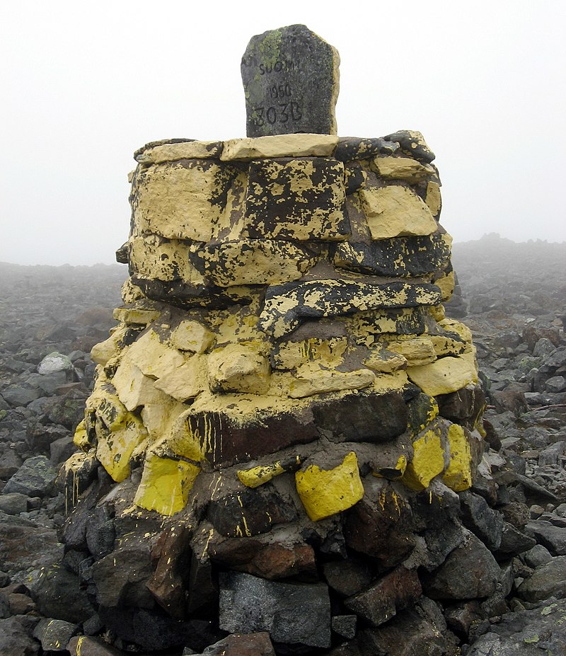
Halti
Halti (, rarely , , ) is a fell at the border between Norway and Finland. The peak (elevation ) of the fell, called Ráisduottarháldi, is in Norway, on the border Nordreisa Municipality and Gáivuotna Municipality (Kåfjord), about north of the border with Finland. The highest point of the fell on the Finnish side is at above sea level, and thus the highest point in the country. The Finnish side of Halti belongs to the municipality of Enontekiö in the province of Lapland.
Korvatunturi
Korvatunturi is a fell in Lapland, on the border between Finland and Russia. Its Finnish part is within Urho Kekkonen National Park in the municipality of Savukoski. In Finnish the name Korvatunturi means "Ear Fell", referring to the mountain's distinctive profile.

Ylläs
Ylläs, or Yllästunturi in Finnish, is a high fell in the municipality of Kolari in the Finnish Lapland. There are two villages near Ylläs: Äkäslompolo on the north side and Ylläsjärvi in the south. They are connected by an 11 km road, around the side of the fell. Both villages derive much of their income from tourism.
Aavasaksa
Aavasaksa is a sharp-edged hill in Ylitornio municipality in Finnish Lapland. It has an elevation of . Aavasaksa is famous for its sights both towards Finland and Sweden, and it is included in the list of the National landscapes of Finland. Decorative hunting cabin "Imperial Lodge" (Keisarinmaja) is one of the buildings on top of the hill. Its construction began with a visit by Alexander II of Russia in mind, but due to political instability it never happened. It's only open in the summer.
Kataja
Kataja is an islet south of Haparanda in Norrbotten. It is the easternmost point of Sweden and it is part of the Haparanda archipelago. The islet has an area of . It is about long and wide.

Ivalo River
Ivalojoki (, ) is a river in Finland that flows through upper Lapland into Lake Inari.
Saana
Saana () is a fell in Enontekiö, Finland. Saana's summit lies above sea level and above the adjacent Kilpisjärvi lake. Geologically it is part of the Scandinavian Mountains, and is made of the same kinds of schist and gneiss rock. The peak is a popular destination for hikers and backpackers because of the sweeping views offered at the summit.

Maanselkä
Maanselkä (; ) is a hilly region in Finland and Russia that forms a watershed between the Baltic Sea and the Arctic Ocean. It is located at the northern end of the East European Plain, around the Arctic Circle.
Ukonsaari
island on Lake Inari in Inari, Finland
Kilpisjärvi
lake in Enontekiö, Finland, and Kiruna, Sweden

Aakenustunturi
Aakenustunturi is a fell in Kittilä in northern Finland. It has an elevation of and is located near Mount Ylläs.

Pitsusköngäs
thumb|Pihtsusköngäs
Pitsusköngäs (also spelled Pihtsusköngäs, ; ), also known as the "Niagara of Finland" or the "King of Finnish waterfalls" is the largest waterfall in all of Finland. Its maximum height is . It is located in the Käsivarsi Wilderness Area, about from the village Kilpisjärvi within the municipality of Enontekiö. It is accessible by following the Nordkalottleden Trail, an 800 kilometer hiking route than runs through Finland, Sweden and Norway.
Kemijärvi
lake in Kemijärvi, Finland
Lemmenjoki River
river in Lapland region, Finland
Simojärvi
Simojärvi is a medium-sized lake of Finland located in Ranua, in the region of Lapland. It belongs to Simojoki main catchment area.

Kitsiputous
thumb|upright|Two hikers near the falls. At the time of taking the picture, the flow is low as the meltwater recedes.
Kitsiputous, located in Enontekiö is one of the highest waterfalls in Finland.

Pallastunturi
thumb|upright=2.0|Autumn view towards Pallastunturi
thumb|upright|A map of area
Pallastunturi is a group of seven fells in the municipalities of Muonio and Enontekiö in Lapland, Finland. The highest peak is Taivaskero, which is also highest peak of Pallas-Yllästunturi National Park and whole Lapland excluding Käsivarsi area.

Äteritsiputeritsipuolilautatsijänkä
thumb|Äteritsiputeritsipuolilautatsi-baari in Salla, Finland.
Äteritsiputeritsipuolilautatsijänkä is a bog region in Savukoski, Lapland in Finland. Its name is 35 letters long and is the longest place name in Finland, and also the third longest, if names with spaces or hyphens are included, in Europe. It has also been the longest official place name in the European Union since 31 January 2020, when Brexit was completed, as the record was previously held by Llanfairpwllgwyngyllgogerychwyrndrobwllllantysiliogogogoch, a village in Wales, United Kingdom.
Pöyrisjärvi
Pöyrisjärvi a medium-sized lake in the Kemijoki main catchment area in the Enontekiö municipality of Finland, close to the border with Norway.
Kotisaari
thumb|Kotisaari in 2008
Kotisaari is an island on the river Kemijoki, near Rovaniemi, Finland.
Starting in the late 1800s, the island was used as a traditional stronghold for lumberjacks. By the 1980s, however, trucks had replaced boats as the primary method of log transportation, and its use as a lumberjack stronghold came to an end.
Vuontisjärvi
Vuontisjärvi (; ) is a small lake and a village located in Finnish Lapland. It belongs to Kemijoki main catchment area.
Ranuanjärvi
Ranuanjärvi is a small and shallow lake of Finland located in the center of municipality of Ranua, in the region of Lapland. It belongs to Iijoki main catchment area.
Vaalajärvi
Vaalajärvi is a medium-sized lake in the Kemijoki main catchment area. It is located in Sodankylä municipality in the region Lapland in Finland. In the area there is a canoeing route lake Vaalajärvi–river Jeesiöjoki–river Kitinen.