Category
page 1Populated places in Istanbul Province

Üsküdar
Üsküdar () is a municipality and district of Istanbul Province, Turkey. Its area is 35 km2, and its population is 524,452 (2022). It is a large and densely populated district on the Anatolian (Asian) shore of the Bosphorus. It is bordered to the north by Beykoz, to the east by Ümraniye, to the southeast by Ataşehir and to the south by Kadıköy; with Karaköy, Kabataş, Beşiktaş, and the historic Sarayburnu quarter of Fatih facing it on the opposite shore to the west. Üsküdar has been a conservative cultural center of the Anatolian side of Istanbul since Ottoman times with its landmark as wel
.jpg)
Kadıköy
thumb|Kadıköy Haldun Taner Stage near the ferry port of Kadıköy
thumb|right|Haydarpaşa Terminal of the [[Turkish State Railways, near Kadıköy centrum]]
.jpg)
Fatih
Fatih () or the Historical peninsula (in Turkish: Tarihi Yarımada), is a municipality and district of Istanbul Province, Turkey. Its area is 15 km2, and its population is 368,227 (2022). It is home to almost all of the provincial authorities (including the mayor's office, police headquarters, metropolitan municipality and tax office) but not the courthouse. It encompasses the historical peninsula, coinciding with old Constantinople. In 2009, the district of Eminönü, which had been a separate municipality located at the tip of the peninsula, was once again remerged into Fatih because of it

Beşiktaş
Beşiktaş () is a district and municipality of Istanbul Province, Turkey. Its area is 18 km2 and its population is 175,190 (2022). It is located on the European shore of the Bosphorus strait. It is bordered on the north by Sarıyer and Şişli, on the west by Kağıthane and Şişli, on the south by Beyoğlu, and on the east by the Bosphorus. Directly across the Bosphorus is the district of Üsküdar.

Beyoğlu
Beyoğlu () is a municipality and district of Istanbul Province, Turkey. Its area is 9 km2, and its population is 225,920 (2022). It is on the European side of Istanbul, Turkey, separated from the old city (historic peninsula of Constantinople now known as Fatih) by the Golden Horn.

Silivri
Silivri, formerly Selymbria (Greek: Σηλυμβρία), is a municipality and district of Istanbul Province, Turkey. Its population is 217,163 (2022). It lies along the Sea of Marmara, outside the urban core of Istanbul, containing many holiday and weekend homes for residents of the city. The largest settlement in the district is also named Silivri.

Çatalca
Çatalca () is a municipality and district of Istanbul Province, Turkey. Its area is 1142 km2, making it the largest district in Istanbul Province by area. Its population is 77,468 (2022). It is in East Thrace, on the ridge between the Marmara and the Black Sea. Most people living in Çatalca are farmers or owners of vacation homes. Many families from Istanbul come to Çatalca for weekend hiking or picnics.

Sultanbeyli
Sultanbeyli () is a municipality and district of Istanbul Province, Turkey. Its area is 29 km2, and its population is 358,201 (2022). It is located inland on the Asian side (Anadolu Yakasi) of the city. The mayor is Ali Tombaş of the Justice and Development Party. Sultanbeyli is a landlocked district, bordered by Sancaktepe to the west, Pendik to the east and Kartal to the south-west.
Bayrampaşa
Bayrampaşa (pronounced ) is a municipality and district of Istanbul Province, Turkey. Its area is 9km2 (3.4 sq mi, 2,000 acres, 800 ha) and its population is 275,314 (2022). It is on the European side of the city.
.jpg)
Esenyurt
Esenyurt () is a municipality and district of Istanbul Province, Turkey. Its area is 43 km2, and its population is 983,571 (2022). Located in the European side of Istanbul, Esenyurt borders with Avcılar and Lake Küçükçekmece on the east, Büyükçekmece on the west, Başakşehir, Arnavutköy and TEM road on the north and Beylikdüzü and E-5 motorway on the south.

Şişli
Şişli () is a municipality and district of Istanbul Province, Turkey. Its area is 10 km2, and its population is 276,528 (2022). Located on the European side of the city, it is bordered by Beşiktaş to the east, Sarıyer to the north, Eyüp and Kağıthane to the west, and Beyoğlu to the south. It is also the name of a specific area of Şişli district centered on the Sişli Mosque.

Büyükçekmece
Büyükçekmece, historically Athyras (Greek: Αθύρας) is a municipality and district of Istanbul Province, Turkey. Its area is 173 km2, and its population is 277,181 (2022). It is on the Sea of Marmara coast of the European side, west of the city. It is largely an industrial area. The mayor is Ahmet Şahin (CHP).

Bakırköy
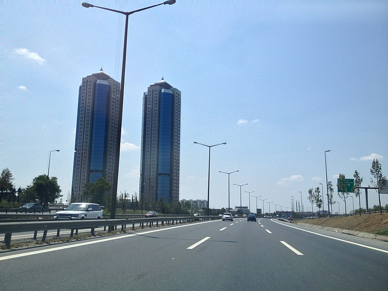
Bakırköy is a municipality and district in the European part of Istanbul Province, Turkey. Its area is 29 km2, and its population is 226,685 (2022). Bakırköy lies between the D.100 highway (locally known as E-5) and the coast of the Sea of Marmara. Bakırköy houses a large psychiatric hospital, and is an important shopping and commercial center.
Esenler
Esenler is a municipality and district of Istanbul Province, Turkey. Its area is 43 km2, and its population is 445,421 (2022). It is on its European side. Esenler is mainly densely packed, working class residential in the midst of its industrial neighbouring districts of Gaziosmanpaşa, Güngören and Bağcılar. The mayor is Tevfik Göksu.

Ataşehir
Ataşehir () is a municipality and district of Istanbul, Turkey. Its area is 25 km2, and its population is 423,127 (2022). It is located at the junction of the O-2 and O-4 motorways on the Anatolian (Asian) side of Istanbul. Its neighbours are the districts of Ümraniye to the north, Sancaktepe to the northeast, Maltepe to the east, Kadıköy to the south and Üsküdar to the west.
Gaziosmanpaşa
Gaziosmanpaşa (; old name: Taşlıtarla) is a developing working class municipality (belediye) and district of Istanbul, Turkey, on its European side. Its area is 12 km2, and its population is 495,998 (2022). Esenler and Bayrampaşa are west, Sultangazi is north and Eyüp is south and east of the district.

Pendik
Pendik () is a municipality and district of Istanbul Province, Turkey. Its area is 190 km2, and its population is 750,435 (2022). It is on the Asian side between Kartal and Tuzla, on the Marmara Sea. It also neighbours Sultanbeyli, Sancaktepe and Çekmeköy from northwest, Şile from north and Gebze from northeast. The district is home to the Sabiha Gökçen International Airport.
%20(cropped).jpg)
Eyüp
Eyüpsultan or Eyüp () is a municipality and district of Istanbul Province, Turkey. Its area is 228 km2, and its population is 422,913 (2022). The district extends from the Golden Horn all the way to the shore of the Black Sea. Eyüp is also the name of a prominent neighborhood and former village in the district, located at the confluence of the Kâğıthane and Alibey streams at the head of the Golden Horn. The Eyüp neighborhood is a historically important area, especially for Turkish Muslims, due to the presence of the tomb of Abu Ayyub al-Ansari, the prominent Medinan companion (Ansar) and

Avcılar
district of İstanbul, northwestern Turkey
.jpg)
Şile
220px|thumb|Şile Castle is a restored castle in the Şile district on Ocaklı Island
Şile is a municipality and district of Istanbul Province, Turkey. Its area is 800 km2, and its population is 43,464 (2022). Bordering Şile is the province of Kocaeli (districts of Gebze, Körfez, Derince, Kandıra) to the east and south, and Istanbul districts of Pendik to the south, Çekmeköy to the southwest, and Beykoz to the west. The popular resort town Ağva is also a part of Şile. However, between June and September, the population rapidly increases because of the many residents of Istanbul who have summ
Arnavutköy
district of İstanbul, northwestern Turkey

Sarıyer
Sarıyer () is a municipality and district of Istanbul Province, Turkey. Its area is 177 km2 and its population is 350,454 (2022). It is on the northeastern part of Istanbul's European side. Sarıyer also administers the Black Sea coast to the west of the mouth of the Bosphorus, including the neighbourhood of Kilyos. It borders Eyüpsultan to the northwest, Beşiktaş to the south and Kağıthane to the west. The mayor is Mustafa Oktay Aksu of the Republican People's Party (CHP).

Zeytinburnu
Zeytinburnu (literally, Olive Cape) is a municipality and district of Istanbul Province, Turkey. Its area is 12 km2, and its population is 292,616 (2022). It is a working-class area on the European side of Istanbul, Turkey, on the shore of the Marmara Sea just outside the walls of the ancient city, beyond the fortress of Yedikule.
Tuzla
district of İstanbul, northwestern Turkey

Beylikdüzü
Beylikdüzü () is a municipality and district of Istanbul Province, Turkey. Its area is 39 km2, and its population is 415,290 (2024). It is on the European side of Istanbul, located north of the Sea of Marmara, south of Esenyurt, east of Büyükçekmece, and west of Avcılar.

Küçükçekmece
Küçükçekmece (; meaning "small-drawer", from much earlier Rhegion (Greek: Ρήγιον) and Küçükçökmece as "little breakdown" or "little depression", in more ancient times just as Bathonea), is a municipality and district of Istanbul Province, Turkey. Its area is 44 km2, and its population was 789,033 in 2024. It is 23 kilometers west of the city centre and lies next to Lake Küçükçekmece. Both the lake and land reside on the European shore of the Sea of Marmara. It is the second most populous district of Istanbul.

Kağıthane
Kağıthane (, also Kâğıthane), formerly Sadâbad () and Glykà Nerà (Greek: Γλυκά Νερά, , 'sweet waters') is a municipality and district of Istanbul Province, Turkey. Its area is 15 km2, and its population is 455,943 (2022). It is at the far northern end of the Golden Horn on the European side of Istanbul. It extends along the shores of the Alibeyköy and Kağıthane rivers that discharge into the Golden Horn. Formerly a working class district, Kağıthane is now part of a major real estate development area.

Beykoz
Beykoz () is a municipality and district of Istanbul Province, Turkey. Its area is 310 km2, and its population is 247,875 (2022). It lies at the northern end of the Bosphorus on the Anatolian side. The name is believed to be a combination of the words bey and kos, which means "village" in Farsi. Beykoz includes an area from the streams of Küçüksu and Göksu (just before Anadoluhisarı) to the opening of the Bosphorus into the Black Sea, and the villages in the hinterland as far as the Riva creek. Before the Turkish alphabet reform of 1928, it was sometimes Latinized variously as Beicos or Beikos

Ümraniye
Ümraniye () is a municipality and district of Istanbul Province, Turkey. Its area is 46 km2, and its population is 723,760 (2023). It was separated from Üsküdar in 1987. It is bordered by Çekmeköy to the northeast, Sancaktepe to the east, Ataşehir to the south, Üsküdar to the west and Beykoz to the northwest.
Bahçelievler
Bahçelievler (meaning "houses with gardens" in Turkish) is a municipality and district of Istanbul Province, Turkey. Its area is 17 km2 (0.3% of Istanbul Province), and its population is 594,350 (2022). It is a large middle class residential suburb of Istanbul, on the European side of the city. It is accessible from the D.100 that runs from the Istanbul airport to the Asian side of the city. Bahçelievler is the northern neighbour of Bakırköy.

Güngören
Güngören is a municipality and district of Istanbul Province, Turkey. Its area is 7 km2, making it the smallest district of Turkey in terms of land area. Its population is 282,692 (2022), down from a peak of 318,545 in 2007. It is an industrial and working class area. It is located near the district of Bakırköy on the Çatalca Peninsula in the western half of Istanbul Province. Güngören, which became a district on June 3, 1992, is adjacent to Zeytinburnu to the east, Esenler, Bakırköy in the south, and Bahçelievler to the west. The district is now fully urbanized and consists of 11 neighbo
Maltepe
district of İstanbul, northwestern Turkey
Kartal
Kartal () is a municipality and district of Istanbul Province, Turkey. Its area is 38 km2, and its population is 483,418 (2022). It is located on the Asian side of the city, on the coast of the Marmara Sea between Maltepe and Pendik.

Bağcılar
Bağcılar is a municipality and district of Istanbul Province, Turkey. Its area is 23 km2, and its population is 740,069 (2022). It is located on the European side of Istanbul, near the city centre, just north of Bahçelievler, between the two major ring roads, TEM and D100 (formerly E5). The district is the fourth most populous in the Istanbul Municipality. Bağcılar developed rapidly between the 1970s and 1990s and is primarily residential in nature. The neighborhood is served by the Istanbul Metro and the T1 line of the Istanbul Tram. The mayor is Yasin Yıldız from the Justice and Develop

Başakşehir
Başakşehir is a municipality and district of Istanbul Province, Turkey. Its area is 107 km2, and its population is 514,900 (2022). It is in the European part of Istanbul. The district is home to İstanbul Başakşehir F.K., a football team competing in the Süper Lig. It also includes Ibn Haldun University and Başakşehir Çam and Sakura City Hospital. Additionally, the district features Bahçeşehir, one of Turkey's early suburban residential development projects. Notable sports venues in the district include Atatürk Olympic Stadium and Başakşehir Fatih Terim Stadium. BBC News has referred to Başakşe
Sultangazi
Sultangazi is municipality and district of Istanbul Province, Turkey. Its area is 37 km2, and its population is 542,531 (2022). To the west are the neighbourhoods of Esenler and Başakşehir, Gaziosmanpaşa is to the south and Eyüpsultan is to the north and east. One border of the district is formed by the TEM highway.
Çekmeköy
Çekmeköy is a municipality and district of Istanbul Province, Turkey. Its area is 152 km2, and its population is 296,066 (2022). It is on the Asian side of Istanbul.
Sancaktepe
Sancaktepe is a municipality and district of Istanbul Province, Turkey. Its area is 63 km2, and its population is 489,848 (2022).
Yarımburgaz
neighborhood in Küçükçekmece district, Istanbul, Turkey
Terazidere
thumbnail|Terazidere Metro Station
Sapan Bağları
Sapanbağları (also spelled Sapan Bağları or Sabanbağları) is a neighborhood in Pendik, Istanbul, Turkey.
Siyavuşpaşa
thumbnail|ruins of the pavilion (kasır or köşk) of Siyâvuş Paşa, namesake of the neighborhood (though the pavilion is located within the current boundaries of neighboring Şirinevler)
Siyavuşpaşa is a neighborhood in the Bahçelievler District of Istanbul, Turkey. Its population is 61,139 (2023).
Karadolap
Karadolap is a neighborhood (mahalle) in the district of Eyüpsultan, Istanbul, Turkey. Its population is 27,766 (2019).
Hacımimi
thumbnail|street in Hacımimi
Hacımimi is a neighborhood (mahalle) in the Beyoğlu District of Istanbul, Turkey. Its population is 1230, and its surface area is 9.2 hectares. The neighborhood is located on a slope descending toward the Bosporus, with streets arranged more or less in a grid. The neighborhood contains many historic structures.
Çırçır
mahalle (administrative quarter) in Eyüpsultan, İstanbul–Europe, northwestern Turkey