Category
page 1Principal areas of Wales
.jpg)
Cardiff
Cardiff is the capital and largest city of Wales. Cardiff had a population of in and forms a principal area officially known as the City and County of Cardiff (). The city is the eleventh largest in the United Kingdom. Located in the southeast of Wales and in the Cardiff Capital Region, Cardiff is the county town of the historic county of Glamorgan and in 1974–1996 of South Glamorgan. It belongs to the Eurocities network of the largest European cities. A small town until the early 19th century, its prominence as a port for coal when mining began in the region helped its expansion. In 1905, it

Swansea
Swansea ( ; ) is a port and coastal city and the second-largest city of Wales. It forms a principal area, officially known as the City and County of Swansea ().

Newport
city in south east Wales, United Kingdom

Anglesey
Anglesey ( ), or ' (), is an island off the north-west coast of Wales. It forms the bulk of the county known in English as the Isle of Anglesey', which also includes Holy Island () and some islets and skerries. The county borders Gwynedd across the Menai Strait to the southeast, and is otherwise surrounded by the Irish Sea. Holyhead is the largest town, and the administrative centre is Llangefni.

Q156150
Powys ( , ) is a county and preserved county in Wales. It borders Gwynedd, Denbighshire and Wrexham to the north; the English ceremonial counties of Shropshire and Herefordshire to the east; Monmouthshire, Blaenau Gwent, Merthyr Tydfil, Caerphilly, Rhondda Cynon Taf and Neath Port Talbot to the south; and Carmarthenshire and Ceredigion to the west. The largest settlement is Newtown, and the administrative centre is Llandrindod Wells.

Gwynedd
thumb|View of Tremadog Bay

Pembrokeshire
Pembrokeshire ( ; ) is a county in the south-west of Wales. It is bordered by Carmarthenshire to the east, Ceredigion to the northeast, and otherwise by the sea. Haverfordwest is the largest town and administrative headquarters of Pembrokeshire County Council.

Ceredigion
Ceredigion (), historically Cardiganshire (, ), is a county in the west of Wales. It borders Gwynedd across the Dyfi estuary to the north, Powys to the east, Carmarthenshire and Pembrokeshire to the south, and the Irish Sea to the west. Aberystwyth is the largest settlement and, together with Aberaeron, is an administrative centre of Ceredigion County Council.

Monmouthshire
Monmouthshire (; ) is a county in the south east of Wales. It borders Powys to the north; the English counties of Herefordshire and Gloucestershire to the north and east; the Severn Estuary to the south, and Torfaen, Newport and Blaenau Gwent to the west. The largest town is Abergavenny, and the administrative centre is Usk.
Carmarthenshire
Carmarthenshire ( ; or informally ) is a county in the south-west of Wales. The three largest towns are Llanelli, Carmarthen and Ammanford. Carmarthen is the county town and administrative centre. The county is known as the "Garden of Wales" and is also home to the National Botanic Garden of Wales.

Flintshire
Flintshire () is a county in the north-east of Wales. It borders the Irish Sea to the north, the Dee Estuary to the north-east, the English county of Cheshire to the east, Wrexham County Borough to the south, and Denbighshire to the west. Connah's Quay is the largest town, and Flintshire County Council is based in Ewloe.

Denbighshire
thumb|Berwyn Viaducts, Denbighshire
Denbighshire ( ; ) is a county in the north-east of Wales. It borders the Irish Sea to the north, Flintshire to the east, Wrexham to the southeast, Powys to the south, and Gwynedd and Conwy to the west. Rhyl is the largest town, and Ruthin is the administrative centre. Its borders differ from the historic county of the same name.

Conwy County Borough
principal area in north-east Wales
The Vale of Glamorgan
principal area in south-east Wales, United Kingdom

Torfaen
Torfaen (; ) is a county borough in the south-east of Wales. Torfaen is bordered by the county of Monmouthshire to the east, the city of Newport to the south, and the county boroughs of Caerphilly and Blaenau Gwent to the south-west and north-west. It is within the boundaries of the historic county of Monmouthshire, and between 1974 and 1996 was a district of Gwent, until it was reconstituted as a principal area in 1996.
Rhondda Cynon Taf
principal area in south-east Wales, United Kingdom

Neath Port Talbot
county borough and one of the unitary authority areas of Wales, United Kingdom

Q596885
principal area in south-east Wales
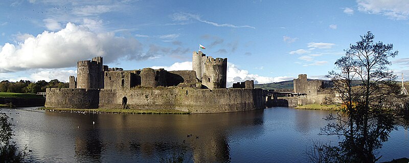
Caerphilly County Borough
principal area in south-east Wales, United Kingdom
Wrexham County Borough
principal area in north-east Wales
Bridgend County Borough
principal area in south-east Wales, United Kingdom
ISO 3166-2:GB
entry for the United Kingdom in ISO 3166-2
Merthyr Tydfil County Borough
principal area in south-east Wales, United Kingdom

principal area of Wales
county or county borough of Wales administered by a principal council
list of Welsh principal areas by percentage Welsh language
Wikimedia list article