Category
page 1Sites of Special Scientific Interest in Cornwall
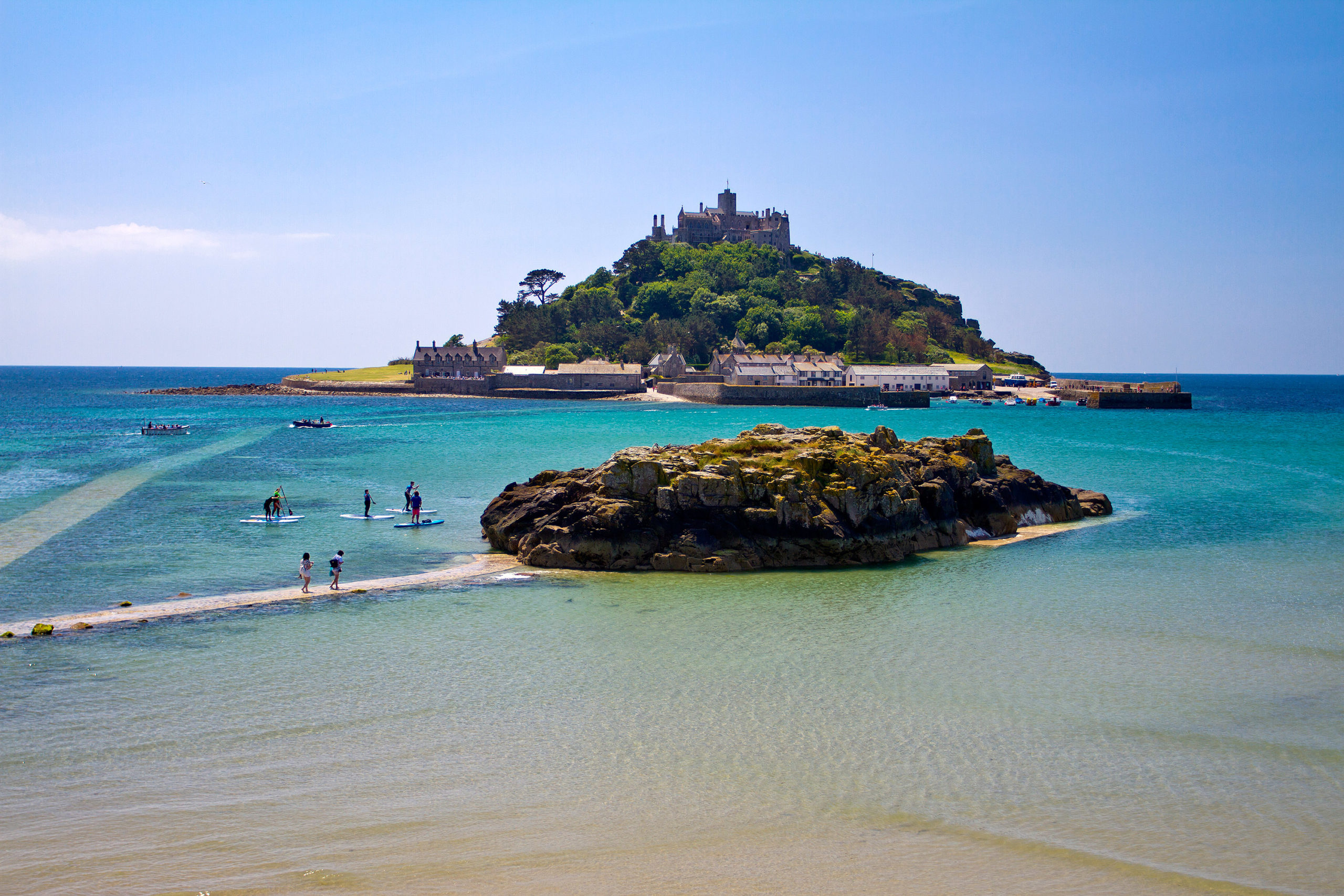
St Michael's Mount
tidal island in Mount's Bay, Cornwall

Bude
Bude (, locally or ; Cornish ) is a seaside town in north Cornwall, England, in the civil parish of Bude-Stratton and at the mouth of the River Neet (also known locally as the River Strat). It was sometimes formerly known as Bude Haven.
St Columb Major
town in Cornwall, England, UK

Porthleven
Porthleven (; ) is a town, civil parish and fishing port in Cornwall, England. The most southerly port in Great Britain, it was a harbour of refuge when this part of the Cornish coastline was infamous for wrecks in the days of sail. The South West Coast Path from Somerset to Dorset passes through the town. At the 2021 census, the population of the parish was 3,117.
The Lizard
peninsula in Cornwall, England, UK

St Agnes
village and civil parish in Cornwall, England, UK

St Erth
village and civil parish in Cornwall, United Kingdom
Bodmin Moor
granite moorland in northeastern Cornwall, England

Menheniot
thumb|255px|Menheniot parish church
Menheniot (pronounced Men-en-yut; ) is a civil parish and village in Cornwall, England, United Kingdom. The village is southeast of Liskeard. The meaning of the name is "sanctuary of Neot" (from minihi and Neot).

St Stephen-in-Brannel
village and civil parish in Cornwall, England, UK

Perranporth
thumb|Perranporth Boating Lake
thumb|Perranporth town centre, with the beach in the background

Mullion
village on the Lizard Peninsula in Cornwall, England, UK
River Fowey
UK river in Cornwall, England

Luxulyan
Luxulyan (; ), also spelt Luxullian or Luxulian, is a village and civil parish in mid Cornwall, England, United Kingdom. The village lies four miles (6.5 km) northeast of St Austell and six miles (10 km) south of Bodmin. The population of the parish was 1,371 in the 2001 census. This had risen to 1,381 at the 2011 census.
Breage
village and civil parish in Cornwall, England

Lezant
Lezant () is a civil parish and village in east Cornwall, England, United Kingdom. Lezant village is about five miles (8 kilometres) south of Launceston. The population of the parish in the 2001 census was 751, increasing slightly to 765 in the 2011 census.

Laneast
Laneast () is a village and civil parish in Cornwall, England, United Kingdom. It lies above the River Inny valley, about six miles (11 km) west of Launceston. The population in the 2001 census was 164, increasing to 209 at the 2011 census.
River Fal
river in Cornwall, England
River Camel
river in Cornwall, England

Rock
village in St Minver Lowlands, Cornwall, England, UK

Roche
village and civil parish in Cornwall, England, UK

Trebetherick
thumb|Sketch map showing Trebetherick and surrounding area

St Mellion
villgae in Cornwall

Week St Mary
civil parish and village in northeast Cornwall, England
Boconnoc
Boconnoc () is a civil parish in Cornwall, England, United Kingdom, approximately east of the town of Lostwithiel. According to the 2011 census the parish had a population of 96.
Kingsand
thumb|Devon Corn CottageKingsand () and Cawsand are twin villages in southeast Cornwall, United Kingdom. The villages are situated on the Rame Peninsula and are in the parish of Maker-with-Rame.
Bedruthan Steps
stretch of coastline in Cornwall, United Kingdom
Coverack
thumb|Coverack from above the harbour. The collapse of the sea wall at picture centre happened during the 18 July 2017 flood.
Coverack (, meaning cove of the stream) is a coastal village and fishing port in Cornwall, UK. It lies in the parish of St Keverne, on the east side of the Lizard peninsula about south of Falmouth.
Treverbyn
thumb|Late 19th-century OS map
Treverbyn is a civil parish and village in mid-Cornwall, England, United Kingdom, lying north of St Austell.
Trevose Head
headland on the Atlantic coast of north Cornwall, United Kingdom
Portwrinkle
Portwrinkle () is a small coastal village in south-east Cornwall, England, United Kingdom. It is at the western end of Whitsand Bay five miles (8 km) south-west of Saltash.
Mawnan
thumb|Cornwall Coast Path, Mawnan
thumb|Mawnan (top right) in relation to surrounding parishes
Warleggan
thumb|Warleggan Church
thumb|Warleggan Down
thumb|Footpath west from Cabilla Moorland
Warleggan () is a hamlet and civil parish on the southern edge of Bodmin Moor in Cornwall, England.
Pentire Head
headland in St Minver Highlands, Cornwall, England, UK
Belowda
Belowda () is a village in Cornwall, England, UK. The village is just north of the A30 trunk road, about seven miles west-southwest of Bodmin. The village also gives its name to the nearby Belowda Beacon. It is in the civil parish of Roche.
Rame Head
headland in Cornwall, England, UK
Whitsand Bay
bay in Cornwall, England
Hingston Down
hill in Cornwall, England, UK
Polyphant
thumb|This bridge carries the lane from Polyphant to Trevell over the Penpont Water
thumb|A miniature Cornish cross of Polyphant stone
Polyphant (), recorded as Polefant c. 1170, is a village in east Cornwall, England, United Kingdom. It is north of the civil parish of Lewannick, five miles (8 km) west of the town of Launceston near the convergence of the River Inny and Penpont Water.

The Loe
freshwater lake in Cornwall, England, UK
River Ottery
river in Cornwall, England

Praa Sands
village in Cornwall, England, UK

Coombe
village near Bude, Cornwall, United Kingdom
River Truro
river in Cornwall, United Kingdom
Tater Du Lighthouse
lighthouse in Cornwall, England
Wheal Frances
village in Cornwall, England, UK
Yeolmbridge
Yeolmbridge is a village in Cornwall (but within the boundaries of the historic county of Devon), two and a half miles north of Launceston.
Stepper Point
headland on the Atlantic coast in north Cornwall, England, United Kingdom