Category
page 1Use New Zealand English from May 2022
Great Barrier Island
largest island near New Zealand's North Island

Dargaville
Dargaville () is a town located in the North Island of New Zealand. It is situated on the bank of the Northern Wairoa River in the Kaipara District of the Northland region. Dargaville is located southwest of Whangārei, and north of Auckland.
Cape Kidnappers / Te Kauwae-a-Māui
point in New Zealand

Muriwai
Muriwai, also called Muriwai Beach, is a coastal community on the west coast of the Auckland Region in the North Island of New Zealand. The black-sand surf beach and surrounding area is a popular recreational area for Aucklanders. The Muriwai Regional Park includes a nesting site for a large colony of gannets.
Warkworth
town in New Zealand

Wellsford
Wellsford () is a town on the Northland Peninsula in the northern North Island of New Zealand. It is the northernmost major settlement in the Auckland Region, and is northwest of the Auckland CBD. It is a major regional centre, being located at the junction of State Highways 1 and 16, almost halfway between Auckland and the Northland city of Whangārei.
Beehive
Executive wing of the New Zealand Parliament buildings
Simone Kessell
actress
%20(cropped).jpg)
Helensville
Helensville () is a town in the North Island of New Zealand. It is sited northwest of Auckland, close to the southern extremity of the Kaipara Harbour. State Highway 16 passes through the town, connecting it to Waimauku to the south, and Kaukapakapa about to the north-east. Parakai is to the north-west. The Kaipara River runs through the town and into the Kaipara Harbour to the north.

Piha
thumb|Timber settlement at Piha circa 1916, photograph by Albert Percy Godber
Karekare
locality in Auckland Region, New Zealand
Aorere River
river in the South Island of New Zealand

Kaiwaka
thumb|Kaiwaka, Northland, New Zealand
Mangawhai
Mangawhai is a township at the south-west extent of the Mangawhai Harbour, or Mangawhai Estuary, in Northland, New Zealand. The adjacent township of Mangawhai Heads is 5 km north-east, on the lower part of the harbour. Kaiwaka is 13 km south-west, and Waipu is 20 km north-west of Mangawhai Heads.
Puhoi
Puhoi is a village in New Zealand, located on the banks of the Puhoi River. The settlement was founded by German Bohemian immigrants in the 1860s. Puhoi has several historic buildings and part of the village is designated as a protected heritage area.
==Etymology==
The name Puhoi means 'slow water' in Māori. The name presumably comes from the fact that moving up the Puhoi River was quite slow. Māori did not refer to the area around the village of Puhoi as Puhoi; the area had many names with the main one being Okahu.
Parakai
Parakai is a town in the North Island of New Zealand, sited northwest of Auckland, close to the southern extremity of the Kaipara Harbour. Helensville is about to the south-east, and Waioneke is to the north-west.
Maungaturoto
Maungaturoto is a small town in the Northland Region of New Zealand.
Kaukapakapa
Kaukapakapa is a town in the North Island of New Zealand. It is situated in the Rodney ward of the Auckland Region and is around northwest of Auckland. State Highway 16 passes through the town, connecting it to Helensville about to the south-west, and Araparera about to the north. The North Auckland Line also passes through Kaukapakapa. The Kaukapakapa River flows from the town to the Kaipara Harbour to the west.
Paparoa
Paparoa is a settlement in Northland, New Zealand. The Paparoa Stream flows from the east, through the settlement, and into the Paparoa Creek to the south, which joins the Arapaoa River which is part of the Kaipara Harbour. State Highway 12 passes through Paparoa. Matakohe is 6 km to the south west, and Maungaturoto is 12 km east.
Matakohe
Matakohe is a settlement in Northland, New Zealand. The Matakohe River is a short river which runs from the north into the Arapaoa River, which is part of the Kaipara Harbour. State Highway 12 passes through Matakohe. Ruawai is 16 km to the west, and Paparoa is 6 km north east. The Hukatere Peninsula extends south into the Kaipara Harbour.
Leigh
locality in Rodney District, Auckland Region, New Zealand
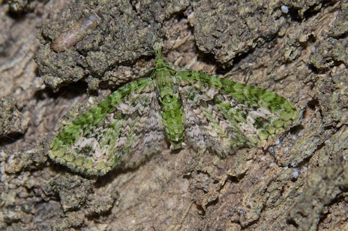
Pasiphila muscosata
species of insect
Sigaus minutus
species of grasshopper endemic to New Zealand
Ruawai
Ruawai () is a small town located 30 km south of Dargaville in Northland, New Zealand.
Matakana
Matakana is a town in the Mahurangi region of the North Island of New Zealand. Matakana is north of Warkworth. The Matakana River flows through the town and into Kawau Bay to the south-east.
Tinopai
Tinopai is a settlement on the Komiti Bay, part of the Hukatere Peninsula in the northern Kaipara Harbour in Northland, New Zealand. The Otamatea River flows from the north east past Tinopai and into the harbour. Matakohe is to the north.
Dairy Flat
locality in New Zealand
Te Kōpuru
locality in Kaipara District, Northland Region, New Zealand
Whau River
river in Auckland, New Zealand
Joseph Manu
New Zealand rugby league footballer
Snells Beach
locality in Rodney District, Auckland Region, New Zealand
Waiwera
Waiwera is a small town in the north of the Auckland Region in New Zealand. Waiwera is 6 km north of Orewa, 6 km south-east of Puhoi, 23 km south-east of Warkworth and approximately 35 km from the Auckland City centre. The settlement lies at the outlet of a river also called Waiwera. Less than 1 kilometre north of the Waiwera turn-off lies the turn-off to Wenderholm Regional Park which is situated on the far side of the headland to the north of the Waiwera River outlet.
Tapora
Tāpora is a locality on the Okahukura Peninsula, which is on the eastern side of the Kaipara Harbour in New Zealand. It is part of the Rodney District. Wellsford lies to the East, as does Port Albert and the Wharehine River, while Manukapua Island lies to the West.
Tauhoa
thumb|View of farmland in Rodney District, near the township of Tauhoa
Tauhoa is a rural community in the Auckland Region of New Zealand's North Island.
Whangateau
Whangateau is a coastal village on the shores of the Whangateau Harbour on the North Island of New Zealand. Whangateau is between Leigh and Big Omaha. During the late 19th century the land around Whangateau was subdivided into small farms and Whangateau was established with support of the county and central government. The settlement remained small and has a population over 100.
Glorit
Glorit is a rural community in the Auckland Region of New Zealand's North Island. State Highway 16 runs through the area, connecting to Tauhoa 12 km to the north and Helensville to the south.
Kaipara Flats
human settlement in New Zealand
Ōmaha
Ōmaha is a small beach town on Ōmaha Bay in the Auckland Region, in the north of New Zealand. It is on a sandspit that adjoins Tāwharanui Peninsula and separates Whangateau Harbour from Ōmaha Bay.
Pahi
place in Northland Region, New Zealand
Puhoi River
river in New Zealand
Waioneke
Waioneke is a locality on the Te Korowai-o-Te-Tonga Peninsula of the Kaipara Harbour, in the Rodney District of New Zealand. Parakai is 22 km to the south-east, and the road continues another 14 km to the north-west. Rangitira Beach and Woodhill Forest are to the west, and Omokoiti Flats and the southern Kaipara Harbour are to the east.