Category
page 1Volcanoes of the Kuril Islands

Urup
thumb|Ice floes off the north-eastern tip of the island.

Paramushir
Paramushir (; ) is a volcanic island in the northern portion of the Kuril Islands chain in the Sea of Okhotsk in the northwest Pacific Ocean. It is separated from Shumshu by the very narrow Second Kuril Strait in the northeast , from Antsiferov by the Luzhin Strait () to the southwest, from Atlasov in the northwest by , and from Onekotan in the south by the wide Fourth Kuril Strait. Its northern tip is from Cape Lopatka at the southern tip of the Kamchatka Peninsula. Severo-Kurilsk, the administrative center of the Severo-Kurilsky district, is the only permanently populated settlement on Param
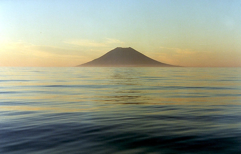
Atlasov Island
island in Russia
Antsiferov Island
island in Russia

Ekarma
Ekarma (; Japanese 越渇磨島; Ekaruma-tō) is an uninhabited volcanic island near the center of the Kuril Islands chain in the Sea of Okhotsk in the northwest Pacific Ocean, separated from Shiashkotan Island by the Ekarma Strait. Its name is derived from the Ainu language, from “safe anchorage”.

Onekotan
Onekotan (; , occasionally ; ) is an uninhabited volcanic island located near the northern end of the Kuril Islands chain in the Sea of Okhotsk in the northwest Pacific Ocean. Its name is derived from the Ainu language for "large village”. It is the second largest island, after Paramushir, in the northern subgroup of the Kurils. It is administratively included in the Severo-Kurilsky District of Sakhalin oblast, Russia.
Chirinkotan
Chirinkotan (; Japanese 知林古丹島; Chirinkotan-tō) is an uninhabited volcanic island located in the centre of the Kuril Islands chain in the Sea of Okhotsk in the northwest Pacific Ocean. Its name is derived from the Ainu language for "mudslide". It is located west of Ekarma, its nearest neighbor.
Matua
island in Russia

Makanrushi
thumb|right|225px|Onekotan Island (center), with Makanrushi at upper left and [[Kharimkotan at bottom. North at top.]]

Simushir
Simushir (, , ), meaning Large Island in Ainu, is an uninhabited volcanic island near the center of the Kuril Islands chain in the Sea of Okhotsk in the northwest Pacific Ocean. It was formerly known as Marikan.
Broutona
Broutona (; Japanese 武魯頓島; Buroton-tō) is an uninhabited volcanic island located near the northern end of the southern Kuril Islands chain in the Sea of Okhotsk in the northwest Pacific Ocean. Its name is derived from William Robert Broughton, a British ship captain who charted many of the Kuril Islands during his voyages during the 18th century. Its original Ainu name was Makanrur, which translates roughly to "island in a strong current".
Kharimkotan
Harimkotan (; ; alternatively , ) is an uninhabited volcanic island located from Onekotan near the northern end of the Kuril Islands chain in the Sea of Okhotsk in the northwest Pacific Ocean. Its name is derived from the Ainu language, from 'village of many Cardiocrinum.'

Raikoke
Raikoke (, ), also spelled Raykoke, is, as of 2019, a Russian uninhabited volcanic island near the centre of the Kuril Islands chain in the Sea of Okhotsk in the northwest Pacific Ocean, distant from the island of Matua. Its name is derived from the Ainu language, from the Hokkaido Ainu word "hellmouth".

Ketoy
Ketoy (or Ketoi) (; Japanese 計吐夷島; Ketoi-tō) is an uninhabited volcanic island located in the centre of the Kuril Islands chain in the Sea of Okhotsk in the northwest Pacific Ocean. Its name is derived from the Ainu language for "skeleton" or "bad".

Shiashkotan
alt=Shiashkotan Island|thumb|264x264px|Shiashkotan Island
Shiashkotan () (; Shasukotan-tō) is an uninhabited volcanic island near the center of the Kuril Islands chain in the Sea of Okhotsk in the northwest Pacific Ocean, separated from Ekarma by the Ekarma Strait. Its name is derived from the Ainu language, from “Konbu village”.

Ushishir
thumb|Caldera and bay of Yankicha
Ushishir (; Japanese: 宇志知島; Ushishiru-tō; Ainu: ウシシㇼ, lit. "Land of the bay") is a collective name for two uninhabited volcanic islands and several reefs, all being parts of an eponymous partially submerged volcano, located in the centre of the Kuril Islands chain in the Sea of Okhotsk in the northwest Pacific Ocean. Its name is derived from the Ainu language for "hot spring".

Rasshua
Rasshua (, ) is an uninhabited volcanic island near the center of the Kuril Islands chain in the Sea of Okhotsk in the northwest Pacific Ocean, from Ushishir and southwest of Matua. Its name is derived from the Ainu language for “fur coat”, "Rushu o a" (ルシュ・オ・ア), or "abundant furs", "Rushi o a" (ルシ・オ・ア).
Ebeko
Ebeko () is a highly active somma volcano located on the northern end of Paramushir Island, Kuril Islands, Russia. It is one of the most active volcanoes of the Kuril Islands. Eleven eruptions have been recorded between 1793 and 1991. Most of the eruptions are small (VEI=1) with the exception of the 1859 eruption (VEI=3). Most eruptions were phreatic and explosive.

Chikurachki
Chikurachki (; , Chikura-dake) is the highest volcano on Paramushir Island in the northern Kuril Islands. It is actually a relatively small volcanic cone constructed on a high Pleistocene volcanic edifice. Oxidized andesitic scoria deposits covering the upper part of the young cone give it a distinctive red color. Lava flows from the high Chikurachki reached the sea and formed capes on the northwest coast; several young lava flows also emerge from beneath the scoria blanket on the eastern flank.
Chyornye Bratya
island group in Kuril Islands, Russia
%20Relief%20Map%2C%20SRTM-1.jpg)
Golovnin
Golovnin (, Tomari-yama; ) is a caldera located in the southern part of Kunashir Island, Kuril Islands, Russia/Japan. It is the southernmost volcano of the Kuril Islands.
Alaid
volcano on Atlasov Island, Kuril Islands, Russia
%20Relief%20Map%2C%20SRTM-1.jpg)
Atsonupuri
Atsonupuri (; Ainu: アトゥサヌプリ, Atusa-nupuri; , Atosa-dake) is a stratovolcano located in the central part of Iturup Island, Kuril Islands, Russia.
left|thumb|150px|Relief Map
Nemo Peak
mountain
Medvezhya
Medvezhya (; , Moyoro-dake) is a volcanic complex located at the northern end of Iturup Island, Kuril Islands, Russia.
Rheniite, a rhenium sulfide mineral (ReS2), was discovered within the active hot fumaroles of the volcano in 1994
Uratman
Uratman () is a somma volcano located at the northern end of Simushir Island, Kuril Islands, Russia. It consists of a Pleistocene caldera which contains an andesite cone of Holocene age. The caldera is exposed to the ocean, forming Brouton Bay.
Sinarka
Sinarka (; ; Kurodake) is a stratovolcano which forms the northern end of Shiashkotan Island, Kuril Islands, Russia, and is the island's highest point. Historical eruptions have occurred at Sinarka during 1825–1750, 1846, 1855, and the last and largest from 1872 to 1878. Recent activity is hydrothermal, from a solfatara field with more than 100 fumaroles and several hot, geyser-like springs which erupt water up to high.
Baransky
Baransky (, Vulkan Baranskogo; , Sashiusu-dake) is a stratovolcano located in the central part of Iturup Island, Kuril Islands, Russia.
Tao-Rusyr Caldera
caldera on Onekotan Island, Russia
Karpinsky Group
volcanic group in the Kuril Islands, Russia
.jpg)
Mendeleyeva
Mendeleyeva (; , Rausu-san) is a stratovolcano located in the southern part of Kunashir Island, Kuril Islands, Russia.
Berutarube
Berutarube (; , Berutarube-zan) is a stratovolcano located at the southern end of Iturup Island, Kuril Islands, Russia.
Kuntomintar
Kuntomintar (; ; Kitaiō-dake) is a Pleistocene andesitic stratovolcano located at the southern end of Shiashkotan Island, Kuril Islands, Russia. Kumtomintar is a high point on a small volcanic ridge with mellow slopes on all side except the north west side. The mountain is home to many steep drainages, waterfalls, and some small ponds. The volcano consists of a central cone that fills a 4-4.5 km caldera and its crater is at 1280 feet, is below the main peak, on the north west side, some periods of time hot water drains from the crater into the ocean via creek. A second caldera is situated

Chirip
Chirip (, ) is a volcano located in the central part of Iturup Island, Kuril Islands, Russia. In lies on the and comprises two twin stratovolcanoes, Chirip and Bogdan Hmelnitskiy. The western side is the steepest, sharing a basin with a small lake with Bogdan Hmelnitskiy. The basin has features that were created during an eruption. Many types of lava are found, including basalt, andesite, and small amounts of dacite.
Rudakov
mountain in Russia
Zavaritski Caldera
volcanic crater in the Kuril Islands, Russia
Smirnov
mountain in Russia
Milna
Russian volcano
Bogatyr Ridge
mountains on Iturup, Russia
Grozny Ridge
mountain range on Iturup, Kuril Islands, Russia
Lvinaya Past
volcano in the southern part of Iturup in the Kuril Islands, claimed by Japan and administered by Russia
Vernadsky Ridge
mountain range on Paramushir, Kuril Islands, Russia
Goryashchaya Sopka
explosive stratovolcano on the Kuril Islands in Russia
Demon
stratovolcano on Iturup Island, Kuril Islands, Russia
Kolokol Group
mountains in Russia
Ivao Group
mountains in Russia
Tri Sestry
stratovolcano on Urup Island, Russia
Lomonosov Group
mountain
Golets-Torny Group
mountain in Russia