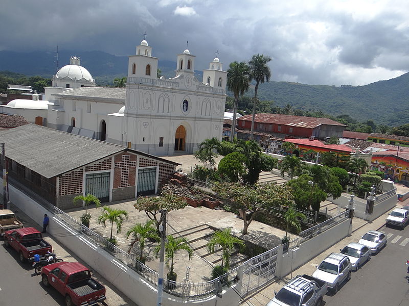
File:Parroquia_Nuestra_Señora_de_la_Asunción,_Ahuachapán.JPG · Wikimedia Commons · See Wikimedia Commons
Ahuachapán
Sign in to saveAhuachapán () is a city, district, and the capital of the Ahuachapán Department in western El Salvador. The district, including the city, covers an area of 244.84 km2 and as of 2007 has a population of 110,511 people. Situated near the Guatemalan border, it is the westernmost city in the country and is the center of an agricultural region producing primarily coffee.
Key facts
- Settlement.name
- Ahuachapán
- Settlement.settlement_type
- District
- Settlement.image_skyline
- File:Parroquia Nuestra Señora de la Asunción, Ahuachapán.JPG
- Settlement.image_caption
- Our Lady of the Assumption Parish
- Settlement.image_flag
- Bandera_del_Departamento_de_Ahuachapán.PNG
- Settlement.shield_size
- 50px
- Settlement.pushpin_map
- El Salvador
- Settlement.pushpin_label_position
- right
- Settlement.pushpin_map_caption
- Location in El Salvador
- Settlement.pushpin_relief
- yes
- Settlement.subdivision_type
- Country
- Settlement.subdivision_type1
- Department
- Settlement.subdivision_name1
- Ahuachapán
- Settlement.subdivision_type2
- Municipality
- Settlement.subdivision_name2
- Ahuachapán Centro
- Settlement.established_title
- Founded
- Settlement.established_date
- 1862
- Settlement.area_total_km2
- 244.84
via Wikipedia infobox
Wikidata facts
- Country
- El Salvador
- Population
- 127301
- Area
- 244.8
- Elevation
- 800
- Time zone
- UTC−06:00
- Official website
- alcaldiadeahuachapan.com
- Image
- Ahuachapan Parroquia Nuestra Señora de la Asuncion.jpg
Show 4 more facts
- twinned administrative body
- San José
- P12749
- September 21
- Commons category
- Ahuachapán
- category of associated people
- Category:People from Ahuachapán
via Wikidata · CC0
~5 min read
Encyclopedic overview
15 sectionsContents
- History
- Geography
- Local attractions
- Monuments/main attractions
- Lagoon of El Espino
- Administrative divisions
- Cantons
- Towns and villages in the district
- Climate
- Economy
- Traditions
- Notable people
- Sports
- See also
- References
Ahuachapán () is a city, district, and the capital of the Ahuachapán Department in western El Salvador. The district, including the city, covers an area of 244.84 km2 and as of 2007 has a population of 110,511 people. Situated near the Guatemalan border, it is the westernmost city in the country and is the center of an agricultural region producing primarily coffee.
Ahuachapán is the site of a geothermal power plant and a hydroelectric station. The local geothermal activity produces many steam vents, visible throughout the surrounding mountains.
Excerpted from Wikipedia’s “Ahuachapán” article, available under the CC BY-SA 4.0 licence.
Gallery (11)
On the map
6 mapped locations