
Aitoliko
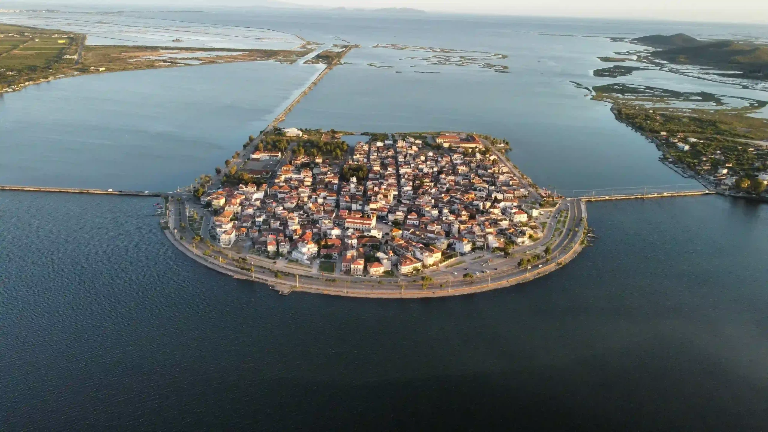
Sign in to saveAitoliko (Greek: Αιτωλικό) is a town and a former municipality in Aetolia-Acarnania, West Greece, Greece. Since the 2011 local government reform, it is part of the municipality Messolonghi, of which it is a municipal unit. The municipal unit has an area of 129,305 m2. It is located north of the Acheloos delta. The Greek National Road 5/E55 passes through the municipal unit. It is located SW of Agrinion, about 20 km NW of Messolonghi, W of Nafpaktos and the Rio-Antirrio bridge and SE of Astakos. Until it became a part of Greece, it was known as Anatoliko (Ανατολικό), meaning eastern.
Key facts
- Greek Dimos.name
- Aitoliko
- Greek Dimos.name_local
- Αιτωλικό
- Greek Dimos.type
- municipal unit
- Greek Dimos.image_map
- DE Etolikou.svg
- Greek Dimos.map_caption
- Location within the regional unit
- Greek Dimos.periph
- West Greece
- Greek Dimos.periphunit
- Aetolia-Acarnania
- Greek Dimos.municipality
- Messolonghi
- Greek Dimos.pop_municunit
- 6215
- Greek Dimos.pop_community
- 4813
- Greek Dimos.population_as_of
- 2021
- Greek Dimos.area_municunit
- 129.3
- Greek Dimos.elevation
- 6
- Greek Dimos.postal_code
- 304 00
- Greek Dimos.area_code
- 26320
- Greek Dimos.licence
- ME
- Greek Dimos.image_skyline
- Αιτωλικό 3843.jpg
- Greek Dimos.caption_skyline
- Aitoliko
via Wikipedia infobox
Official website
Αρχική - Etoliko.gr
Τοπικές ειδήσεις, αναλύσεις, απόψεις και ιστορίες από το Αιτωλικό Αρθρογραφία που συνδέει, εμπνέει και ενημερώνει.
etoliko.gr →Link to the official site · 32,691 chars · not written by Vinony
Wikidata facts
- Instance of
- town
- Country
- Greece
- Located in
- Missolonghi Municipality
- Population
- 4012
- Elevation
- 0
- Official website
- etoliko.gr
- Image
- Αιτωλικό 3843.jpg
- Dialing code
- 2632
- Patron saint
- Gabriel
Show 3 more facts
- postal code
- 304 00
- Commons category
- Aitoliko (Missolonghi)
- native label
- Ανατολικό
Sources (3)
via Wikidata · CC0
~5 min read
Encyclopedic overview
8 sectionsContents
- Subdivisions
- Historical population
- The delta and the lagoons
- History
- Notable people
- See also
- References
- External links
Aitoliko (Greek: Αιτωλικό) is a town and a former municipality in Aetolia-Acarnania, West Greece, Greece. Since the 2011 local government reform, it is part of the municipality Messolonghi, of which it is a municipal unit. The municipal unit has an area of 129,305 m2. It is located north of the Acheloos delta. The Greek National Road 5/E55 passes through the municipal unit. It is located SW of Agrinion, about 20 km NW of Messolonghi, W of Nafpaktos and the Rio-Antirrio bridge and SE of Astakos. Until it became a part of Greece, it was known as Anatoliko (Ανατολικό), meaning eastern.
==Subdivisions== The municipal unit Aitoliko is subdivided into the following communities (constituent villages in brackets): Aitoliko (Aitoliko, Agios Nikolaos, Kefalovryso, Mesa Pigadi, Bouza, Nisaki, Poros, Chaliki) Agios Ilias Stamna (Stamna, Kefalovrysos, Stathmos Stamnas) Fragkoulaiika (Fragkou, Koulaiika) Chrysovergi (Chrysovergi, Giatsaiika)
Excerpted from Wikipedia’s “Aitoliko” article, available under the CC BY-SA 4.0 licence.
Gallery (5)
On the map
3 mapped locations