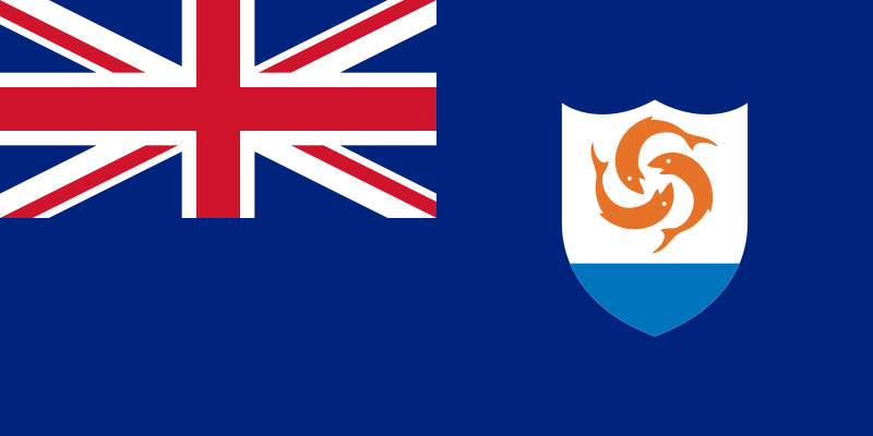
File:Flag_of_Anguilla.svg · Wikimedia Commons · See Wikimedia Commons
Anguilla
Sign in to saveAlso known as ai, Malliouhana, AIA
Anguilla is a British Overseas Territory in the Caribbean. It is one of the most northerly of the Leeward Islands in the Lesser Antilles, lying east of Puerto Rico and the Virgin Islands and directly north of Saint Martin. The territory consists of the main island of Anguilla, approximately long by wide at its widest point, together with a number of much smaller islands and cays with no permanent population. The territory's capital is The Valley. The total land area of the territory is , with a population of approximately in .
Anguilla is a British Overseas Territory in the Caribbean consisting of a main island and several smaller islands located north of Saint Martin and east of Puerto Rico and the Virgin Islands. With a capital in The Valley, it has a small population and limited land area, making it one of the least densely populated territories in the region.
AI-generated from the Wikipedia summary — may contain errors.
Key facts
- Dependency.name
- Anguilla
- Dependency.settlement_type
- British Overseas Territory
- Dependency.image_flag
- Flag of Anguilla.svg
- Dependency.flag_size
- 130
- Dependency.flag_link
- Flag of Anguilla
- Dependency.image_seal
- Coat of arms of Anguilla.svg
- Dependency.seal_size
- 65
- Dependency.seal_type
- Coat of arms
- Dependency.seal_link
- Coat of arms of Anguilla
- Dependency.motto
- "Unity, Strength and Endurance"
- Dependency.anthem
- "God Save the King"God Save the King / Queen
- Dependency.song_type
- Territorial anthem
- Dependency.song
- "God Bless Anguilla"File:National Anthem of Anguilla - God bless Anguilla.ogg
- Dependency.image_map
- Anguilla in United Kingdom.svg
- Dependency.mapsize
- 290px
- Dependency.image_map2
- Anguilla - Location Map (2013) - AIA - UNOCHA.svg
- Dependency.mapsize2
- 290px
- Dependency.subdivision_type
- Sovereign state
via Wikipedia infobox
Wikidata facts
- Instance of
- British overseas territory
- Part of
- Windward Islands
- Official name
- Anguilla
- Demonym
- Aangwilan
- Country
- United Kingdom
- Located in
- British overseas territory
- Continent
- North America
- Capital
- The Valley
- Official language
- English language
- Currency
- Eastern Caribbean dollar
- Population
- 19079
- Area
- 91
- Time zone
- UTC−04:00
- Head of government
- Ellis Webster
- Form of government
- constitutional monarchy
- Legislature
- Anguilla House of Assembly
- Anthem
- God Save the King
- Image
- Anguilla - Location Map (2013) - AIA - UNOCHA.svg
- Calling code
- +1264
- Mains voltage
- 110
- Motto
- Единство, сила и издържливост
- Flag
- flag of Anguilla
- Coat of arms
- coat of arms of Anguilla
Show 21 more facts
- Unicode character
- 🇦🇮
- top-level Internet domain
- .ai
- Commons category
- Anguilla
- topic's main category
- Category:Anguilla
- located in/on physical feature
- Caribbean
- Commons gallery
- Anguilla
- geography of topic
- geography of Anguilla
- emergency phone number
- 911
- different from
- Anguilla
- category of associated people
- Category:Anguillan people
- native label
- Aangwila
- topic's main Wikimedia portal
- Portal:Anguilla
- maritime identification digits
- 301
- office held by head of government
- Premier of Anguilla
- language used
- English language
- demographics of topic
- demographics of Anguilla
- P11012
- Sarzedo
- driving side
- left
- P12749
- Campotosto
- name
- Anguilla
- Commonwealth Sport country code
- ANG
Sources (12)
via Wikidata · CC0
~31 min read
Encyclopedic overview
35 sectionsContents
- Etymology
- History
- Geography and geology
- Geology
- Climate
- Temperature
- Rainfall
- Governance
- Political system
- Defence
- Population
- Demographics
- Religion
- Languages
- Education
- Culture
- Cuisine
- Literature
- Music
- Sports
- Natural history
- Wildlife
- Notable people
- Economy
- Transportation
- Air
- Road
- Boat
- See also
- Notes
- References
- Further reading
- External links
- Government
- General information
Anguilla is a British Overseas Territory in the Caribbean. It is one of the most northerly of the Leeward Islands in the Lesser Antilles, lying east of Puerto Rico and the Virgin Islands and directly north of Saint Martin. The territory consists of the main island of Anguilla, approximately long by wide at its widest point, together with a number of much smaller islands and cays with no permanent population. The territory's capital is The Valley. The total land area of the territory is , with a population of approximately in .
==Etymology== The native Arawak name for the island was Malliouhana.
Excerpted from Wikipedia’s “Anguilla” article, available under the CC BY-SA 4.0 licence.
Gallery (446)
On the map
60 mapped locations
Available in 147 languages
- Español
- Français
- Deutsch
- 中文
- 日本語
- Русский
- Português
- Italiano
- العربية
- हिन्दी
- Afrikaans
- Albanian
- Albanian
- Amharic
- Angika
- Aragonese
- Armenian
- Asturian
Show 128 more
- azb
- Azerbaijani
- Bahasa Indonesia
- Balinese
- Bangla
- Bashkir
- Basque
- be_x_old
- Belarusian
- Bosnian
- Breton
- Bulgarian
- Catalan
- cdo
- Cebuano
- Central Kurdish
- Cherokee
- Cornish
- Croatian
- Czech
- Danish
- Divehi
- Egyptian Arabic
- Erzya
- Esperanto
- Estonian
- Faroese
- Fiji Hindi
- Filipino
- Finnish
- Gagauz
- Galician
- gcr
- Georgian
- Greek
- Hakka Chinese
- Hebrew
- Hungarian
- Icelandic
- Ido
- Iloko
- Inari Sami
- Interlingue
- Irish
- Jamaican Creole English
- Javanese
- Kazakh
- Kinyarwanda
- Kurdish
- Kyrgyz
- Lao
- Latin
- Latvian
- Ligurian
- Limburgish
- Lingua Franca Nova
- Lithuanian
- lld
- Lombard
- Low German
- Lower Sorbian
- Luxembourgish
- Macedonian
- Malay
- Malayalam
- Marathi
- Mazanderani
- Mingrelian
- Nederlands
- Nepali
- Northern Frisian
- Norwegian
- Norwegian Nynorsk
- Novial
- nrm
- Occitan
- Odia
- Old English
- Ossetic
- Papiamento
- Pashto
- Picard
- Piedmontese
- Polski
- Punjabi
- Romanian
- Rusyn
- Scots
- Serbian
- Serbian (Latin)
- Shan
- Sicilian
- simple
- Sinhala
- Slovak
- Slovenian
- Sundanese
- Svenska
- Swahili
- Tajik
- Tamil
- Tatar
- Telugu
- Tibetan
- Tiếng Việt
- Tongan
- Türkçe
- Ukrainian
- Upper Sorbian
- Urdu
- Uyghur
- Uzbek
- Waray
- Welsh
- Western Frisian
- Western Mari
- Western Panjabi
- Wolof
- Wu Chinese
- Yakut
- Yoruba
- Zaza
- zh_classical
- zh_min_nan
- zh_yue
- فارسی
- ไทย
- 한국어
via Wikidata sitelinks · CC0