File:Arabat_arrow.jpg · Wikimedia Commons · See Wikimedia Commons
Arabat Spit
Sign in to saveAlso known as Arabat Tongue, Arabat Arrow
narrow spit of land of East Crimea, Ukraine
Key facts
- Location
- Henichesk Raion , Autonomous Republic of Crimea , Ukraine/Russian Federation (disputed )
via Wikipedia infobox
Wikidata facts
- Instance of
- spit
- Country
- Ukraine
- Body of water
- Syvash Bay
- Image
- Arabat arrow.jpg
- Width
- 4.135
- Length
- 115
Show 4 more facts
- located in/on physical feature
- Crimea
- Commons category
- Arabat Spit
- on focus list of Wikimedia project
- WikiProject Ukraine
- native label
- Арабат бели, Arabat beli
Sources (2)
via Wikidata · CC0
~5 min read
Encyclopedic overview
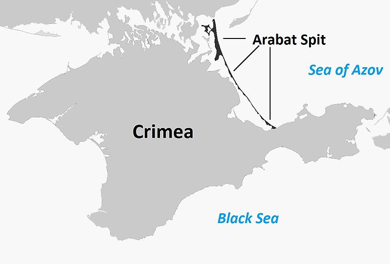
The southern part of the spit viewed from Arabat Fortress Aerial view of the spit between the Syvash lagoons (left) and Sea of Azov (right) The Arabat Spit (Ukrainian: Арабатська коса; Russian: Арабатская коса; Crimean Tatar: Arabat beli), or Arabat Arrow (Russian: Арабатская стрелка), is a barrier spit that separates the large, shallow, salty Syvash lagoons from the Sea of Azov. The spit runs between the Henichesk Strait in the north and the north-eastern shores of Crimea in the south. It is the largest of several spits of the Sea of Azov.
Name
Excerpted from Wikipedia’s “Arabat Spit” article, available under the CC BY-SA 4.0 licence.
Gallery (3)
On the map
Available in 38 languages
- Español
- Français
- Deutsch
- 中文
- 日本語
- Русский
- Português
- Italiano
- Armenian
- Azerbaijani
- Bahasa Indonesia
- Bashkir
- Belarusian
- Bulgarian
- Catalan
- Cebuano
- Crimean Tatar
- Croatian
Show 19 more
via Wikidata sitelinks · CC0