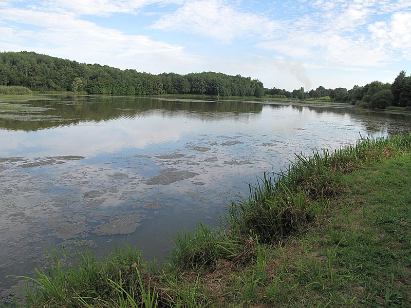
File:Grand-Etang_(Ain).jpg · Wikimedia Commons · See Wikimedia Commons
Arbigny
Sign in to saveArbigny () is a commune in the Ain department in the Auvergne-Rhône-Alpes region of eastern France.
OverviewAI-generated
Arbigny is a commune in France, situated within the Ain department and the arrondissement of Bourg-en-Bresse. It lies in the Auvergne-Rhône-Alpes region, near the Saône river. The town shares borders with Chavannes-sur-Reyssouze, Saint-Bénigne, Sermoyer, and Vescours. Its elevation is recorded as 214 meters above sea level, with an area of 17.47 square kilometers.
The population of Arbigny is 466, comprising 235 males and 228 females. The postal code for the commune is 01190. It has been associated with the cantons of Replonges and Pont-de-Vaux. A townhall is located on Chemin du Roset in La Croix.
Synthesized by Vinony from 46 facts across 7 sources: Wikidata, Openweathermap, Open Meteo, OpenStreetMap, GeoNames, Vinony graph, Geo. Generated from structured data (not the Wikipedia text) and checked against those facts — may still contain errors.
In the Vinony graph
The entry is geolocated on the map, across 2 mapped points.
Within Vinony's link graph, Arbigny is referenced by 397 other articles, and connects out to France, time zone and Middle Ages.
It is catalogued under topics including Bresse, Communes of Ain and Incomplete lists from April 2021.
Its subject is documented across 57 Wikipedia language editions.
Weather now
cached 21h ago7-day forecast
via Open-Meteo
Place details
- Locality
- Arbigny
- Region
- Auvergne-Rhône-Alpes
- Country
- France
- Population
- 370
via OpenStreetMap · GeoNames
Key facts
- French commune.name
- Arbigny
- French commune.commune status
- Commune
- French commune.image
- Grand-Etang (Ain).jpg
- French commune.caption
- The Grand-Étang near Arbigny
- French commune.arrondissement
- Bourg-en-Bresse
- French commune.canton
- Replonges
- French commune.INSEE
- 01016
- French commune.postal code
- 01190
- French commune.mayor
- Daniel Gras
- French commune.term
- 2020–2026
- French commune.intercommunality
- Bresse et Saône
- French commune.elevation m
- 200
- French commune.elevation min m
- 169
- French commune.elevation max m
- 214
- French commune.area km2
- 17.47
via Wikipedia infobox
Wikidata facts
- Instance of
- commune of France
- Official name
- Arbigny
- Country
- France
- Located in
- arrondissement of Bourg-en-Bresse
- Population
- 462
- Area
- 17.47
- Elevation
- 184
- Time zone
- UTC+02:00
- Body of water
- Saône
- Shares border with
- Uchizy
- Image
- Église St Pierre - Arbigny (FR01) - 2020-09-14 - 2.jpg
Show 8 more facts
- Commons category
- Arbigny
- postal code
- 01190
- associated electoral district
- canton of Pont-de-Vaux
- male population
- 235
- female population
- 228
- P8168
- Corte Franca
- email address
- mailto:[email protected]
- phone number
- +33-3-85-30-32-76
via Wikidata · CC0
~2 min read
Encyclopedic overview
9 sectionsContents
- Geography
- History
- Administration
- Population
- Sights
- Protected natural areas
- See also
- References
- External links
Arbigny () is a commune in the Ain department in the Auvergne-Rhône-Alpes region of eastern France.
==Geography== Arbigny is some 20 km north of Mâcon and 40 km south by south-east of Chalon-sur-Saône. The commune can be accessed by the D933 from Sermoyer in the north passing through the centre of the commune and village and continuing south to Pont-de-Vaux. The D126 runs west from the village changing to the D163 at the border of the commune and continuing to Uchizy. There are two other hamlets in the commune - La Croix and La Varenne. About 80% of the commune is farmland with the rest being the forested eastern part.
Excerpted from Wikipedia’s “Arbigny” article, available under the CC BY-SA 4.0 licence.
Gallery (9)
On the map
2 mapped locations