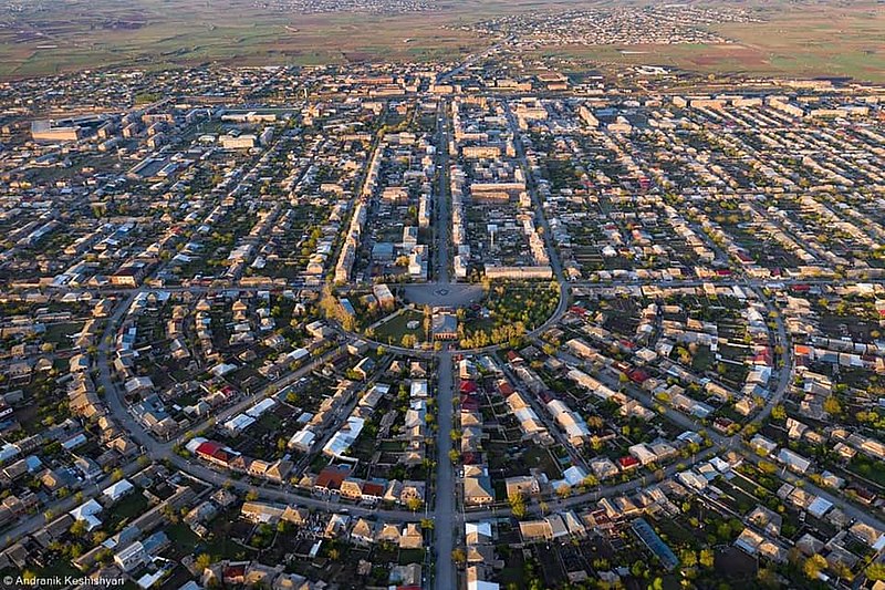
File:Armavir.jpg · Wikimedia Commons · See Wikimedia Commons
Armavir is a city located in Armenia, a country in the South Caucasus region. It serves as an important urban center in the country, though specific details about its current significance would require additional information.
AI-generated from the Wikipedia summary — may contain errors.
Wikidata facts
- Official name
- Սարդարապատ
- Country
- Russian Empire
- Official language
- Armenian
- Population
- 38635
- Area
- 8.51
- Elevation
- 870
- Time zone
- UTC+04:00
- Official website
- armavircity.am
- Image
- Արմավիր քաղաք.jpg
Show 7 more facts
Sources (7)
via Wikidata · CC0
~11 min read
Encyclopedic overview
Night Armavir Armavir (Armenian: Արմավիր [ɑɾmɑˈviɾ]), is a town and urban municipal community located in the west of Armenia serving as the administrative centre of Armavir Province. It was founded in 1931 by the government of the Armenian Soviet Socialist Republic. As of the 2011 census, the population of the town is 29,319, down from 46,900 as reported in the 1989 census. As of the 2022 census, the population of the town is 27,470. Currently, the town has a population of 38,495 as per the 2023 official estimate.
The town was known as Sardarapat before 1935, and Hoktemberyan from 1935 to 1995. Currently, Armavir is the seat of the Diocese of Armavir of the Armenian Apostolic Church.
Excerpted from Wikipedia’s “Armavir” article, available under the CC BY-SA 4.0 licence.
Gallery (7)
On the map
Available in 59 languages
- Español
- Français
- Deutsch
- 中文
- 日本語
- Русский
- Português
- Italiano
- العربية
- Armenian
- Azerbaijani
- Bahasa Indonesia
- Bangla
- be_x_old
- Belarusian
- Bulgarian
- Catalan
- Cebuano
Show 40 more
- Central Kurdish
- Chechen
- Czech
- Esperanto
- Estonian
- Finnish
- Georgian
- Greek
- Hungarian
- hyw
- Kazakh
- Kurdish
- Latin
- Lithuanian
- Malay
- Malayalam
- Mazanderani
- Mingrelian
- Nederlands
- Northern Frisian
- Norwegian
- Ossetic
- Polski
- Romanian
- Scots
- Serbian
- Serbian (Latin)
- simple
- Sinhala
- Svenska
- Swahili
- Tiếng Việt
- Tumbuka
- Türkçe
- Ukrainian
- Upper Sorbian
- Urdu
- Waray
- فارسی
- 한국어
via Wikidata sitelinks · CC0