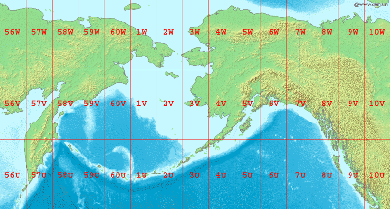
File:LA2-Bering-Sea-UTM-zones.png · Wikimedia Commons · See Wikimedia Commons
Bering Sea
Sign in to saveMarginal sea in the Pacific Ocean
The Bering Sea is a body of water in the Pacific Ocean that lies between Alaska and Russia. It is important for its rich fishing grounds, which support a significant commercial fishing industry.
AI-generated from the Wikipedia summary — may contain errors.
Wikidata facts
- Instance of
- sea
- Part of
- Pacific Ocean
- Has part
- Norton Sound
- Named after
- Vitus Bering
- Country
- Russia
- Located in
- Alaska
- Area
- 2300000
- Shares border with
- Aleutians West Census Area
- Image
- Bering Sea sunset - NOAA.jpg
- Width
- 1600
- Length
- 2400
Show 8 more facts
- inflows
- Nome River
- Commons category
- Bering Sea
- topic's main category
- Category:Bering Sea
- vertical depth
- 4191
- native label
- Берингскойе море
- different from
- Barents Sea
- on focus list of Wikimedia project
- Wikipedia:Vital articles/Level/4
- volume as quantity
- 3796000
via Wikidata · CC0
~10 min read
Encyclopedic overview
The Bering Sea (/ˈbɛərɪŋ, ˈbɛrɪŋ/ BAIR-ing, BERR-ing, US also /ˈbɪərɪŋ/ BEER-ing; Russian: Бе́рингово мо́ре, romanized: Béringovo móre, IPA: [ˈbʲerʲɪnɡəvə ˈmorʲe]) is a marginal sea of the Northern Pacific Ocean. It forms, along with the Bering Strait, the divide between the two largest landmasses on Earth: Eurasia and the Americas. It comprises a deep water basin, which then rises through a narrow slope into the shallower water above the continental shelves. The Bering Sea is named after Vitus Bering, a Danish-born Russian navigator, who, in 1728, was the first European to systematically explore it, sailing from the Pacific Ocean northward to the Arctic Ocean.
The Bering Sea is separated from the Gulf of Alaska by the Alaska Peninsula. It covers over 2,000,000 square kilometers (770,000 sq mi) and is bordered on the east and northeast by Alaska, on the west by the Russian Far East and the Kamchatka Peninsula, on the south by the Alaska Peninsula and the Aleutian Islands and on the far north by the Bering Strait, which connects the Bering Sea to the Arctic Ocean's Chukchi Sea. Bristol Bay is the portion of the Bering Sea between the Alaska Peninsula and Cape Newenham on mainland Southwest Alaska.
Excerpted from Wikipedia’s “Bering Sea” article, available under the CC BY-SA 4.0 licence.
Gallery (11)
On the map
2 mapped locations
Available in 111 languages
- Español
- Français
- Deutsch
- 中文
- 日本語
- Русский
- Português
- Italiano
- العربية
- हिन्दी
- Afrikaans
- Albanian
- Aragonese
- Armenian
- Asturian
- azb
- Azerbaijani
- Bahasa Indonesia
Show 92 more
- Bangla
- Bashkir
- Basque
- Bavarian
- be_x_old
- Belarusian
- Bosnian
- Breton
- Bulgarian
- Burmese
- Catalan
- Cebuano
- Central Kurdish
- Chechen
- Chuvash
- Croatian
- Czech
- Danish
- Esperanto
- Estonian
- Extremaduran
- Fiji Hindi
- Filipino
- Finnish
- Galician
- Georgian
- Greek
- Hebrew
- Hungarian
- Icelandic
- Ido
- Iloko
- Irish
- Karachay-Balkar
- Kazakh
- Khmer
- Kotava
- Kurdish
- Kyrgyz
- Latin
- Latvian
- Lithuanian
- Low German
- Lower Sorbian
- Luxembourgish
- Macedonian
- Malay
- Malayalam
- Manx
- Marathi
- Mari
- Mingrelian
- Mongolian
- Nederlands
- Northern Frisian
- Norwegian
- Norwegian Nynorsk
- Occitan
- olo
- Ossetic
- Polski
- Punjabi
- Romanian
- Serbian
- Serbian (Latin)
- simple
- Sindhi
- Slovak
- Slovenian
- Svenska
- Swahili
- Tajik
- Tamil
- Tiếng Việt
- Türkçe
- Ukrainian
- Upper Sorbian
- Urdu
- Uzbek
- Venetian
- Waray
- Welsh
- Western Frisian
- Western Panjabi
- Wu Chinese
- Yiddish
- Yoruba
- zh_min_nan
- zh_yue
- فارسی
- ไทย
- 한국어
via Wikidata sitelinks · CC0