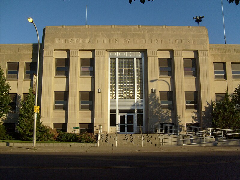
File:Miles_City_MT_Custer_County_Courthouse.jpg · Wikimedia Commons · See Wikimedia Commons
Custer County
Sign in to saveAlso known as Custer County, Montana, Custer County, MT
county in Montana, United States
Key facts
- Country
- United States
- State
- Montana
- Founded
- June 2, 1865
- Named after
- George Armstrong Custer (1839–1876)
- Seat
- Miles City
- Largest city
- Miles City
- Total
- 3,793 sq mi (9,820 km )
- Land
- 3,783 sq mi (9,800 km )
- Water
- 9.9 sq mi (26 km ) 0.3%
- Estimate 2025
- 12,034
- Density
- 3.137/sq mi (1.211/km )
- Time zone
- UTC−7 ( Mountain )
- Summer dst
- UTC−6 ( MDT )
- Congressional district
- 2nd
- Website
- https://custercountymt.com/
via Wikipedia infobox
Wikidata facts
- Population
- 12135
- Area
- 9824
- Official website
- custercountymt.gov
- Image
- Miles City MT Custer County Courthouse.jpg
- Households
- 4837
Show 5 more facts
- water as percent of area
- 0.3
- native label
- Custer County
- Commons category
- Custer County, Montana
- inception
- 1865-00-00
- per capita income
- 31267
Sources (9)
via Wikidata · CC0
~5 min read
Article
Custer County is a county located in the southeast part of the U.S. state of Montana. As of the 2020 U.S. census, the population was 11,867. Its county seat and largest town is Miles City. The county was established after the end of the American Civil War (1861–1865), on June 2, 1865, as one of the nine original counties of the new western federal Territory of Montana, which had been formed the previous May 1864 by the United States Congress, with the approval of 16th President Abraham Lincoln (1809–1865, served 1861–1865). It was originally named Big Horn County of the old Montana Territory, and was renamed on February 16, 1877, in honor of Lieutenant Colonel George Armstrong Custer (1839–1876), commander of the famous 7th Cavalry Regiment of the United States Army, recently massacred and killed in the nearby Battle of the Little Bighorn, in the later portion of the American Indian Wars, the year before in June 1876.
Geography