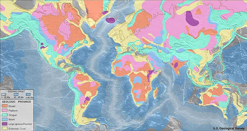
File:World_geologic_provinces.jpg · Wikimedia Commons · See Wikimedia Commons
geological map
Sign in to saveAlso known as geologic map
special-purpose map made to show geological features
Wikidata facts
- Depicts
- chronostratigraphy
- Image
- Geologic Map of Georgia.png
Show 3 more facts
- different from
- topographic map
- Commons category
- Geological maps
- topic's main category
- Category:Geologic maps
Sources (3)
via Wikidata · CC0
~19 min read
Encyclopedic overview
Mapped global geologic provinces Screenshot of a structure map generated by geological mapping software for an 8500 ft deep gas and oil reservoir in the Erath field, Vermilion Parish, Erath, Louisiana. The left-to-right gap, near the top of the contour map indicates a Fault line. This fault line is between the blue/green contour lines and the purple/red/yellow contour lines. The thin red circular contour line in the middle of the map indicates the top of the oil reservoir. Because gas floats above oil, the thin red contour line marks the gas/oil contact zone.
A geological map or geologic map is a special-purpose map made to show various geological features. Rock units or geologic strata are shown by color or symbols. Bedding planes and structural features such as faults, folds, are shown with strike and dip or trend and plunge symbols which give three-dimensional orientations features. Geological mapping is an interpretive process involving multiple types of information, from analytical data to personal observation, all synthesized and recorded by the geologist. Geologic observations have traditionally been recorded on paper, whether on standardized note cards, in a notebook, or on a map.
Excerpted from Wikipedia’s “geological map” article, available under the CC BY-SA 4.0 licence.