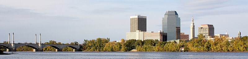
File:Springfield_Skyline,_MA.jpg · Wikimedia Commons · See Wikimedia Commons
Hampden County
Sign in to saveAlso known as Hampden County, Massachusetts, Hampden County, MA
county in Massachusetts, United States
Key facts
- Country
- United States
- State
- Massachusetts
- Founded
- August 1, 1812
- Named after
- John Hampden
- Seat
- Springfield
- Largest city
- Springfield
- Total
- 634 sq mi (1,640 km )
- Land
- 617 sq mi (1,600 km )
- Water
- 17 sq mi (44 km ) 2.7%
- Estimate 2024
- 464,338
- Density
- 755/sq mi (292/km )
- Time zone
- UTC−5 ( Eastern )
- Summer dst
- UTC−4 ( EDT )
- Congressional districts
- 1st , 2nd
via Wikipedia infobox
Wikidata facts
- Named after
- John Hampden
- Country
- United States
- Located in
- Massachusetts
- Contains
- Holyoke
- Capital
- Springfield
- Population
- 465825
- Area
- 1642
- Official website
- www.pvpc.org
- Image
- Hampden County Courthouse - DSC03264.JPG
- Households
- 180492
Show 10 more facts
- Commons category
- Hampden County, Massachusetts
- category of associated people
- Category:People from Hampden County, Massachusetts
- category for people who died here
- Category:Deaths in Hampden County, Massachusetts
- topic's main category
- Category:Hampden County, Massachusetts
- category for people born here
- Category:Births in Hampden County, Massachusetts
- inception
- 1812-00-00
- water as percent of area
- 2.7
- native label
- Hampden County
- per capita income
- 31483
Sources (9)
via Wikidata · CC0
~12 min read
Encyclopedic overview
Hampden County is a non-governmental county located in the Pioneer Valley of the U.S. state of Massachusetts, in the United States. As of the 2020 census, Hampden County's population was 465,825. Its traditional county seat is Springfield, the Connecticut River Valley's largest city, and economic and cultural capital; with an estimated population of 154,758, approximately one-third of Hampden County residents live in Springfield. 42°08′N 72°38′W / 42.14°N 72.63°W / 42.14; -72.63
History
Excerpted from Wikipedia’s “Hampden County” article, available under the CC BY-SA 4.0 licence.
Gallery (10)
On the map
2 mapped locations