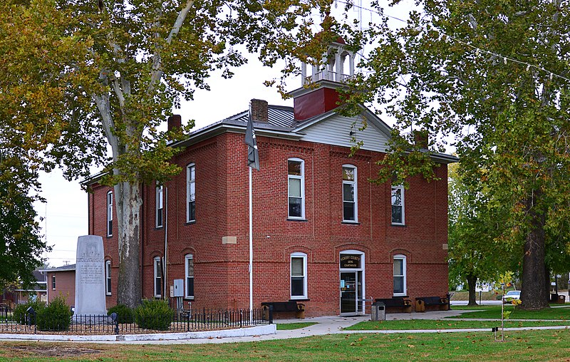
File:Hickory_County_Missouri_Courthouse_20191026-6904.jpg · Wikimedia Commons · See Wikimedia Commons
Hickory County
Sign in to saveAlso known as Hickory County, Missouri, Hickory County, MO
county in Missouri, United States
In the Vinony graph
Vinony's link graph records 473 inbound references to Hickory County, and connects out to race and ethnicity in the United States Census, Missouri and African Americans.
The entry is geolocated on the map in MO.
It is catalogued under topics including 1845 establishments in Missouri, Hickory County, Missouri and Missouri counties.
Vinony links it to 45 Wikipedia language editions.
Key facts
- Country
- United States
- State
- Missouri
- Founded
- February 14, 1845
- Named after
- Andrew Jackson , nicknamed "Old Hickory"
- Seat
- Hermitage
- Largest city
- Hermitage
- Total
- 412 sq mi (1,070 km )
- Land
- 399 sq mi (1,030 km )
- Water
- 13 sq mi (34 km ) 3.1%
- Estimate 2025
- 9,044
- Density
- 20.7/sq mi (8.01/km )
- Time zone
- UTC−6 ( Central )
- Summer dst
- UTC−5 ( CDT )
- Congressional district
- 4th
- Website
- Hickory County, Missouri
via Wikipedia infobox
Wikidata facts
- Named after
- Andrew Jackson
- Country
- United States
- Located in
- Missouri
- Contains
- Hermitage
- Capital
- Hermitage
- Population
- 8279
- Area
- 1066
- Shares border with
- St. Clair County
- Official website
- www.hickorycountymo.com
- Image
- USACE Harry S Truman Dam Missouri.jpg
- Households
- 4012
Show 7 more facts
- Commons category
- Hickory County, Missouri
- topic's main category
- Category:Hickory County, Missouri
- inception
- 1845-02-14
- water as percent of area
- 3.1
- native label
- Hickory County
- per capita income
- 19905
- category of associated people
- Category:People from Hickory County, Missouri
Sources (11)
via Wikidata · CC0
~6 min read
Encyclopedic overview
Hickory County is located in the U.S. state of Missouri. As of the 2020 census, the population was 8,279. Its county seat is Hermitage. The county was organized February 14, 1845, and named after President Andrew Jackson, whose nickname was "Old Hickory." The Pomme de Terre Dam, a Corps of Engineers facility, is located three miles south of Hermitage and forms Lake Pomme de Terre by damming the Pomme de Terre River and Lindley Creek. Truman Reservoir, also a Corps of Engineers facility, floods the Pomme de Terre Reservoir from the northern border of the county southward to the city limits of Hermitage.
Geography
Excerpted from Wikipedia’s “Hickory County” article, available under the CC BY-SA 4.0 licence.