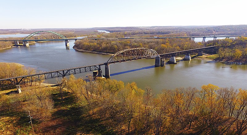
File:Illinois_River_near_LaSalle_Illinois.jpg · Wikimedia Commons · See Wikimedia Commons
Illinois River
Sign in to saveIllinois tributary of the Mississippi River in the United States
Key facts
- Country
- United States
- State
- Illinois
- Source
- Confluence of the Kankakee and Des Plaines Rivers
- Location
- Grundy County
- Coordinates
- 41°23′37″N 88°15′37″W / 41.39361°N 88.26028°W / 41.39361; -88.26028
- Elevation
- 505 ft (154 m)
- Mouth
- Mississippi River
- Length
- 273 mi (439 km)
- Basin size
- 28,070 sq mi (72,700 km )
- Average
- 23,280 cu ft/s (659 m /s)
- Minimum
- 1,330 cu ft/s (38 m /s)
- Maximum
- 123,000 cu ft/s (3,500 m /s)
- Progression
- Illinois → Mississippi → Gulf of Mexico
- Left
- Kankakee River , Mazon River , Vermilion River , Mackinaw River , Sangamon River
- Right
- Des Plaines River , Fox River , Illinois and Michigan Canal
via Wikipedia infobox
Wikidata facts
- Instance of
- river
- Country
- United States
- Located in
- Illinois
- Image
- Illinois River, seen from Starved Rock.jpg
- Length
- 432
Show 7 more facts
- tributary
- Kankakee River
- Commons category
- Illinois River
- mouth of the watercourse
- Mississippi River
- topic's main category
- Category:Illinois River
- watershed area
- 104000
- discharge
- 657
- basin country
- Illinois
Sources (3)
via Wikidata · CC0
~12 min read
Encyclopedic overview
The Illinois River (Miami-Illinois: Inoka Siipiiwi) is a principal tributary of the Mississippi River at approximately 273 miles (439 km) in length. Located in the U.S. state of Illinois, the river has a drainage basin of 28,756.6 square miles (74,479 km). The Illinois River begins with the confluence of the Des Plaines and Kankakee rivers in the Chicago metropolitan area, and it generally flows to the southwest across Illinois, until it empties into the Mississippi near Grafton, Illinois. Its drainage basin extends into southeastern Wisconsin, northwestern Indiana, and a very small area of southwestern Michigan in addition to central Illinois. Along its banks are several river ports, including the largest, Peoria, Illinois. Historic and recreation areas on the river include Starved Rock, and the internationally important wetlands of the Emiquon Complex and Dixon Waterfowl Refuge.
The river was important among Native Americans and French traders as the principal water route connecting the Great Lakes with the Mississippi. The French colonial settlements along these rivers formed the heart of the area known as the Illinois Country in the 17th and 18th centuries. After the construction of the Illinois and Michigan Canal and the Hennepin Canal in the 19th century, the role of the river as link between Lake Michigan and the Mississippi was extended into the era of modern industrial shipping. The Illinois now forms the basis for the Illinois Waterway, extending the river's capabilities for navigation and commercial shipping.
Excerpted from Wikipedia’s “Illinois River” article, available under the CC BY-SA 4.0 licence.
Gallery (7)
On the map
2 mapped locations