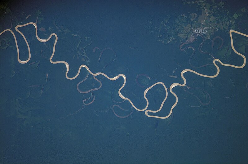
File:City_of_Carauari,_the_Juruá_River_and_its_tributaries,_taken_from_the_International_Space_Station.jpg · Wikimedia Commons · See Wikimedia Commons
Key facts
- Country
- Brazil , Peru
- Location
- Ucayali Region , Peru
- Coordinates
- 10°5′36.4776″S 72°11′56.4576″W / 10.093466000°S 72.199016000°W / -10.093466000; -72.199016000
- Elevation
- 377 m (1,237 ft)
- Mouth
- Amazon River
- Length
- 2,682.29 km (1,666.70 mi) 3,283 km (2,040 mi)
- Basin size
- 190,573 km (73,581 mi )
- Average
- (Period: 1979–2015)6,004.1 m /s (212,030 cu ft/s) (Period: 1973–1990)6,600 m /s (230,000 cu ft/s) (Period: 1971–2000)6,662.1 m /s (235,270 cu ft/s)
- Progression
- Amazon → Atlantic Ocean
- River system
- Solimões
- Left
- Môa , Ipixuna
- Right
- Gregório , Tarauaca , Xerua , Andirá
via Wikipedia infobox
Wikidata facts
- Instance of
- river
- Country
- Peru
- Located in
- Atalaya Province
- Continent
- South America
- Image
- Rio Jurua, Cruzeiro do Sul, Acre.jpg
- Length
- 3100
Show 7 more facts
- tributary
- Amônia River
- watershed area
- 224000
- drainage basin
- Amazon basin
- discharge
- 4765.0
- Commons category
- Rio Juruá
- mouth of the watercourse
- Amazon
- basin country
- Brazil
Sources (3)
via Wikidata · CC0
~1 min read
Encyclopedic overview
The Juruá River (Portuguese: Rio Juruá [ʒuɾuˈa]; Spanish: Río Yuruá) is a southern affluent river of the Amazon River west of the Purus River. The Juruá emerges from highlands in east-central Peru, then winds its way through lowlands in Brazil, sharing with this the bottom of the immense inland Amazon depression; and having all the characteristics of the Purus as regards curvature, sluggishness and general features of the low, half-flooded forest country it traverses.
For most of its length, the river flows through the Purus várzea ecoregion. This is surrounded by the Juruá-Purus moist forests ecoregion. The Juruá rises among the Ucayali highlands, and is navigable and unobstructed for a distance of 1,133 km (704 mi) above its junction with the Amazon. It has a total length of approximately 3,283 km (2,040 mi), and is one of the longest tributaries of the Amazon.
Excerpted from Wikipedia’s “Juruá River” article, available under the CC BY-SA 4.0 licence.
Gallery (2)
On the map
2 mapped locations