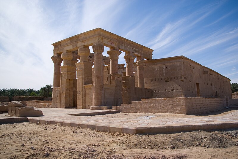
File:Temple_of_Hibis.jpg · Wikimedia Commons · See Wikimedia Commons
Kharga Oasis
Sign in to saveAlso known as El Kharga, El-Ḵarga, Al-Kharga, Al-Wāḥāt al-Khārijah, Elkargeh
Depression in Egypt
Key facts
- Country
- Egypt
- Governorate
- New Valley
- Total
- 1,017 km (393 sq mi)
- Elevation
- 32 m (105 ft)
- Density
- 86.02/km (222.8/sq mi)
- Time zone
- UTC+2 ( EET )
- Summer dst
- UTC+3 ( EEST )
via Wikipedia infobox
Wikidata facts
- Instance of
- depression
- Country
- Egypt
- Area
- 440098
- Elevation
- 32
- Time zone
- Egypt Standard Time
- Image
- Kharga Oasis by Hanne Siegmeier.jpg
Show 3 more facts
- Commons category
- Kharga Oasis
- different from
- pricing strategy
- described by source
- Encyclopædia Britannica 11th edition
via Wikidata · CC0
~9 min read
Encyclopedic overview
The Kharga Oasis (Arabic: الخارجة al-Ḫāriǧa, pronounced [elˈxæɾɡæ]) lit. 'the outer'; Coptic: (ϯ)ⲟⲩⲁϩ ⲛ̀ϩⲏⲃ (di)wah enhib, "Oasis of Hib", (ϯ)ⲟⲩⲁϩ ⲙ̀ⲯⲟⲓ (di)wah empsoi "Oasis of Psoi") is the southernmost of Egypt's five western oases. It is located in the Western Desert, about 200 km (125 miles) to the west of the Nile valley. "Kharga" or "El Kharga" is also the name of a major town located in the oasis, the capital of New Valley Governorate. The oasis, which was known as the 'Southern Oasis' to the Ancient Egyptians, the 'outer' (he Exotero) to the Greeks and Oasis Magna to the Romans, is the largest of the oases in the Libyan Desert of Egypt. It is in a depression about 160 km (100 miles) long and between 20 km (12 miles) and 80 km (50 miles) wide. Its estimated population is 87,482 as of 2023.
Overview
Excerpted from Wikipedia’s “Kharga Oasis” article, available under the CC BY-SA 4.0 licence.
Gallery (10)
On the map
2 mapped locations