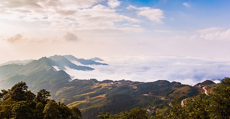
File:Mẫu_Sơn.jpg · Wikimedia Commons · See Wikimedia Commons
Key facts
- Country
- Vietnam
- Region
- Northeast
- Central hall
- No.2, Hùng Vương street, Chi Lăng ward, Lạng Sơn city
- Subdivision
- 15 municipalities, 10 rural districts
- Type
- Province
- Body
- Lạng Sơn Provincial People's Government
- Chairman of people s committee
- Hồ Tiến Thiệu
- Chairman of people s council
- Hoàng Văn Nghiệm
- Total
- 8,310.18 km (3,208.58 sq mi)
- Density
- 106.061/km (274.696/sq mi)
- Nungz
- 42.90%
- Tai
- 36.08%
- Kinh
- 16.09%
- Yao
- 3.61%
- Others
- 1.32%
- Province
- VNĐ 30.355 trillion, US$ 1.318 billion
- Time zone
- UTC+7 (Indochina Time)
- Iso 3166 code
- VN-09
via Wikipedia infobox
Wikidata facts
- Population
- 814000
- Area
- 8310.18
- Elevation
- 299
- Official website
- www.langson.gov.vn
- Image
- Lạng Sơn1.jpg
- Dialing code
- 025
Show 4 more facts
- Commons category
- Lang Son
- urban population
- 185870
- rural population
- 616220
- postal code
- 25000–25999
Sources (11)
via Wikidata · CC0
~20 min read
Article
Lạng Sơn ( Vietnamese pronunciation: [laːŋ˧˨ʔ səːn˧˧]) is a province in the Northeastern region of Vietnam, bordering China.
Geography
Gallery (12)
On the map
Connections
Ho Chi Minh City
City
Hanoi
City
Illicium verum
Entity
Vietnamese đồng
Entity
list of cities in Vietnam
Entity
Nung
Entity
China
Country
Vietnam
Country
gold
Entity
Chinese
Entity
mountain
Entity
maize
Entity
silver
Entity
elephant
Entity
time zone
Entity
lead
Entity
United States dollar
Entity
geographic coordinate system
Entity
Vietnamese
Entity
International Standard Book Number
Entity