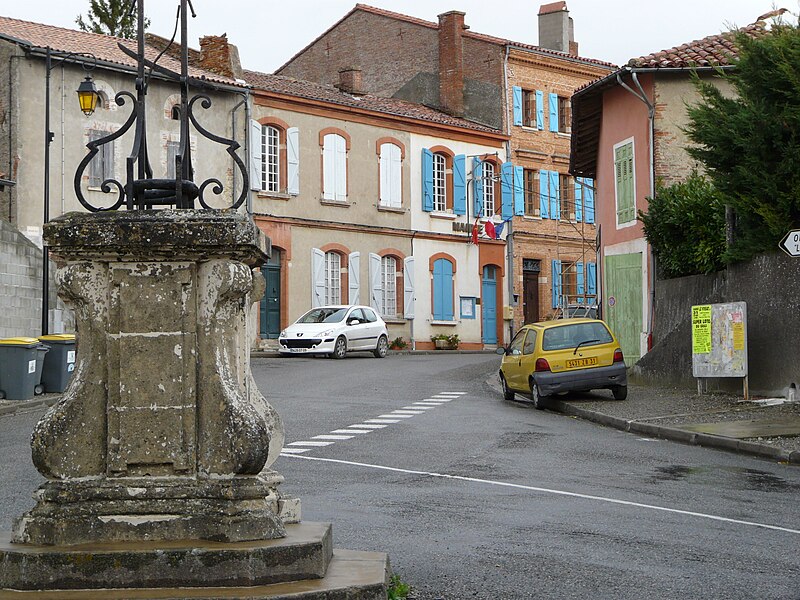
File:Mairie_de_Latrape.JPG · Wikimedia Commons · See Wikimedia Commons
Latrape
Sign in to saveLatrape (; ) is a commune in the Haute-Garonne department in southwestern France.
OverviewAI-generated
Latrape is a commune in France, situated within the canton of Rieux-Volvestre, the arrondissement of Muret, and the Haute-Garonne department. It is located in the Occitanie region and shares borders with Lézat-sur-Lèze, Bax, Canens, and Carbonne. The commune has an area of 19.08 and an elevation of 369 above sea level. Its postal code is 31310.
The population of Latrape is recorded as 444, comprising 189 males and 175 females. Another source lists the population as 333. The associated electoral district is the canton of Auterive. The official name of the locality is Latrape.
Synthesized by Vinony from 34 facts across 6 sources: Wikidata, Openweathermap, OpenStreetMap, GeoNames, Vinony graph, Geo. Generated from structured data (not the Wikipedia text) and checked against those facts — may still contain errors.
In the Vinony graph
The entry is geolocated on the map, across 2 mapped points.
Within Vinony's link graph, Latrape is referenced by 588 other articles, and connects out to France, time zone and geographic coordinate system.
It is catalogued under the topic Communes of Haute-Garonne.
Its subject is documented across 37 Wikipedia language editions.
Weather now
cached 8h agoKey facts
- French commune.name
- Latrape
- French commune.commune status
- Commune
- French commune.image
- Mairie de Latrape.JPG
- French commune.caption
- Town hall
- French commune.arrondissement
- Muret
- French commune.canton
- Auterive
- French commune.INSEE
- 31280
- French commune.postal code
- 31310
- French commune.mayor
- Charles Naylies
- French commune.term
- 2020–2026
- French commune.intercommunality
- Volvestre
- French commune.elevation m
- 354
- French commune.elevation min m
- 227
- French commune.elevation max m
- 369
- French commune.area km2
- 19.08
via Wikipedia infobox
Wikidata facts
- Instance of
- commune of France
- Official name
- Latrape
- Country
- France
- Located in
- arrondissement of Muret
- Population
- 444
- Area
- 19.08
- Elevation
- 297
- Time zone
- UTC+02:00
- Shares border with
- Rieux-Volvestre
- Image
- Mairie de Latrape.JPG
Show 7 more facts
- Commons category
- Latrape
- postal code
- 31310
- associated electoral district
- canton of Auterive
- male population
- 189
- female population
- 175
- email address
- mailto:[email protected]
- phone number
- +33-5-61-87-61-02
Sources (4)
via Wikidata · CC0
~1 min read
Encyclopedic overview
4 sectionsContents
- Geography
- Population
- See also
- References
Latrape (; ) is a commune in the Haute-Garonne department in southwestern France.
==Geography== The commune is bordered by eight other communes, seven of them is in Haute-Garonne, and one in Ariège: Lacaugne to the north, Carbonne and Rieux-Volvestre to the northwest, Castagnac to the east, Canens to the southeast, Bax to the south, Mailholas to the west, and finally by the department of Ariège to the northeast by the commune of Lézat-sur-Lèze.
Excerpted from Wikipedia’s “Latrape” article, available under the CC BY-SA 4.0 licence.
On the map
2 mapped locations