
Lesotho
Sign in to saveAlso known as Kingdom of Lesotho, ls, LES, The Mountain Kingdom
Lesotho ( , ), officially the Kingdom of Lesotho and formerly known as Basutoland, is a landlocked country in Southern Africa. Entirely surrounded by South Africa, it is the largest of only three sovereign enclaves in the world, the others being San Marino and Vatican City, which are surrounded by Italy. Lesotho is situated in the Maloti Mountains and contains the highest peak in Southern Africa. It has an area of over and has a population of about 2.3 million. Its capital and largest city is Maseru.
OverviewAI-generated
Lesotho, officially the Kingdom of Lesotho, is a sovereign state, enclave, and landlocked country located in Africa. It is entirely surrounded by South Africa. The capital city is Maseru. The country is named after Sesotho, which is one of its official languages alongside English. The head of state is Letsie III of Lesotho. Lesotho is a member of the United Nations, the Commonwealth of Nations, the African Union, and the World Trade Organization.
The nation has a population of 2,116,427 and covers an area of 30,355. Its highest point is Thabana Ntlenyana. Lesotho contains administrative entities including Berea District, Butha-Buthe District, Leribe District, and Mafeteng District. The currency used is the loti and the rand. The top-level Internet domain is .ls, and the telephone country code is +266. The national anthem is Lesotho Fatse La Bontata Rona.
Synthesized by Vinony from 68 facts across 9 sources: Wikidata, REST Countries, Openweathermap, Open Meteo, World Bank, OpenStreetMap, PubMed, Vinony graph, Geo. Generated from structured data (not the Wikipedia text) and checked against those facts — may still contain errors.
In the Vinony graph
Lesotho is indexed among the 215 entries in Vinony's Countries collection.
Vinony's link graph records 6,652 inbound references to Lesotho, and connects out to African Union, list of kings of Lesotho and Christianity.
The entry is geolocated on the map in LS, across 6 mapped points.
It sits within the topics 1966 establishments in Africa, Commonwealth monarchies and Countries and territories where English is an official language.
Weather now
cached 17h ago7-day forecast
via Open-Meteo
Country
- Capital
- Maseru
- Population
- 2,116,427
- Region
- Africa · Southern Africa
- Demonym
- Mosotho
- Currencies
- LSL (L), ZAR (R)
- Languages
- English, Sotho
- Calling code
- +266
- Drives on
- Left
- Gini
- 44.9 (2017)
- FIFA code
- LES
- TLD
- .ls
- Timezones
- UTC+02:00
- Borders
- ZAF
via REST Countries
Indicators · World Bank
- GDP
- $2.3B(2024)
- Population
- 2,337,423(2024)
- Life expectancy
- 57.8 yrs(2024)
- Unemployment
- 16.3 %(2025)
- Urban population
- 43.7 %(2024)
- Internet users
- 51.8 %(2024)
- Forest area
- 1.1 %(2023)
- Renewable energy
- 34.9 %(2022)
via World Bank Open Data · CC BY 4.0
Wikipedia views (30d)
74,635 totalvia Wikimedia Pageviews API
Key facts
- Country.conventional_long_name
- Kingdom of Lesotho
- Country.common_name
- Lesotho
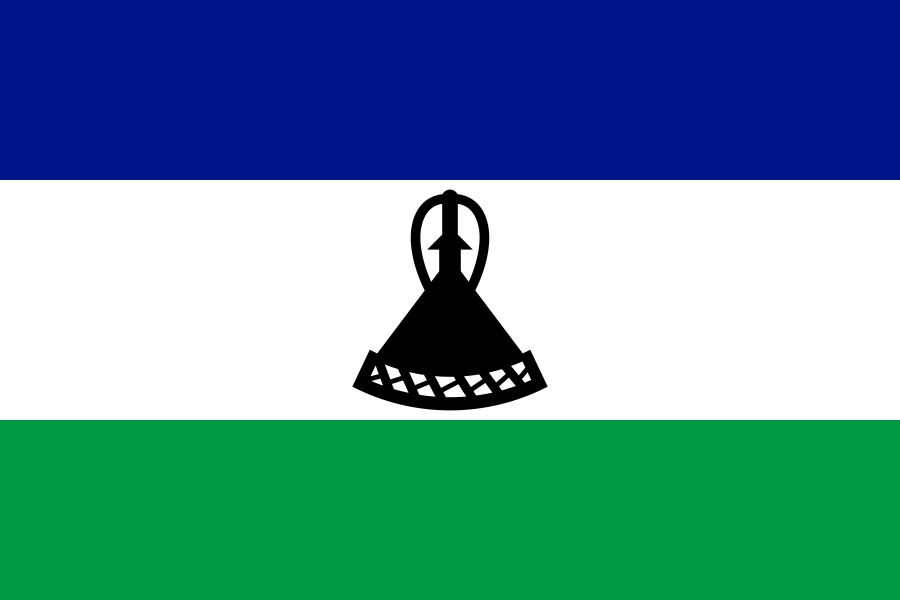
- Country.image_flag
- Flag of Lesotho.svg
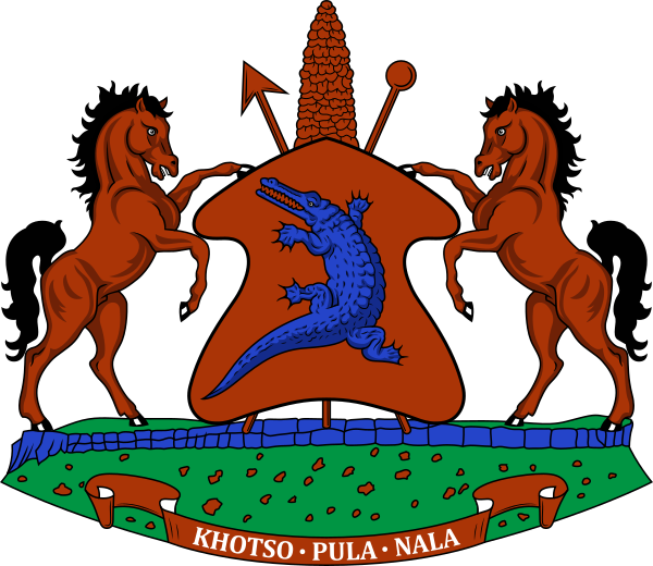
- Country.image_coat
- Coat of arms of Lesotho.svg
- Country.coa_size
- 90
- Country.national_motto
- "Peace, Rain, Prosperity"
- Country.national_anthem
- ''Lesotho fatše la bo-ntat'a rona''()
- Country.image_map
- Lesotho (orthographic projection).svg
- Country.map_caption
- Location of Lesotho (dark green)
- Country.capital
- Maseru
- Country.largest_city
- Maseru
- Country.ethnic_groups_year
- 2020
- Country.religion_year
- 2020
- Country.government_type
- Unitary parliamentary constitutional monarchy
- Country.leader_title1
- Monarch
- Country.leader_name1
- Letsie III
- Country.leader_title2
- Prime Minister
- Country.leader_name2
- Sam Matekane
via Wikipedia infobox
Research
1,605 papers- Lesotho.Department of State publication. Background notes series · 1987United States. Department of State. Bureau of Public Affairs
- [Lesotho].Jeune Afrique (Paris, France : 1980) · 1996
- Perceptions of Lesotho nurse-midwives regarding post-partum depression management.Curationis · 2024Maloleka N, Rathobei LM, Naranjee NDOI: 10.4102/curationis.v47i1.2624
- Global and country-level estimates of human population at high altitude.Proceedings of the National Academy of Sciences of the United States of America · 2021Tremblay JC, Ainslie PNDOI: 10.1073/pnas.2102463118
- Exploring economic empowerment and gender issues in Lesotho's Child Grants Programme: a qualitative study.ReviewHealth policy and planning · 2024Besnier E, Hlabana T, Kotzias V et al.DOI: 10.1093/heapol/czad009
- Exploring health equity in Lesotho's Child Grants Programme.Health policy and planning · 2024Besnier E, Kotzias V, Hlabana T et al.DOI: 10.1093/heapol/czad116
- Why I wander with wonder through Lesotho's wetlands.Nature · 2024Nordling LDOI: 10.1038/d41586-024-00726-0
- COVID-19 in Patients with Drug-Resistant Tuberculosis in Lesotho.The American journal of tropical medicine and hygiene · 2023Andom AT, Asfaw M, Maama-Maime LB et al.DOI: 10.4269/ajtmh.23-0422
via PubMed
Wikidata facts
- Instance of
- country
- Part of
- Southern Africa
- Named after
- Sesotho
- Official name
- le Royaume du Lesotho
- Demonym
- ليسوطويات
- Country
- Lesotho
- Contains
- Thaba-Tseka District
- Continent
- Africa
- Capital
- Maseru
- Official language
- Sesotho
- Currency
- rand
- Population
- 2007201
- Area
- 30355
- Head of government
- Sam Matekane
- Head of state
- Letsie III of Lesotho
- Form of government
- constitutional monarchy
- Legislature
- Parliament of Lesotho
- Shares border with
- South Africa
- Highest point
- Thabana Ntlenyana
- Official website
- www.gov.ls
- Image
- Lesotho - Location Map (2013) - LSO - UNOCHA.svg
- Life expectancy
- 54.174
- Nominal GDP
- 2553459763
Show 60 more facts
- Unemployment rate
- 26
- Calling code
- +266
- Licence plate code
- LS
- Mains voltage
- 220
- Motto
- Мир, дъжд, просперитет
- Flag
- flag of Lesotho
- Coat of arms
- coat of arms of Lesotho
- twinned administrative body
- Gummersbach
- top-level Internet domain
- .ls
- Commons category
- Lesotho
- enclave within
- South Africa
- member of
- African Continental Free Trade Area
- topic's main category
- Category:Lesotho
- category for people born here
- Q13335042
- category for films shot at this location
- Category:Films shot in Lesotho
- IPA transcription
- lɛˈsutu
- Commons gallery
- Lesotho
- lowest point
- Orange River
- mobile country code
- 651
- driving side
- left
- geography of topic
- Geography of Lesotho
- age of majority
- 21
- marriageable age
- 21
- category for people who died here
- Category:Death in Lesotho
- topic's main Wikimedia portal
- Portal:Lesotho
- diplomatic relation
- China
- language used
- Xhosa
- number of out-of-school children
- 151913
- located in/on physical feature
- Southern Africa
- total fertility rate
- 3.185
- maritime identification digits
- 644
- inception
- 1966-00-00
- replaces
- Basutoland
- Unicode character
- 🇱🇸
- central bank
- Central Bank of Lesotho
- native label
- Lesotho
- history of topic
- history of Lesotho
- VAT rate
- 14
- BTI Status Index
- 5.05
- BTI Governance Index
- 3.84
- economy of topic
- economy of Lesotho
- demographics of topic
- demographics of Lesotho
- Democracy Index
- 6.30
- Human Development Index
- 0.514
- hashtag
- Lesotho
- on focus list of Wikimedia project
- Wikipedia:Vital articles/Level/4
- Happy Planet Index score
- 27.3
- Gini coefficient
- 44.9
- Inequality-adjusted Human Development Index
- 0.372
- P12749
- Ban Ki-moon
- birth rate
- 25.778
- male population
- 1137496
- death rate
- 14.069
- rural population
- 1615392
- female population
- 1168329
- urban population
- 690433
- P8168
- Janie Jones
- Commonwealth Sport country code
- LES
- name in native language
- Kingdom of Lesotho
Sources (15)
via Wikidata · CC0
Travel guide
Get in
thumb|375px|A map showing the visa requirements of Lesotho, with countries in green having visa-free access. Others can apply for an eVisa
See
thumb|The Lesotho Highlands Semonkong Falls — these falls near Semonkong drop 200 m in single plunge! In summer, you can swim in the pond below while in winter the pond freezes over and an ice enclosure develops around the falls. Katse Dam — an impressive dam towering 185 m in a narrow valley Dinosaur footprints — well-preserved footprints of these terrible lizards exist around the country; the most accessible are near Moyeni & Morija Rock art — found in many places throughout the country, the most impressive found within Liphofung Cave.
Do
Pony-Trekking especially at either Malealea, Semonkong, or at the Basotho Pony-Trekking Centre — whether you are a seasoned pro at horse riding or a complete novice, pony-trekking is an extremely enjoyable way to see the Lesotho countryside. These organized tours give you access to parts of the country which you wouldn't see from your car. The exceptionally sure-footed Basotho Pony can take you through far-off villages and atop daunting mountains. Skiing — at Afriski, Oxbow during the winter.
Eat
thumb|Maseru There are many Western style restaurants in Maseru. For a more traditional meal, why not befriend some locals and see what they cook you?
Sleep
Lesotho hosts dozens of hotels, lodges and guesthouses.
Stay safe
It is risky to walk in Maseru alone at night. During the day, at least the main roads of Maseru are safe to walk alone.
As with pretty much everywhere else in the world, you may find friendly chats with locals turn in to veiled requests for money — stick to your principles and only give to registered charities.
At night time, it is the norm to drive through red lights. This is more just to hasten your journey (the police won't care), and a precaution against carjackings.
Stay healthy
The HIV/AIDS incidence rate in Lesotho is the 3rd highest in the world at around 25% or 1 in 4 people infected. Even more worrying is the prevalence rate of around 50% for women under 40 in urban areas.
Consult a doctor as to which vaccinations you will require, but they will most likely include hep A, hep B, and typhoid. If you are staying in rural areas for a long time then a rabies shot would be a good idea. Tropical diseases such as malaria, yellow fever and bilharzia are not present in Lesotho.
It is a very good idea to carry some sterile needles and dressing in your first aid kit: the hospitals throughout Lesotho are not of a very high standard.
If you do have any serious health problems while in Lesotho, get in contact with your country's embassy either in Maseru, or in most cases, in Pretoria in South Africa, as there are very good hospitals across the border in SA for those who can afford to use them.
Lesotho is a high, mountainous plateau, and altitude sickness may occur when you first arrive. Drink a lot of water and keep covered up, skin burns quickly in the thin mountain air. It gets hot in the sun in the summer.
The water in Lesotho is not clean and should not be drunk untreated. Be warned about street vendors who sell fizzy drinks as these are usually in unclean reused glass bottles.
Pack moisturizer! Lesotho's air is dry and some people will develop dry skin.
Respect
thumb|Lamb shepherd in Lesotho Try to learn a few Sesotho words before travelling to Lesotho. The locals appreciate a foreigner who has made the effort to learn their language. Always refer to an elder person, or a person of higher social standing as "Ntate" (male) or " 'Me " (female).
Dumela (pronounced due-mela) is hello. So you would say Dumela Ntate or Dumela 'Me. Kea leboha (sounds like kia-lebh-oha) — thank you U phela joang (O-phela-joang) — how are you Respond with either hantle (well) or Ke phela hantle (I am well) Sala hantle (as it is written) is "stay well" if they are staying and you are going. Equivalent to goodbye. Tsamaea hantle is "go well" if they are going and you are staying
Always respond to people: It is very offensive to ignore someone who greets you. As a foreigner, locals will be keen to say hello and ask you what you're up to in their country.
Never get angry at anyone; in the Basotho culture, people never show frustration towards others, and if you do, then you can easily offend someone. You will almost certainly get frustrated when dealing with Lesotho officialdom, always keep your cool no matter how much buffoonery you are subjected to. To show respect when giving and receiving items, use both hands. Also show a respect for food: don't throw it around, or eat whilst walking. Overall, Basotho people are humble and down to earth.
Connect
In Maseru, there are several internet cafes, although fairly cheap (usually LSL0.20-0.50 per min) they are pretty slow at best.
The mobile phone network is OK in the towns, but fair out in the countryside. The only British mobile phone network that has a roaming agreement is Vodafone. There are two mobile operators in Lesotho, Vodacom and Econet Telecom Lesoth . Vodacom has the widest coverage outside the towns, but is the (more) oversubscribed, and hence the less reliable. You can buy a Vodacom or Ezicel Buddie pay as you go sim card for under M50 in Maseru: worthwhile if you are staying for a while. Mobile phones are available for hire in Maseru. Lesotho uses GSM900. The networks are good, and both have 4G options.
If you have a South African Vodacom SIM Card, you can use it in Lesotho only on the Vodacom network. Be sure to enable roaming.
Go next
Ukhahlamba Drakensberg — mountainous region in South Africa, close to Lesotho
Travel guide from Wikivoyage (CC BY-SA 4.0)
~40 min read
Encyclopedic overview
26 sectionsContents
- History
- Basutoland
- Independence
- Politics
- Foreign relations
- Defence and law enforcement
- Law
- Districts
- Geography
- Climate
- Drought
- Wildlife
- Economy
- Demographics
- Ethnic groups and languages
- Religion
- Education and literacy
- Health
- Violence against women
- Sport and culture
- Film and media
- See also
- Notes
- References
- Sources
- External links
Lesotho (/lɪˈsuːtuː/ lih-SOO-too; Sotho pronunciation: [lɪˈsʊːtʰʊ] ), officially the Kingdom of Lesotho and formerly known as Basutoland, is a landlocked country in Southern Africa. Surrounded by South Africa, it is the largest of the only three sovereign enclaves. Lesotho is located in the Maloti Mountains, with the highest peak in southern Africa. It has an area of over 30,000 km (11,600 mi), with a population of about 2.3 million. Its capital and largest city is Maseru.
Lesotho was formed in 1824 by King Moshoeshoe I. Continuous encroachments by Dutch settlers made the King enter into an agreement with the United Kingdom to become a protectorate in 1868 and, in 1884, a crown colony. It achieved independence in 1966, and was subsequently ruled by the Basotho National Party (BNP) for two decades. Its constitutional government was restored in 1993 after seven years of military rule. King Moshoeshoe II was exiled in 1990 but returned in 1992 and was reinstated in 1995. One year later, Moshoeshoe II died and his son Letsie III took the throne, which he still holds.
Excerpted from Wikipedia’s “Lesotho” article, available under the CC BY-SA 4.0 licence.
Gallery (51)
On the map
6 mapped locations
Available in 238 languages
- Español
- Français
- Deutsch
- 中文
- 日本語
- Русский
- Português
- Italiano
- العربية
- हिन्दी
- Abkhazian
- Achinese
- Afrikaans
- Albanian
- Albanian
- Amharic
- ami
- Angika
Show 219 more
- Aragonese
- Armenian
- Arpitan
- Asturian
- azb
- Azerbaijani
- Bahasa Indonesia
- Balinese
- Bambara
- Bangla
- Banjar
- Bashkir
- Basque
- bat_smg
- Bavarian
- be_x_old
- Belarusian
- Betawi
- Bhojpuri
- Bikol
- Bishnupriya
- Bislama
- Bosnian
- Breton
- Bulgarian
- Buriat
- Burmese
- Catalan
- cbk_zam
- cdo
- Cebuano
- Central Kurdish
- Chechen
- Chuvash
- Colognian
- Cornish
- Corsican
- Crimean Tatar
- Croatian
- Czech
- dag
- Danish
- Divehi
- dty
- Egyptian Arabic
- Esperanto
- Estonian
- Ewe
- Extremaduran
- Faroese
- Fiji Hindi
- Filipino
- Finnish
- fiu_vro
- Fon
- Frafra
- Fula
- Gagauz
- Galician
- Ganda
- gcr
- Georgian
- Gilaki
- gpe
- Greek
- Guarani
- Haitian Creole
- Hakka Chinese
- Hausa
- Hebrew
- Hungarian
- Icelandic
- Ido
- Igbo
- Iloko
- Inari Sami
- Interlingua
- Interlingue
- Irish
- Jamaican Creole English
- Javanese
- Kabyle
- Kannada
- Kara-Kalpak
- Karachay-Balkar
- Kazakh
- kbp
- Kikuyu
- Kinyarwanda
- Kongo
- Kotava
- Kurdish
- Kyrgyz
- Ladino
- Latin
- Latvian
- Ligurian
- Limburgish
- Lingala
- Lingua Franca Nova
- Lithuanian
- lld
- Lombard
- Low German
- Lower Sorbian
- Luxembourgish
- Macedonian
- Malagasy
- Malay
- Malayalam
- Maltese
- Manipuri
- Manx
- Māori
- Marathi
- Mazanderani
- Minangkabau
- Mingrelian
- Moksha
- Mongolian
- Moroccan Arabic
- Navajo
- nds_nl
- Nederlands
- Nepali
- Newari
- Northern Frisian
- Northern Sami
- Northern Sotho
- Norwegian
- Norwegian Nynorsk
- Novial
- Obolo
- Occitan
- Old English
- olo
- Oromo
- Ossetic
- Pampanga
- Papiamento
- Pashto
- Piedmontese
- Polski
- Punjabi
- Quechua
- Romanian
- Sango
- Sanskrit
- Santali
- Sardinian
- Saterland Frisian
- Scots
- Scottish Gaelic
- Serbian
- Serbian (Latin)
- Shan
- Shona
- Sicilian
- Silesian
- simple
- Sindhi
- Sinhala
- Slovak
- Slovenian
- Somali
- South Ndebele
- Southern Sotho
- Standard Moroccan Tamazight
- Sundanese
- Svenska
- Swahili
- Swati
- szy
- Tajik
- Talysh
- Tamil
- Taroko
- Tatar
- tay
- Telugu
- Tibetan
- Tiếng Việt
- Tok Pisin
- Toki Pona
- Tsonga
- Tswana
- Tumbuka
- Türkçe
- Turkmen
- Udmurt
- Ukrainian
- Upper Sorbian
- Urdu
- Uyghur
- Uzbek
- Venda
- Venetian
- Veps
- Volapük
- Waray
- Welsh
- Western Frisian
- Western Panjabi
- Wolof
- Wu Chinese
- Xhosa
- Yakut
- Yiddish
- Yoruba
- Zaza
- Zeelandic
- zh_classical
- zh_min_nan
- zh_yue
- Zhuang
- Zulu
- فارسی
- ไทย
- 한국어
via Wikidata sitelinks · CC0