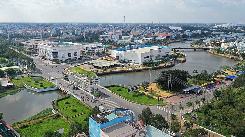
File:Thành_phố_Tân_An.jpg · Wikimedia Commons · See Wikimedia Commons
Key facts
- Country
- Vietnam
- Region
- Mekong Delta
- Metropolitan area
- Ho Chi Minh City metropolitan area
- Dissolved
- 12 June 2025
- Capital
- Tân An
- People s council chair
- Nguyễn Văn Được
- People s committee chair
- Nguyễn Văn Út
- Total
- 4,494.79 km (1,735.45 sq mi)
- Density
- 415.981/km (1,077.39/sq mi)
- Ethnicities
- Vietnamese , Hoa , Khmer
- Time zone
- UTC+7 (ICT)
- Iso 3166 code
- VN-41
- Hdi 2020
- 0.720 , ( 27th )
- Website
- eng .longan .gov .vn
via Wikipedia infobox
Wikidata facts
- Country
- Vietnam
- Located in
- Mekong Delta
- Contains
- Kiến Tường
- Continent
- Asia
- Capital
- Tân An
- Population
- 1734260
- Area
- 4494.79
- Elevation
- 4
- Shares border with
- Svay Rieng Province
- Official website
- www.longan.gov.vn
- Image
- Một góc TP.Tân An bên sông Vàm Cỏ Tây.jpg
- Dialing code
- 272
Show 10 more facts
- Commons category
- Long An
- native label
- ខេត្តកំពង់គោ
- language used
- Khmer
- topic's main category
- Category:Long An province
- category of associated people
- Category:People from Long An province
- urban population
- 318580
- rural population
- 1415680
- postal code
- 83000–83999
- merged into
- Tây Ninh
- dissolved, abolished or demolished date
- 2025-06-12
Sources (12)
via Wikidata · CC0
~4 min read
Encyclopedic overview
Tôn Thạnh Temple, an ancient temple in Long An
Long An was a former province in the Mekong Delta region of southern Vietnam. The provincial capital is Tân An city, and other major districts and town include Kiến Tường, Bến Lức, Cần Giuộc and Đức Hòa. There are 15 districts within the province (included 1 provincial capital city and 1 district-level town).
Excerpted from Wikipedia’s “Long An” article, available under the CC BY-SA 4.0 licence.