Official website (http://www.loriol.com/)
Loriol-sur-Drôme
Sign in to saveAlso known as Loriol-sur-Drome
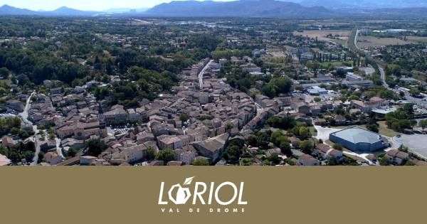
Loriol-sur-Drôme (, literally Loriol on Drôme; Vivaro-Alpine: L’Auriòu de Droma) is a commune in the Drôme department in southeastern France.
OverviewAI-generated
Loriol-sur-Drôme is a commune in France, situated within the Drôme department and the arrondissement of Valence. It serves as the capital of the canton of Loriol-sur-Drôme. The town is located in the Auvergne-Rhône-Alpes region and shares borders with Baix, Le Pouzin, Cliousclat, and Grane. It is positioned next to the Rhône river and stands at an elevation of 365 meters above sea level.
The administrative area covers 28.66 square kilometers. According to available data, the population is 6,648, comprising 3,221 males and 3,372 females. The postal code for the commune is 26270. Loriol-sur-Drôme has twinned relationships with the administrative bodies of Tradate and Schwalmstadt.
Synthesized by Vinony from 49 facts across 8 sources: Wikidata, Openweathermap, OpenStreetMap, Firecrawl, GeoNames, Open Meteo, Vinony graph, Geo. Generated from structured data (not the Wikipedia text) and checked against those facts — may still contain errors.
Weather now
7-day forecast
via Open-Meteo
Place details
- Locality
- Loriol-sur-Drôme
- Region
- Auvergne-Rhône-Alpes
- Country
- France
- Population
- 5,803
via OpenStreetMap · GeoNames
Key facts
- French commune.name
- Loriol-sur-Drôme
- French commune.commune status
- Commune
- French commune.image
- Mairie Loriol 2011-09-02-028.jpg
- French commune.caption
- Town hall
- French commune.image coat of arms
- Blason ville fr Loriol-sur-Drôme (Drôme).svg
- French commune.arrondissement
- Die
- French commune.canton
- Loriol-sur-Drôme
- French commune.INSEE
- 26166
- French commune.postal code
- 26270
- French commune.mayor
- Claude Aurias
- French commune.term
- 2020–2026
- French commune.intercommunality
- Val de Drôme en Biovallée
- French commune.elevation m
- 108
- French commune.elevation min m
- 81
- French commune.elevation max m
- 365
- French commune.area km2
- 28.66
via Wikipedia infobox
Official website
Ville de Loriol - Site officiel de la ville de Loriol
Découvrez Loriol-sur-Drôme, une ville authentique entre Valence et Montélimar, idéale pour une escapade gourmande et culturelle en Drôme provençale.
loriol.com →Link to the official site · 7,808 chars · not written by Vinony
Wikidata facts
- Instance of
- commune of France
- Named after
- Drôme
- Official name
- Loriol
- Country
- France
- Located in
- arrondissement of Die
- Population
- 6614
- Area
- 28.66
- Elevation
- 130
- Time zone
- UTC+02:00
- Body of water
- Rhône
- Shares border with
- Saulce-sur-Rhône
- Official website
- www.loriol.com
- Image
- Mairie Loriol 2011-09-02-028.jpg
Show 11 more facts
- twinned administrative body
- Schwalmstadt
- Commons category
- Loriol-sur-Drôme
- postal code
- 26270
- native label
- Loriol-sur-Drôme
- associated electoral district
- canton of Loriol-sur-Drôme
- male population
- 3221
- female population
- 3372
- P8168
- Biggin Hill
- email address
- mailto:[email protected]
- phone number
- +33-4-75-61-63-76
- fax number
- +33-4-75-61-67-03
via Wikidata · CC0
~1 min read
Encyclopedic overview
4 sectionsContents
- History
- Population
- See also
- References
Loriol-sur-Drôme (, literally Loriol on Drôme; Vivaro-Alpine: L’Auriòu de Droma) is a commune in the Drôme department in southeastern France.
Loriol is situated in the Rhône valley, between Valence and Montélimar. The neighbouring villages are Livron-sur-Drôme, Mirmande, and Cliousclat.
Excerpted from Wikipedia’s “Loriol-sur-Drôme” article, available under the CC BY-SA 4.0 licence.
Gallery (2)
On the map
2 mapped locations