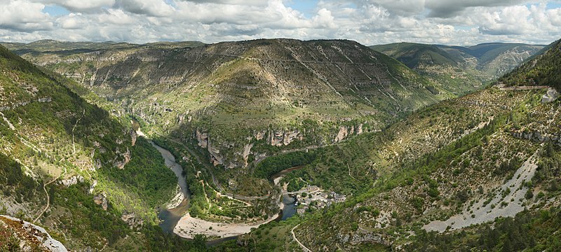
File:Saint_Chely_Tarn.jpg · Wikimedia Commons · See Wikimedia Commons
The Massif Central is a large elevated region located in south-central France that covers a significant portion of the country's interior. It is an important geographical feature that influences the climate, geology, and landscape of central France.
AI-generated from the Wikipedia summary — may contain errors.
Wikidata facts
- Instance of
- mountain range
- Part of
- Hercynian Forest
- Country
- France
- Located in
- France
- Area
- 85000
- Elevation
- 1886
- Highest point
- Puy de Sancy
- Image
- France Massif central.jpg
Show 4 more facts
- Commons category
- Massif Central
- topic's main category
- Category:Massif Central
- Commons gallery
- Massif central
- time period
- Paleozoic
Sources (1)
via Wikidata · CC0
~5 min read
Encyclopedic overview
The Massif Central (French pronunciation: [masif sɑ̃tʁal]) is a highland region in south-central France consisting of mountains and plateaus. It covers about 15% of mainland France.
Subject to volcanism that has subsided in the last 10,000 years, these central mountains are separated from the Alps by a deep north–south cleft created by the Rhône river and known in French as the sillon rhodanien (literally "Rhône furrow"). The region was a barrier to transport within France until the opening of the A75 motorway, which not only made north–south travel easier but also opened access to the massif itself.
Excerpted from Wikipedia’s “Massif Central” article, available under the CC BY-SA 4.0 licence.
Gallery (8)
On the map
2 mapped locations
Available in 58 languages
- Español
- Français
- Deutsch
- 中文
- 日本語
- Русский
- Português
- Italiano
- العربية
- Afrikaans
- Armenian
- Arpitan
- Bahasa Indonesia
- Basque
- be_x_old
- Belarusian
- Bosnian
- Breton
Show 39 more
- Bulgarian
- Catalan
- Cebuano
- Croatian
- Czech
- Danish
- Esperanto
- Estonian
- Finnish
- Georgian
- Greek
- Hungarian
- Icelandic
- Kyrgyz
- Latvian
- Lithuanian
- Macedonian
- Nederlands
- Northern Frisian
- Norwegian
- Norwegian Nynorsk
- Occitan
- Polski
- Romanian
- Serbian
- Serbian (Latin)
- Sicilian
- simple
- Slovak
- Slovenian
- Svenska
- Tiếng Việt
- Ukrainian
- Venetian
- Welsh
- Western Frisian
- فارسی
- ไทย
- 한국어
via Wikidata sitelinks · CC0