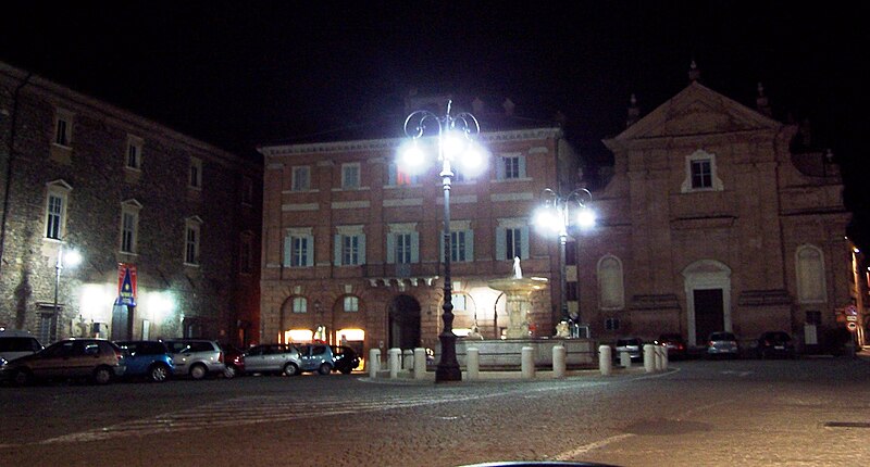
File:Matelica_night_1.jpg · Wikimedia Commons · See Wikimedia Commons
Matelica
Sign in to saveMatelica is a (municipality) of the Province of Macerata in the Italian region of Marche. Located about southwest of Ancona and west of Macerata, it extends over an area of .
Key facts
- Italian comune.name
- Matelica
- Italian comune.official_name
- Comune di Matelica
- Italian comune.image_skyline
- matelica_night_1.jpg
- Italian comune.image_caption
- Piazza Enrico Mattei
- Italian comune.image_shield
- Matelica-Stemma.svg
- Italian comune.region
- Marche
- Italian comune.province
- Macerata (MC)
- Italian comune.frazioni
- Balzani, Braccano, Castiglione, Cavalieri, Colferraio, Collepere, Colli, Grimaldi, Mistriano, Pezze, Piane, Poggeto, San Nicola, Terricoli, Valbona, Vinano
- Italian comune.mayor_party
- Matelica Futura
- Italian comune.mayor
- Massimo Baldini
- Italian comune.area_total_km2
- 81.1
- Italian comune.population_total
- 9384
- Italian comune.population_as_of
- 31 December 2021
- Italian comune.population_demonym
- Matelicesi
- Italian comune.elevation_m
- 354
- Italian comune.saint
- St. Adrian
- Italian comune.day
- 16 September
- Italian comune.postal_code
- 62024
via Wikipedia infobox
Wikidata facts
- Official name
- Matelica
- Demonym
- matelicesi
- Population
- 9170
- Area
- 81.1
- Elevation
- 354
- Official website
- www.comune.matelica.mc.it
- Image
- PanoramaMatelica.jpg
- Dialing code
- 0737
- Licence plate code
- MC
Show 4 more facts
- Commons category
- Matelica
- postal code
- 62024
- P8168
- 1984 Cincinnati Open
- native label
- Matelica
Sources (7)
via Wikidata · CC0
~3 min read
Article
7 sectionsContents
- Geography
- Climate
- History
- Main sights
- Twin towns
- References and notes
- External links
Matelica is a (municipality) of the Province of Macerata in the Italian region of Marche. Located about southwest of Ancona and west of Macerata, it extends over an area of .
==Geography== Matelica lies in an ample valley where the Braccano creek joins the Esino river, dominated by the town from an eastern ravine. The valley, roughly in the north–south direction, is delimited on the east and west sides by Apennines sub-ranges, whose highest peaks are respectively Mount Gemmo at and Mount San Vicino at , compared to the above sea-level of the city centre.
Gallery (2)
On the map
2 mapped locations