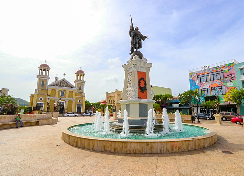
File:Plaza_Mayaguez.jpg · Wikimedia Commons · See Wikimedia Commons
Mayagüez
Sign in to saveAlso known as Mayagüez, Puerto Rico, Mayagüez Municipio, Mayagüez, PR, Mayagüez PR
municipality in Puerto Rico
Key facts
- Sovereign state
- United States
- Commonwealth
- Puerto Rico
- Founded
- September 18, 1760
- Founded by
- Faustino Martínez de Matos, Juan de Silva, Juan de Aponte
- Named after
- Originally Virgin of Candelaria then local indigenous name variant.
- Seat
- Casa Alcaldia de Mayaguez
- Barrios
- 21 barrios Algarrobos Bateyes Guanajibo Isla de Mona e Islote Monito Juan Alonso Leguísamo Limón Malezas Mayagüez Arriba Mayagüez barrio-pueblo Miradero Montoso Naranjales Quebrada Grande Quemado Río Cañas Abajo Río Cañas Arriba Río Hondo Rosario Sábalos Sabanetas
- Type
- Mayor-council government
- Mayor
- Jorge Ramos Ruiz ( PPD )
- Senatorial dist
- Mayagüez
- Representative dist
- 18 and 19
- Municipality
- 274.09 sq mi (709.89 km )
- Land
- 77.63 sq mi (201.07 km )
- Water
- 196.46 sq mi (508.82 km )
- Highest elevation
- 1,577 ft (480.6 m)
- Lowest elevation
- 0 ft (0 m)
- Estimate 2025
- 68,905
- Rank
- 9th in Puerto Rico
via Wikipedia infobox
Wikidata facts
- Instance of
- municipality of Puerto Rico
- Country
- United States
- Located in
- Puerto Rico
- Official language
- English language
- Population
- 59427
- Area
- 59.966393
- Elevation
- 21
- Time zone
- UTC−04:00
- Shares border with
- San Germán
- Official website
- www.pr.gov/directorio-municipos/mayaguez
- Image
- Plaza Mayaguez.jpg
- Households
- 29542
- Dialing code
- 939
- Patron saint
- Virgin of Candelaria
Show 10 more facts
- Commons category
- Mayagüez, Puerto Rico
- topic's main category
- Category:Mayagüez, Puerto Rico
- category for people born here
- Category:Births in Mayagüez, Puerto Rico
- category of associated people
- Category:People from Mayagüez, Puerto Rico
- postal code
- 00682
- inception
- 1760-00-00
- described by source
- Encyclopædia Britannica 11th edition
- native label
- Mayagüez
- per capita income
- 11598
- twinned administrative body
- Callao
Sources (11)
via Wikidata · CC0
~36 min read
Encyclopedic overview
Mayagüez ( Spanish pronunciation: [maʝaˈɣwes], locally [maʝaˈweʔ]) is the ninth-largest municipality in Puerto Rico. It was founded as Pueblo de Nuestra Señora de la Candelaria de Mayagüez (Township of Our Lady of Candelaria), and is also known as La Sultana del Oeste (The Sultaness of the West), Ciudad de las Aguas Puras (City of Pure Waters), or Ciudad del Mangó (Mango City). On April 6, 1894, the Spanish Crown granted it the formal title of Excelente Ciudad de Mayagüez (Excellent City of Mayagüez). Mayagüez is located in the center of the western coast on the island of Puerto Rico. It has a population of 73,077, and it is the principal city of the Mayagüez Metropolitan Statistical Area (pop. 213,831) and the Mayagüez–Aguadilla, PR Combined Statistical Area (pop. 467,599).
History
Excerpted from Wikipedia’s “Mayagüez” article, available under the CC BY-SA 4.0 licence.