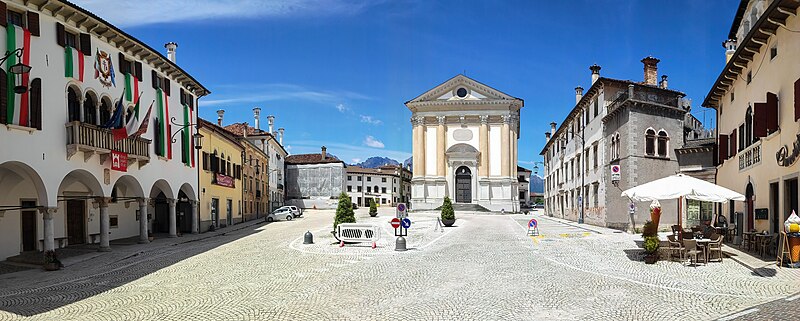
File:Piazza_Papa_Luciani,_Mel.jpg · Wikimedia Commons · See Wikimedia Commons
settlement in the Italian municipality of Borgo Valbelluna
Key facts
- Country
- Italy
- Region
- Veneto
- Province
- Belluno (BL)
- Frazioni
- Bardies, Campo, Campo San Pietro, Carve, Carve Montagna, Col, Conzago, Cordellon, Corte, Farra, Follo, Gus, Marcador, Nave, Pagogna, Pellegai, Samprogno, San Candido, Signa, Tallandino, Tiago, Torta, Tremea, Valmaor, Vanie-Rive di Villa, Villa di Villa, Zottier
- Mayor
- Stefano Cesa
- Total
- 85.7 km (33.1 sq mi)
- Elevation
- 362 m (1,188 ft)
- Density
- 69.6/km (180/sq mi)
- Demonym
- Zumellesi
- Time zone
- UTC+1 ( CET )
- Summer dst
- UTC+2 ( CEST )
- Dialing code
- 0437
- Website
- Official website
via Wikipedia infobox
Wikidata facts
- Official name
- Mel
- Demonym
- zumellesi
- Country
- Italy
- Located in
- Borgo Valbelluna
- Population
- 5968
- Area
- 86.24
- Elevation
- 362
- Time zone
- UTC+02:00
- Capital of
- Borgo Valbelluna
- Shares border with
- Valdobbiadene
- Official website
- www.comune.mel.bl.it
- Image
- Mel panorama.jpg
- Dialing code
- 0437
- Licence plate code
- BL
- Patron saint
- Annunciation
Show 4 more facts
- postal code
- 32026
- Commons category
- Mel (Borgo Valbelluna)
- member of
- The most beautiful villages in Italy
- has certification
- Bandiera arancione
via Wikidata · CC0
~1 min read
Encyclopedic overview
Castle of Zumelle Mel and surrounding mountains Mel was a comune (municipality) in the province of Belluno in the Italian region of Veneto, located about 170 kilometres (106 miles) north of Venice and about 14 kilometres (9 miles) southwest of Belluno and about 16 kilometres (10 miles) northeast of Feltre. It merged with the municipalities of Trichiana and Lentiai on 30 January 2019 to form the comune of Borgo Valbelluna. It is one of I Borghi più belli d'Italia ("The most beautiful villages of Italy").
Overview
Excerpted from Wikipedia’s “Mel” article, available under the CC BY-SA 4.0 licence.