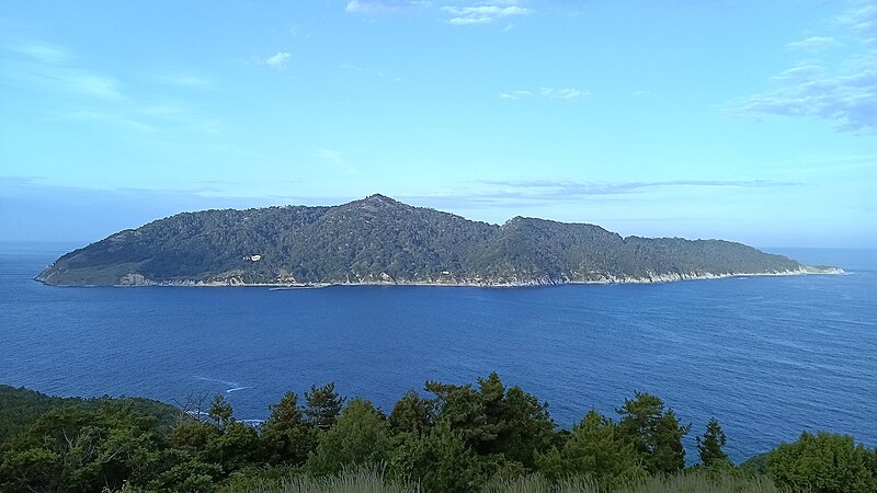
File:金華山.jpg · Wikimedia Commons · See Wikimedia Commons
Miyagi Prefecture
Sign in to saveprefecture of Japan
Miyagi Prefecture is a region in Japan located on the country's eastern coast. It is notable as an important economic and cultural area, and it was significantly affected by the 2011 earthquake and tsunami disaster.
AI-generated from the Wikipedia summary — may contain errors.
Wikidata facts
- Instance of
- prefecture of Japan
- Named after
- Miyagi district
- Official name
- 宮城県
- Country
- Japan
- Located in
- Japan
- Contains
- Motoyoshi district
- Capital
- Sendai
- Population
- 2288456
- Area
- 7282.29
- Time zone
- UTC+09:00
- Head of government
- Yoshihiro Murai
- Shares border with
- Iwate Prefecture
- Official website
- www.pref.miyagi.jp
- Image
- 211030 Saigyo Modoshi no Matsu Park Matsushima Miyagi pref Japan01n.jpg
Show 14 more facts
- topic's main category
- Category:Miyagi Prefecture
- Commons category
- Miyagi prefecture
- category for people born here
- Category:Births in Miyagi prefecture
- category of associated people
- Category:People from Miyagi Prefecture
- Commons gallery
- Miyagi prefecture
- twinned administrative body
- Province of Rome
- name in kana
- みやぎけん
- inception
- 1871-01-01
- territory overlaps
- Rikuzen Province
- associated electoral district
- Miyagi 6th district
- official symbol
- Cervidae
- native label
- 宮城県
- topic has template
- Template:Miyagi
- OpenStreetMap zoom level
- 7
Sources (10)
via Wikidata · CC0
~9 min read
Encyclopedic overview
Panoramic view of Sendai plain, spreading to Sendai metropolitan area in Miyagi Prefecture Miyagi Prefecture (宮城県, Miyagi-ken; Japanese pronunciation: [mʲiꜜ.ja.ɡʲi, -ŋʲi, mʲi.ja.ɡʲiꜜ.keɴ, -ŋʲiꜜ-]) is a prefecture of Japan located in the Tōhoku region of Honshu. Miyagi Prefecture has a population of 2,265,724 (1 August 2023) and has a geographic area of 7,282 km (2,812 sq mi). Miyagi Prefecture borders Iwate Prefecture to the north, Akita Prefecture to the northwest, Yamagata Prefecture to the west, and Fukushima Prefecture to the south.
Sendai is the capital and largest city of Miyagi Prefecture, and the largest city in the Tōhoku region, with other major cities including Ishinomaki, Ōsaki, and Tome. Miyagi Prefecture is located on Japan's eastern Pacific coast and bounded to the west by the Ōu Mountains, the longest mountain range in Japan, with 24% of its total land area being designated as Natural Parks. Miyagi Prefecture is home to Matsushima Islands, a group of islands ranked as one of the Three Views of Japan, near the town of Matsushima.
Excerpted from Wikipedia’s “Miyagi Prefecture” article, available under the CC BY-SA 4.0 licence.
Gallery (12)
On the map
Available in 94 languages
- Español
- Français
- Deutsch
- 中文
- 日本語
- Русский
- Português
- Italiano
- العربية
- Achinese
- Afrikaans
- Aragonese
- Armenian
- azb
- Azerbaijani
- Bahasa Indonesia
- Balinese
- Bangla
Show 75 more
- Basque
- bat_smg
- Belarusian
- Bikol
- Bulgarian
- Burmese
- Catalan
- cdo
- Cebuano
- Central Kurdish
- Chechen
- Croatian
- Czech
- Danish
- Esperanto
- Estonian
- Extremaduran
- Filipino
- Finnish
- Galician
- Gan Chinese
- Georgian
- Hakka Chinese
- Hebrew
- Hungarian
- Iloko
- Irish
- Kannada
- Khmer
- Latvian
- Lithuanian
- Macedonian
- Malay
- Manipuri
- Marathi
- Mingrelian
- Mongolian
- Nederlands
- Nepali
- Northern Frisian
- Northern Sami
- Norwegian
- Occitan
- Ossetic
- Pampanga
- Polski
- Romanian
- Scots
- Serbian
- Serbian (Latin)
- simple
- Sinhala
- Slovak
- Sundanese
- Svenska
- Swahili
- Tajik
- Tatar
- Tiếng Việt
- Toki Pona
- Türkçe
- Ukrainian
- Urdu
- Uyghur
- Uzbek
- Waray
- Welsh
- Western Panjabi
- Wu Chinese
- zh_classical
- zh_min_nan
- zh_yue
- فارسی
- ไทย
- 한국어
via Wikidata sitelinks · CC0