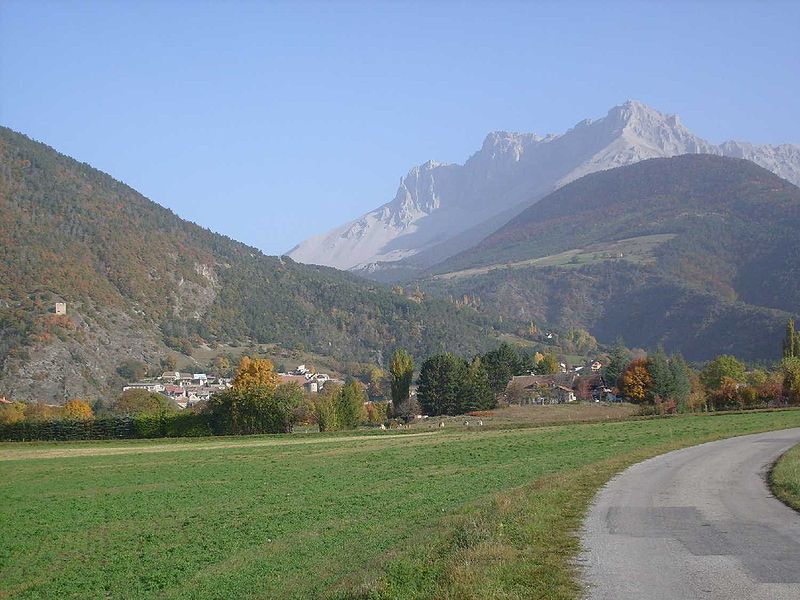
File:Montmaur001.jpg · Wikimedia Commons · See Wikimedia Commons
Montmaur
Sign in to savecommune in Hautes-Alpes, France
OverviewAI-generated
Montmaur is a commune in France, situated within the Hautes-Alpes department and the arrondissement of Gap. It is part of the Provence-Alpes-Côte d'Azur region and falls under the canton of Veynes. The municipality borders the communes of Agnières-en-Dévoluy, Aspres-sur-Buëch, Châteauneuf-d'Oze, and La Cluse.
The area of Montmaur is 48.77 square kilometers. Population figures vary by source, with one listing 537 residents, including 256 males and 256 females, while another records a population of 459. The commune has an elevation above sea level of 2680 meters, though a separate weather data source lists an elevation of 928 meters. Its postal code is 05400.
Synthesized by Vinony from 41 facts across 7 sources: Wikidata, Open Meteo, Openweathermap, OpenStreetMap, GeoNames, Vinony graph, Geo. Generated from structured data (not the Wikipedia text) and checked against those facts — may still contain errors.
Weather now
7-day forecast
via Open-Meteo
Place details
- Locality
- Montmaur
- Region
- Provence-Alpes-Côte d'Azur
- Country
- France
- Population
- 459
via OpenStreetMap · GeoNames
Key facts
- Country
- France
- Region
- Provence-Alpes-Côte d'Azur
- Department
- Hautes-Alpes
- Arrondissement
- Gap
- Canton
- Veynes
- Mayor 2020 2026
- Georges Lesbros
- Area
- 48.77 km (18.83 sq mi)
- Density
- 10.9/km (28.3/sq mi)
- Time zone
- UTC+01:00 ( CET )
- Summer dst
- UTC+02:00 ( CEST )
- Insee postal code
- 05087 /05400
- Elevation
- 849–2,680 m (2,785–8,793 ft) , (avg. 873 m or 2,864 ft)
via Wikipedia infobox
~1 min read
Encyclopedic overview
Montmaur ( French pronunciation: [mɔ̃mɔʁ] ) is a commune in the Hautes-Alpes department in southeastern France.
Population
Excerpted from Wikipedia’s “Montmaur” article, available under the CC BY-SA 4.0 licence.