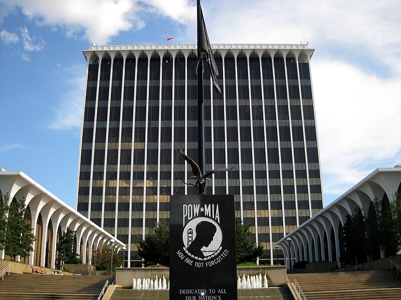
File:Government_Center_Columbus_Georgia_Consolidated_Government.jpg · Wikimedia Commons · See Wikimedia Commons
Muscogee County
Sign in to saveAlso known as Muscogee County, Georgia, Muscogee County, GA
county in Georgia, United States
Key facts
- Country
- United States
- State
- Georgia
- Founded
- June 9, 1826 ; 199 years ago ( 1826-06-09 )
- Named after
- Muscogee people
- Seat
- Columbus
- Largest city
- Columbus
- Total
- 221 sq mi (570 km )
- Land
- 216 sq mi (560 km )
- Water
- 4.6 sq mi (12 km ) 2.1%
- Estimate 2025
- 202,171
- Density
- 958/sq mi (370/km )
- Time zone
- UTC−5 ( Eastern )
- Summer dst
- UTC−4 ( EDT )
- Congressional districts
- 2nd , 3rd
- Website
- columbusga.gov
via Wikipedia infobox
Wikidata facts
- Named after
- Muscogee
- Country
- United States
- Located in
- Georgia
- Capital
- Columbus
- Population
- 206922
- Area
- 572
- Shares border with
- Russell County
- Official website
- www.muscogeecounty.net
- Image
- Government Center Columbus Georgia Consolidated Government.jpg
- Households
- 73648
Show 9 more facts
- Commons category
- Muscogee County, Georgia
- topic's main category
- Category:Muscogee County, Georgia
- inception
- 1825-06-09
- category of associated people
- Category:People from Muscogee County, Georgia
- category for people born here
- Category:Births in Muscogee County, Georgia
- water as percent of area
- 2.1
- native label
- Muscogee County
- different from
- Muskogee
- per capita income
- 26709
Sources (10)
via Wikidata · CC0
~8 min read
Encyclopedic overview
Muscogee County is a county located on the central western border of the U.S. state of Georgia named after the Muscogee that originally inhabited the land with its western border with the state of Alabama that is formed by the Chattahoochee River. As of the 2020 census, the population was 206,922. Its county seat and only city is Columbus, with which it has been a consolidated city-county since the beginning of 1971.
Muscogee County is part of the Columbus, GA–AL, metropolitan statistical area. The only other city in the county was Bibb City, a company town that disincorporated in December 2000, two years after its mill closed permanently. Fort Benning, a large Army installation, takes up nearly one quarter of the county and extends southeast into neighboring Chattahoochee County; it generates considerable economic power in the region.
Excerpted from Wikipedia’s “Muscogee County” article, available under the CC BY-SA 4.0 licence.