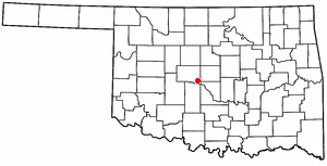
File:OKMap-doton-Mustang.PNG · Wikimedia Commons · See Wikimedia Commons
Mustang
Sign in to saveAlso known as Mustang, Oklahoma, Mustang, OK
human settlement in Canadian County, Oklahoma, United States of America
Key facts
- Country
- United States
- State
- Oklahoma
- County
- Canadian
- Type
- Council-manager
- Total
- 12.01 sq mi (31.10 km )
- Land
- 11.98 sq mi (31.04 km )
- Water
- 0.027 sq mi (0.07 km )
- Elevation
- 1,335 ft (407 m)
- Density
- 1,658.8/sq mi (640.47/km )
- Time zone
- UTC-6 ( Central (CST) )
- Summer dst
- UTC-5 (CDT)
- Fips code
- 40-50100
via Wikipedia infobox
Wikidata facts
- Instance of
- city in the United States
- Official name
- Mustang
- Country
- United States
- Located in
- Canadian County
- Population
- 19879
- Area
- 31.110576
- Elevation
- 411
- Official website
- www.cityofmustang.org
- Image
- US military plaque in Mustang, Oklahoma.jpg
- Households
- 7499
- Dialing code
- 405
Show 5 more facts
- postal code
- 73064
- P8168
- Coburn
- Commons category
- Mustang, Oklahoma
- water as percent of area
- 0.2139
- per capita income
- 32484
Sources (8)
via Wikidata · CC0
~6 min read
Encyclopedic overview
Mustang is a city in the southeastern corner of Canadian County, Oklahoma, United States. It is part of the Oklahoma City metropolitan area. Mustang's population was 19,879 at the 2020 census, a 14.3% increase from 17,398 in 2010. The city is now primarily known as a bedroom community for Oklahoma City.
History
Excerpted from Wikipedia’s “Mustang” article, available under the CC BY-SA 4.0 licence.