
Nauru
Sign in to saveAlso known as Republic of Nauru, Pleasant Island, Naoero, nr
Nauru, officially the Republic of Nauru, formerly known as Pleasant Island, is an island country and microstate in the South Pacific Ocean. It lies within the Micronesia subregion of Oceania, with its nearest neighbour being Banaba (part of Kiribati) about to the east. Nauru is also known to have one of the highest obesity rates in the world.
OverviewAI-generated
Nauru is a sovereign state and island country located in Insular Oceania. It is a republic with Yaren District as its capital. The nation’s highest point is Command Ridge. Its official languages are Nauruan and English. The currency used is the Australian dollar.
The population is recorded at 11,680 and 11,947. The area covers 21 square kilometers. Nauru is a member of the United Nations and the Commonwealth of Nations. It has diplomatic relations with Australia, Taiwan, Russia, and Germany. The country contains administrative entities such as Aiwo District and Anabar District. Its top-level Internet domain is .nr.
The legislative body is the Parliament of Nauru. The head of state has included Sprent Dabwido, Baron Waqa, Lionel Aingimea, and Russ J Kun. The anthem is Nauru Bwiema. The telephone country code is +674. The country is located in the UTC+12:00 time zone.
Synthesized by Vinony from 70 facts across 9 sources: Wikidata, REST Countries, Openweathermap, Open Meteo, World Bank, OpenStreetMap, Firecrawl, Vinony graph, Geo. Generated from structured data (not the Wikipedia text) and checked against those facts — may still contain errors.
In the Vinony graph
Nauru is indexed among the 215 entries in Vinony's Countries collection.
Vinony's link graph records 3,227 inbound references to Nauru, and connects out to French Polynesia, obesity and Central Intelligence Agency.
The entry is geolocated on the map in landmark, across 6 mapped points.
It sits within the topics 1968 establishments in Nauru, Countries and territories where English is an official language and Countries in Micronesia.
Weather now
7-day forecast
via Open-Meteo
Country
- Capital
- Yaren
- Population
- 11,680
- Region
- Oceania · Micronesia
- Demonym
- Nauruan
- Currencies
- AUD ($)
- Languages
- English, Nauru
- Calling code
- +674
- Drives on
- Left
- Gini
- 34.8 (2012)
- TLD
- .nr
- Timezones
- UTC+12:00
via REST Countries
Indicators · World Bank
- GDP
- $162.6M(2024)
- Population
- 11,947(2024)
- Life expectancy
- 62.3 yrs(2024)
- Urban population
- 100 %(2024)
- Internet users
- 83 %(2024)
- Forest area
- 0 %(2023)
- Renewable energy
- 1.9 %(2022)
via World Bank Open Data · CC BY 4.0
Wikipedia views (30d)
113,551 totalvia Wikimedia Pageviews API
Key facts
- Country.conventional_long_name
- Republic of Nauru
- Country.common_name
- Nauru
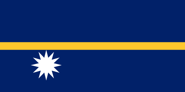
- Country.image_flag
- Flag of Nauru.svg
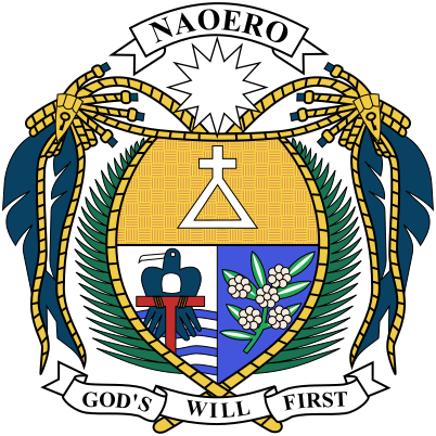
- Country.image_coat
- Coat of arms of Nauru.svg
- Country.national_motto
- "God's will first"
- Country.national_anthem
- Nauru Bwiema (Nauruan)"Nauru, Our Homeland" File:Nauru Bwiema.ogg
- Country.image_map
- NRU orthographic.svg
- Country.map_width
- 250px
- Country.capital
- Yaren (de facto)
- Country.demonym
- Nauruan
- Country.government_type
- Unitary parliamentary republic with an executive presidency under a non-partisan democracy
- Country.leader_title1
- President
- Country.leader_name1
- David Adeang
- Country.leader_title2
- Speaker of the Parliament
- Country.leader_name2
- Marcus Stephen
- Country.leader_title3
- Minister Assisting the President
- Country.leader_name3
- Lionel Aingimea
- Country.legislature
- Parliament
via Wikipedia infobox
Described at
Nauru: Guánový ostrov - Nauru - PlaceMania
Krajina, ktorá sama seba vyjedla a budúcnosť má stále neistú.
placemania.sk →Bohatstvo je však niekedy zlým radcom. Istý čas tu ľudia žili vo veľkom štýle, ale v 90. rokoch ich čakalo nepríjemné prekvapenie. Hoci politici predpovedali, že fosfátová manna sa jedného dňa vyčerpá, a chceli na to krajinu pripraviť strategickými investíciami, tie sa nakoniec veľmi nevydarili. Časť peňazí išla na leteckú spoločnosť, ktorá absolútne nezodpovedala potrebám ostrova, ďalšie peniaze sa investovali do katastrofálnych projektov a na zvyšku sa priživili korupčníci. Bolo teda načase priznať si pravdu: štátna pokladnica je prázdna. Zostala len zdevastovaná krajina po ťažbe a štát, v ktorom ľudia prežívajú, ako sa dá. Na istý čas sa stal daňovým rajom s niekoľkými stovkami registrovaných “virtuálnych” bánk a neskôr prenajal časť svojho malého územia Austrálii na zriadenie záchytného centra pre nelegálnych migrantov. Dnes čerpá peniaze z najrôznejších lobistických aktivít, takže v OSN a iných inštitúciách presadzuje veľmi pochybné stanoviská. Zakladateľ projektu PlaceMania.sk a zodpovedá za jeho obsah, technické fungovanie a dlhodobý rozvoj. Cestovné zápisky na webe vychádzajú z vlastnej skúsenosti z ciest; faktografické záznamy o miestach vznikajú kombináciou verejných zdrojov, automatizovaného spracovania dát a redakčného overovania. Zameriava sa na netradičné lokality, ich historický a geografický kontext a menej známe súvislosti. Things to do near Nauru: Guánový ostrov, Nauru, Republic of Nauru, Naoero, Nauru Adası, Науру, ناورو, Krajina, Politická oblasť, NR, NRU. Find tours, guided tours, local activities, attractions, tickets, excursions, sightseeing, day trips and travel experiences nearby. Coordinates: -0.522778, 166.931503. Pozrite si ďalšie zaujímave miesta vo svete, ktoré stoja za naplánovanie ďalšej cesty. Ako sa z bane na netopierie výkaly stalo významné archeologické nálezisko pôvodných obyvateľov Ameriky. Chcete vidieť ďalšie úchvatné miesta ako Nauru: Guánový ostrov? Nájdeš ich u nás na mape. Objav s nami ďalšie úžasné miesta na zemi.
Excerpt from a page describing this subject · 13,168 chars · not written by Vinony
Wikidata facts
- Instance of
- country
- Part of
- Micronesia
- Official name
- Ripublik Naoero
- Demonym
- Naurisk
- Country
- German New Guinea
- Contains
- Yaren District
- Continent
- Oceania
- Capital
- Yaren District
- Official language
- English language
- Currency
- Australian dollar
- Population
- 13650
- Area
- 21.0
- Head of government
- Ruben Kun
- Head of state
- Russ J Kun
- Legislature
- Parliament of Nauru
- Anthem
- Nauru Bwiema
- Highest point
- Command Ridge
- Official website
- www.naurutourism.org
- Image
- Coral reef on Nauru.jpg
- Life expectancy
- 64
- Nominal GDP
- 150922211
- Calling code
- +674
- Licence plate code
- NAU
- Mains voltage
- 240
Show 49 more facts
- Motto
- Ewyllus Duw'n Gyntaf
- Flag
- flag of Nauru
- Coat of arms
- coat of arms of Nauru
- Commons category
- Nauru
- top-level Internet domain
- .nr
- topic's main category
- Category:Nauru
- category of associated people
- Category:Nauruan people
- diplomatic relation
- China
- history of topic
- history of Nauru
- Commons gallery
- Naoero / Nauru
- lowest point
- Pacific Ocean
- mobile country code
- 536
- category for people born here
- Category:Births in Nauru
- driving side
- left
- geography of topic
- geography of Nauru
- emergency phone number
- 112
- marriageable age
- 16
- topic's main Wikimedia portal
- Portal:Nauru
- office held by head of government
- President of Nauru
- language used
- English language
- number of out-of-school children
- 468
- office held by head of state
- President of Nauru
- has characteristic
- free country
- located in/on physical feature
- Micronesia
- maritime identification digits
- 544
- native label
- Naoero
- executive body
- Cabinet of Nauru
- Unicode character
- 🇳🇷
- culture
- culture of Nauru
- inception
- 1968-01-31
- economy of topic
- economy of Nauru
- demographics of topic
- demographics of Nauru
- P11012
- Bavarian Forest
- hashtag
- Nauru
- on focus list of Wikimedia project
- Wikipedia:Vital articles/Level/4
- Gini coefficient
- 34.8
- P12749
- Meghalaya
- birth rate
- 26.785
- male population
- 6435
- death rate
- 6.582
- rural population
- 0
- total fertility rate
- 3.463
- female population
- 6233
- urban population
- 12668
- P8168
- Pardosa lasciva
- Commonwealth Sport country code
- NRU
- P6413
- Nauru
- described at URL
- www.placemania.sk/svetova-zaujimavost/nauru-guanovy-ostrov
Sources (15)
via Wikidata · CC0
Travel guide
Get in
The Australian offshore detention centre operating on the island means that there are always a lot of Australian government staff staying at the island's two small hotels and filling seats on the flights to and from Nauru (especially the direct flight to and from Brisbane). This, in combination with the visa requirement, means that you probably should plan and book your trip a few months ahead.
Get around
thumb|300px|View of the ring road Every year, there are on average 200 tourists in Nauru, so it has the honour of being the least touristed country in the world. Crowds aren't a problem at all. There's hardly any public transportation, so your best bet to get around would be in a rented vehicle; car, scooter or bike. Other alternatives are by foot (not very pleasant in the tropical heat and humidity) or hitchhiking, which is quite common on the island.
See
thumb|300px|Coral formations in Anibare Bay The Nauru experience is pretty much the exact opposite of all the typical South Pacific island clichés. If you're looking for sandy beaches, cool ocean breezes, and pristine blue waters, you'll find precious little of the sort. In fact, if you're looking for pretty much anything that can be described as flashy or tourist-oriented, you're out of luck. But don't write Nauru off just yet: its subtle and offbeat charms are waiting for anyone who's willing to take the time to seek them out — and that goes double for World War II history buffs, urbexers, and anyone who's just looking for a slow-paced, low-key, off-the-beaten-path getaway.
thumb|300px|Japanese relic from World War II on Command Ridge. thumb|300px|Karst landscape with limestone stalagmites in the island's interior
Eat
Most food is imported from Australia and arrives by ship or air, usually once every six to eight weeks. You can find western and Asian (primarily Chinese) food. Because of the tropical climate dishes might not be as heavy and hearty as the original versions. As not all ingredients may be available, dishes are often rather simple.
Since Nauru is an island nation, seafood is very popular in its restaurants. Cooked and smoked hams are also very popular, as meat is one of their main dishes.
Drink
Other than that, restaurants and shops offer soft drinks and some also have alcoholic beverages.
Stay safe
Nauru is a peaceful island and all kinds of crime are very rare. In emergency situations you can call either the emergency number (117 or 118) or go to the police station, which is near the airport.
While earthquakes are not a risk on Nauru itself, it can potentially be struck by tsunamis resulting from earthquakes along the Ring of Fire, which surrounds the Pacific Ocean.
There are no records of a cyclone ever hitting Nauru, and right at the Equator they are rare. Nevertheless, if you visit during the height of the wet season, be prepared for heavy rain and thunderstorms.
There are wild dogs roaming all around Nauru. They are dangerous, and locals have been warned not to walk along dark roads at night.
Stay healthy
Water supply in Nauru is dependent on rainwater collected into tanks from the roofs of houses and from an aging reverse osmosis desalination plant. You should avoid tap water.
Emergency: 118 or 117 Considering its size and remoteness, Nauru has a decent healthcare system. Aside from the rampant problem of obesity among the population, the infant mortality and life expectation numbers are on par with industrialised nations. There are two hospitals on the island, Nauru General Hospital and RON Hospital, both in the Denigomodu district in the west of the island. However, if you have contracted anything more serious you may have to get transferred to Australia, so make sure you have good travel insurance when visiting Nauru!
The tropical diseases usually encountered in equatorial countries are less of a risk in Nauru, although it's recommended to get a hepatitis B shot. There is a risk of dengue fever, though, so you should protect yourself from mosquito bites.
If you come from a country where yellow fever is endemic or you've visited such a country in the last six days, you need to have proof of yellow fever vaccination.
Respect
Nauru is a predominantly Christian country, and Christian values and rules of conduct apply.
It is illegal to import pornographic material, and the government also blocks access to Internet porn. Open displays of affection between same-sex partners may offend some in Nauru. The trafficking of drugs and narcotics of any kind will be punished severely. The one place on the island that you may not take photographs is the Australian processing centre for asylum seekers.
Go next
Virtually everyone comes and goes by the local airline and thus your next destination will be Australia or one of the few small Oceanian islands (Fiji, Kiribati, Marshall Islands, Federated States of Micronesia and the Solomon Islands) the local airline flies to. When leaving Nauru, locally produced goods may be subjected to export duties.
Travel guide from Wikivoyage (CC BY-SA 4.0)
~38 min read
Encyclopedic overview
28 sectionsContents
- History
- Geography
- Climate
- Ecology
- Politics
- Foreign relations
- Economy
- Demographics
- Public services
- Education
- Health
- Transport
- Effects of mining
- Food, farming, and diet
- Plants and farming
- Food
- Non-food basic needs
- Culture
- Music
- Media
- Sport
- See also
- Notes
- References
- Citations
- Sources
- Further reading
- External links
Nauru, officially the Republic of Nauru , formerly known as Pleasant Island, is an island country and microstate in the South Pacific Ocean. It lies within the Micronesia subregion of Oceania, with its nearest neighbour being Banaba (part of Kiribati) about 300 kilometres (190 mi) to the east.
With an area of only 21 square kilometres (8.1 mi; 2,100 ha; 5,200 acres), Nauru is the third-smallest country in the world, as well as the smallest member state of the Commonwealth of Nations by both area and population. Its population of about 10,800 is the world's third-smallest (not including colonies or overseas territories). Nauru is a member of the United Nations, the Commonwealth of Nations, and the Organisation of African, Caribbean and Pacific States.
Excerpted from Wikipedia’s “Nauru” article, available under the CC BY-SA 4.0 licence.
Gallery (59)
On the map
6 mapped locations
Available in 223 languages
- Español
- Français
- Deutsch
- 中文
- 日本語
- Русский
- Português
- Italiano
- العربية
- हिन्दी
- Abkhazian
- Achinese
- Afrikaans
- Akan
- Albanian
- Albanian
- Amharic
- ami
Show 204 more
- Angika
- Aragonese
- Armenian
- Arpitan
- Assamese
- Asturian
- azb
- Azerbaijani
- Bahasa Indonesia
- Balinese
- Bangla
- Banjar
- Bashkir
- Basque
- bat_smg
- be_x_old
- Belarusian
- Betawi
- Bikol
- Bishnupriya
- Bislama
- Bosnian
- Breton
- Bulgarian
- Buriat
- Burmese
- Catalan
- cbk_zam
- cdo
- Cebuano
- Central Kurdish
- Chechen
- Cheyenne
- Church Slavic
- Cornish
- Crimean Tatar
- Croatian
- Czech
- dag
- Danish
- Divehi
- dty
- Dzongkha
- Egyptian Arabic
- Esperanto
- Estonian
- Extremaduran
- Faroese
- Fiji Hindi
- Filipino
- Finnish
- fiu_vro
- Fula
- Gagauz
- Galician
- gcr
- Georgian
- Gilaki
- Goan Konkani
- Gorontalo
- Gothic
- Greek
- Guarani
- Gujarati
- Haitian Creole
- Hakka Chinese
- Hausa
- Hebrew
- Hungarian
- Icelandic
- Ido
- Iloko
- Inari Sami
- Interlingua
- Interlingue
- Irish
- Jamaican Creole English
- Javanese
- kai
- Kannada
- Kara-Kalpak
- Karachay-Balkar
- Kazakh
- kge
- Kinyarwanda
- Kotava
- Kurdish
- Kyrgyz
- Ladino
- Latin
- Latvian
- Lezghian
- Ligurian
- Limburgish
- Lingua Franca Nova
- Lithuanian
- lld
- Lombard
- Low German
- Lower Sorbian
- Luxembourgish
- Macedonian
- Malagasy
- Malay
- Malayalam
- Maltese
- Manipuri
- Manx
- Māori
- Marathi
- Mazanderani
- Minangkabau
- Mingrelian
- Mirandese
- Mongolian
- Moroccan Arabic
- nds_nl
- Nederlands
- Nepali
- Newari
- Northern Frisian
- Northern Sami
- Norwegian
- Norwegian Nynorsk
- Novial
- nup
- Occitan
- Odia
- Old English
- olo
- Ossetic
- Pampanga
- Papiamento
- Pashto
- Piedmontese
- Polski
- Punjabi
- Quechua
- roa_rup
- Romanian
- Romansh
- Samoan
- Sanskrit
- Sardinian
- Scots
- Scottish Gaelic
- Serbian
- Serbian (Latin)
- Shan
- Shona
- Sicilian
- Silesian
- simple
- Sindhi
- Sinhala
- Slovak
- Slovenian
- Somali
- Sundanese
- Svenska
- Swahili
- szy
- Tahitian
- Tajik
- Tamil
- Taroko
- Tatar
- tay
- Telugu
- Tibetan
- Tiếng Việt
- Tok Pisin
- Toki Pona
- Tongan
- Türkçe
- Udmurt
- Ukrainian
- Upper Sorbian
- Urdu
- Uyghur
- Uzbek
- Venetian
- Veps
- Volapük
- Waray
- Welsh
- Western Frisian
- Western Mari
- Western Panjabi
- Wolof
- Wu Chinese
- Xhosa
- Yakut
- Yiddish
- Yoruba
- Zaza
- Zeelandic
- zh_classical
- zh_min_nan
- zh_yue
- Zhuang
- فارسی
- ไทย
- 한국어
via Wikidata sitelinks · CC0