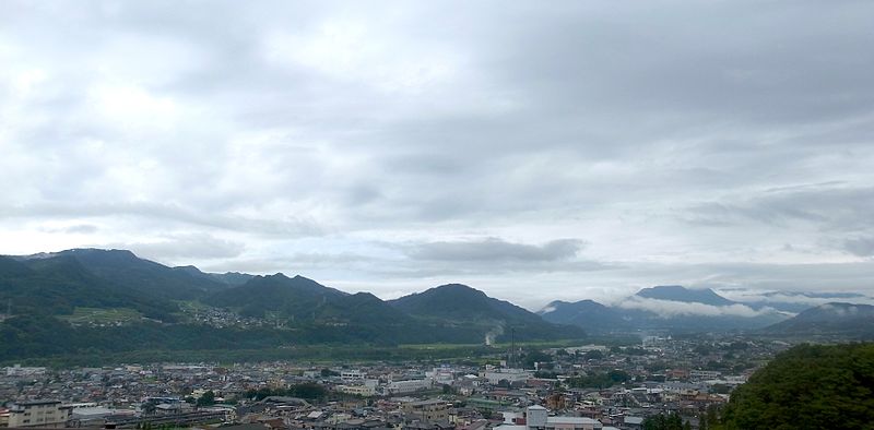
File:Numata-area-aug12-2014.jpg · Wikimedia Commons · See Wikimedia Commons
Key facts
- Country
- Japan
- Region
- Kantō
- Prefecture
- Gunma
- Town settled
- April 1, 1889
- City settled
- April 1, 1954
- Mayor
- Minoru Hoshino (星野稔) - from May 2022
- Total
- 443.46 km (171.22 sq mi)
- Density
- 105.78/km (273.96/sq mi)
- Time zone
- UTC+9 ( Japan Standard Time )
- Phone number
- 0278-23-2111
- Address
- Shimono-machi 999, Numata-shi, Gunma-ken 378-8501
- Climate
- Cfa
- Website
- Official website
- Flower
- Chinese bellflower
- Tree
- Sakura
via Wikipedia infobox
Wikidata facts
- Instance of
- city of Japan
- Country
- Japan
- Located in
- Gunma Prefecture
- Population
- 51265
- Area
- 443.46
- Time zone
- Japan Standard Time
- Shares border with
- Nikkō-shi
- Official website
- www.city.numata.gunma.jp
- Image
- Terrace Numata.jpg
Show 7 more facts
- Commons category
- Numata, Gunma
- topic's main category
- Category:Numata, Gunma
- name in kana
- ぬまたし
- inception
- 1954-04-01
- twinned administrative body
- Füssen
- associated electoral district
- Gunma 1st district
- native label
- 沼田市
Sources (10)
via Wikidata · CC0
~4 min read
Encyclopedic overview
Numata city hall
Numata (沼田市, Numata-shi) is a city located in Gunma Prefecture, Japan. As of 31 July 2020, the city had an estimated population of 46,908 in 20,589 households, and a population density of 110 persons per km. The total area of the city is 443.46 square kilometres (171.22 sq mi), making it the largest city in terms of area within Gunma Prefecture. (The neighboring town of Minakami is the largest municipality in terms of area within Gunma.)
Excerpted from Wikipedia’s “Numata” article, available under the CC BY-SA 4.0 licence.