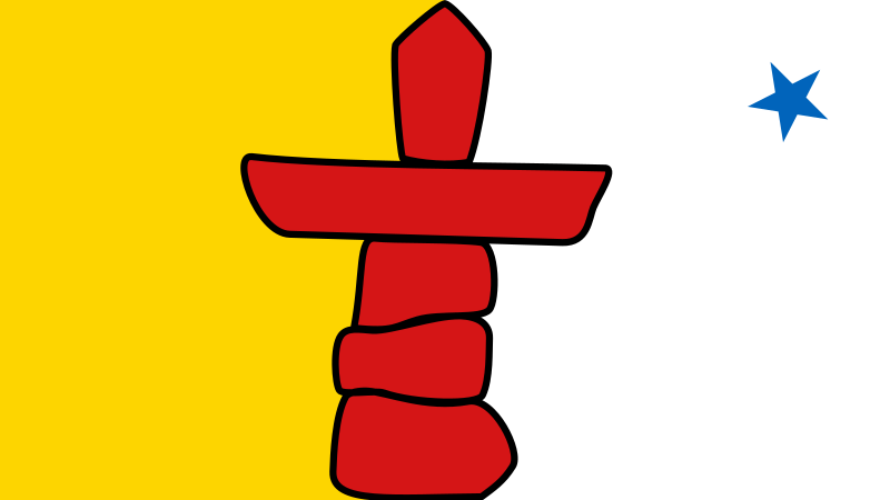
File:Flag_of_Nunavut.svg · Wikimedia Commons · See Wikimedia Commons
Nunavut
Sign in to saveAlso known as NU, Nvt., Nunavut Territory, CA-NU, Territory of Nunavut
Nunavut is the largest and northernmost territory of Canada. It was separated from the Northwest Territories on April 1, 1999, via the Nunavut Act and the Nunavut Land Claims Agreement Act, which provided this territory to the Inuit for self-government. The boundaries had been drawn in 1993. The creation of Nunavut resulted in the first major change to Canada's political map in half a century since the province of Newfoundland (now Newfoundland and Labrador) was admitted in 1949.
Nunavut is Canada's largest and northernmost territory, created on April 1, 1999, through legislation that granted the Inuit people their own self-governing territory. Its establishment marked the first significant change to Canada's political map in 50 years, reshaping the country's northern governance structure.
AI-generated from the Wikipedia summary — may contain errors.
Key facts
- Province or territory of Canada.name
- Nunavut
- Province or territory of Canada.settlement_type
- Territory
- Province or territory of Canada.government_type
- Parliamentary system with consensus government
- Province or territory of Canada.image_flag
- Flag of Nunavut.svg
- Province or territory of Canada.image_shield
- Coat of arms of Nunavut.svg
- Province or territory of Canada.motto
- ()"Our land, our strength"""
- Province or territory of Canada.image_map
- Nunavut in Canada 2.svg
- Province or territory of Canada.Label_map
- yes
- Province or territory of Canada.capital
- Iqaluit
- Province or territory of Canada.largest_city
- Iqaluit
- Province or territory of Canada.official_lang
- Inuit (Inuktitut and Inuinnaqtun)EnglishFrench
- Province or territory of Canada.ViceroyType
- Commissioner
- Province or territory of Canada.Viceroy
- Eva Aariak
- Province or territory of Canada.Premier
- John Main
- Province or territory of Canada.Legislature
- Legislative Assembly of Nunavut
- Province or territory of Canada.HouseSeats
- 1
- Province or territory of Canada.SenateSeats
- 1
- Province or territory of Canada.Former
- Districts of Franklin, Keewatin, Mackenzie
via Wikipedia infobox
Research
1,038 papers- Clam research in Nunavut: A scoping review of the literature.ReviewOne health (Amsterdam, Netherlands) · 2025Gerend S, Caughey A, Banuet-Martinez M et al.DOI: 10.1016/j.onehlt.2025.101168
- Forensic psychiatry services in Nunavut.International journal of circumpolar health · 2021Upfold C, Chaimowitz GDOI: 10.1080/22423982.2021.1954362
- Mapping the maternal health research landscape in Nunavut: A systematic search & critical review of methodology.Social science & medicine (1982) · 2020Brubacher LJ, Dewey CE, Cunsolo A et al.DOI: 10.1016/j.socscimed.2020.113206
- A Nunavut community-directed Inuit youth mental wellness initiative: making I-SPARX fly.International journal of circumpolar health · 2024Bohr Y, Hankey J, Thomas A et al.DOI: 10.1080/22423982.2024.2401210
- A review of health and wellness studies involving Inuit of Manitoba and Nunavut.International journal of circumpolar health · 2020Hayward A, Cidro J, Dutton R et al.DOI: 10.1080/22423982.2020.1779524
- Solving the housing crisis in Nunavut, Canada.Scandinavian journal of public health · 2023Sultan ADOI: 10.1177/14034948231152637
- Nunavut: building nursing capacity.Nursing leadership (Toronto, Ont.) · 2012Malott MDOI: 10.12927/cjnl.2012.22804
- Forensic psychiatry patients, services, and legislation in Nunavut and Greenland.International journal of law and psychiatry · 2023Upfold C, Jentz C, Heilmann P et al.DOI: 10.1016/j.ijlp.2023.101921
via PubMed
Wikidata facts
- Instance of
- territory of Canada
- Official name
- Nunavut
- Demonym
- Nunavutoise
- Country
- Canada
- Located in
- Canada
- Continent
- North America
- Capital
- Iqaluit
- Official language
- Inuinnaqtun
- Currency
- Canadian dollar
- Population
- 36858
- Area
- 2038722
- Time zone
- UTC−05:00
- Body of water
- Arctic Ocean
- Head of government
- P.J. Akeeagok
- Form of government
- parliamentary democracy
- Shares border with
- Greenland
- Highest point
- Barbeau Peak
- Official website
- www.gov.nu.ca/iu
- Image
- Wfm baffin island.jpg
- Nominal GDP
- 4160000000
- Motto
- Notre terre, notre force
- Flag
- flag of Nunavut
- Coat of arms
- coat of arms of Nunavut
Show 19 more facts
- separated from
- Northwest Territories
- Commons gallery
- ᓄᓇᕗᑦ
- lowest point
- Arctic Ocean
- Commons category
- Nunavut
- inception
- 1999-04-01
- postal code
- X0C
- topic's main category
- Category:Nunavut
- category for films shot at this location
- Category:Films shot in Nunavut
- category of associated people
- Category:People from Nunavut
- office held by head of government
- Premier of Nunavut
- short name
- Nun.
- history of topic
- history of Nunavut
- native label
- ᓄᓇᕗᑦ
- minimum temperature record
- -57.8
- different from
- Nunavik
- total fertility rate
- 2.7545
- driving side
- right
- coextensive with
- Nunavut
- P12749
- Zamboni pile
Sources (13)
via Wikidata · CC0
~30 min read
Encyclopedic overview
36 sectionsContents
- History
- Early history
- European exploration
- 20th and 21st centuries
- Geography
- Climate
- Demography
- Language
- Religion
- Economy
- Mining
- Mining projects
- Historic mines
- Energy
- Transportation
- Tourism
- Culture
- Media
- Periodicals
- Film
- Music
- Performing arts
- Sport
- Government and politics
- Administrative regions
- Licence plates
- Symbols
- Territorial dispute
- Alcohol and tobacco
- See also
- Footnotes
- References
- Further reading
- External links
- Tourism
- Journalism
Nunavut is the largest and northernmost territory of Canada. It was separated from the Northwest Territories on April 1, 1999, via the Nunavut Act and the Nunavut Land Claims Agreement Act, which provided this territory to the Inuit for self-government. The boundaries had been drawn in 1993. The creation of Nunavut resulted in the first major change to Canada's political map in half a century since the province of Newfoundland (now Newfoundland and Labrador) was admitted in 1949.
Nunavut comprises a major portion of Northern Canada and most of the Arctic Archipelago. Its vast territory makes it the fifth-largest country subdivision in the world, as well as North America's second-largest (after Greenland). Nunavut's capital and Canada's smallest capital by population, Iqaluit (formerly "Frobisher Bay"), on Baffin Island in the east, was chosen by a capital plebiscite in 1995. Other major communities include the regional centres of Rankin Inlet and Cambridge Bay.
Excerpted from Wikipedia’s “Nunavut” article, available under the CC BY-SA 4.0 licence.
Gallery (28)
On the map
3 mapped locations
Available in 130 languages
- Español
- Français
- Deutsch
- 中文
- 日本語
- Русский
- Português
- Italiano
- العربية
- हिन्दी
- Afrikaans
- Albanian
- Albanian
- Amharic
- Aramaic
- Armenian
- Asturian
- azb
Show 111 more
- Azerbaijani
- Bahasa Indonesia
- Balinese
- Bangla
- Basque
- bat_smg
- be_x_old
- Belarusian
- Betawi
- Bhojpuri
- Bosnian
- Breton
- Bulgarian
- Buriat
- Catalan
- cdo
- Cebuano
- Central Kurdish
- Cornish
- Corsican
- Croatian
- Czech
- dag
- Danish
- Egyptian Arabic
- eml
- Esperanto
- Estonian
- Faroese
- Filipino
- Finnish
- fiu_vro
- Galician
- Georgian
- Greek
- Haitian Creole
- Hebrew
- Hungarian
- Icelandic
- Ido
- Iloko
- Inuktitut
- Inupiaq
- Irish
- Karachay-Balkar
- Kazakh
- Kurdish
- Ladino
- Latin
- Latvian
- Ligurian
- Lingua Franca Nova
- Lithuanian
- Lombard
- Luxembourgish
- Macedonian
- Malay
- Malayalam
- Manx
- Marathi
- Mazanderani
- Mingrelian
- Mongolian
- Nederlands
- Northern Frisian
- Norwegian
- Norwegian Nynorsk
- Occitan
- Old English
- Ossetic
- Pampanga
- Papiamento
- Piedmontese
- Polski
- Punjabi
- Romanian
- Sardinian
- Scots
- Scottish Gaelic
- Serbian
- Serbian (Latin)
- Silesian
- simple
- Sinhala
- Slovak
- Slovenian
- Svenska
- Swahili
- Tamil
- Tatar
- Toki Pona
- Türkçe
- Ukrainian
- Urdu
- Uzbek
- Venetian
- Volapük
- Waray
- Welsh
- West Flemish
- Western Frisian
- Western Panjabi
- Wu Chinese
- Yakut
- Zaza
- zh_classical
- zh_min_nan
- zh_yue
- فارسی
- ไทย
- 한국어
via Wikidata sitelinks · CC0