File:Orkanger_02.jpg · Wikimedia Commons · See Wikimedia Commons
Orkdal Municipality
Sign in to saveformer municipality in Trøndelag, Norway
Key facts
- Country
- Norway
- County
- Trøndelag
- District
- Orkdalen
- Established
- 1 Jan 1838
- Created as
- Formannskapsdistrikt
- Disestablished
- 1 Jan 2020
- Succeeded by
- Orkland Municipality
- Administrative centre
- Orkanger
- Mayor 2015 2019
- Oddbjørn Bang ( Sp )
- Total
- 594.30 km (229.46 sq mi)
- Land
- 564.46 km (217.94 sq mi)
- Water
- 29.84 km (11.52 sq mi) 5%
- Rank
- # 188 in Norway
- Highest elevation
- 846.7 m (2,778 ft)
- Density
- 20.3/km (53/sq mi)
- Change 10 years
- +8.3%
- Demonym
- Orkdaling
- Norwegian form
- Neutral
via Wikipedia infobox
Wikidata facts
- Demonym
- orkdaling
- Country
- Norway
- Located in
- Trøndelag
- Capital
- Fannrem
- Population
- 11779
- Area
- 0.59094096
- Time zone
- UTC+01:00
- Shares border with
- Skaun Municipality
- Official website
- www.orkdal.kommune.no
- Image
- Orkanger 02.jpg
- Households
- 197
Show 7 more facts
- twinned administrative body
- Hällefors Municipality
- Commons category
- Orkdal
- topic's main category
- Category:Orkdal
- language used
- Bokmål
- dissolved, abolished or demolished date
- 2019-12-31
- replaced by
- Orkland Municipality
- located in the present-day administrative territorial entity
- Orkland Municipality
via Wikidata · CC0
~8 min read
Encyclopedic overview
Orkdal is a former municipality in Trøndelag county, Norway. The municipality existed from 1838 until its dissolution in 2020 when it joined Orkland Municipality. It was part of the Orkdalen region. The administrative centre of the municipality was the city of Orkanger. Some of the notable villages in the municipality included Kjøra, Geitastrand, Gjølme, Thamshavn, Fannrem, Vormstad, Svorkmo, and Hoston.
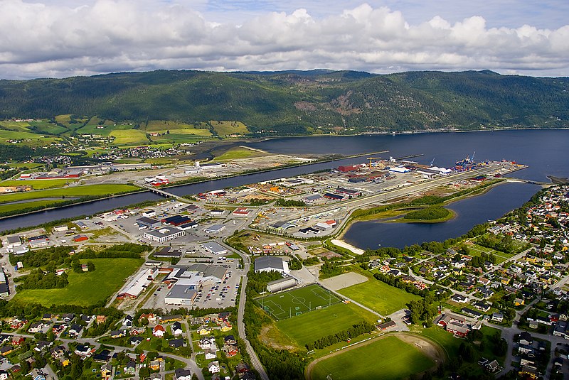
Orkanger with the Orkla river At the time of its dissolution in 2020, the 594-square-kilometre (229 sq mi) municipality was the 188th largest by area out of the 422 municipalities in Norway. Orkdal Municipality was the 96th most populous municipality in Norway with a population of 12,086. The municipality's population density was 20.3 inhabitants per square kilometre (53/sq mi) and its population had increased by 8.3% over the previous 10-year period.
Excerpted from Wikipedia’s “Orkdal Municipality” article, available under the CC BY-SA 4.0 licence.