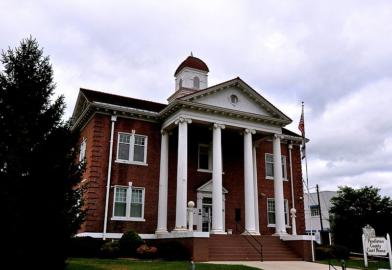
File:Pendleton_County_Courthouse,_West_Virginia.JPG · Wikimedia Commons · See Wikimedia Commons
ペンドルトン郡
Sign in to saveAlso known as Pendleton County, West Virginia, Pendleton County, Virginia, Pendleton County, WV
ウェストバージニア州の郡
Key facts
- Country
- United States
- State
- West Virginia
- Founded
- May 1, 1788
- Named after
- Edmund Pendleton
- Seat
- Franklin
- Largest town
- Franklin
- Total
- 698 sq mi (1,810 km )
- Land
- 696 sq mi (1,800 km )
- Water
- 2.1 sq mi (5.4 km ) 0.3%
- Estimate 2025
- 5,826
- Density
- 8.83/sq mi (3.41/km )
- Time zone
- UTC−5 ( Eastern )
- Summer dst
- UTC−4 ( EDT )
- Congressional district
- 2nd
- Website
- pencowv .com
via Wikipedia infobox
Wikidata facts
- Named after
- Edmund Pendleton
- Country
- United States
- Located in
- Virginia
- Capital
- Franklin
- Population
- 6143
- Area
- 1808
- Elevation
- 667
- Shares border with
- Highland County
- Highest point
- Spruce Knob
- Official website
- www.pendletoncounty.wv.gov
- Image
- Pendleton County Courthouse, West Virginia.JPG
- Households
- 3194
Show 8 more facts
- Commons category
- Pendleton County, West Virginia
- topic's main category
- Category:Pendleton County, West Virginia
- category of associated people
- Category:People from Pendleton County, West Virginia
- different from
- Pendleton County
- water as percent of area
- 0.3
- native label
- Pendleton County
- inception
- 1787-12-04
- per capita income
- 26301
Sources (8)
via Wikidata · CC0
Article · 日本語
ペンドルトン郡(英: Pendleton County)は、アメリカ合衆国ウェストバージニア州の東部に位置する郡である。2010年国勢調査での人口は7,695人であり、2000年の8,196人から6.1%減少した。郡庁所在地は(人口721人)であり、同郡で唯一の法人化町でもある。ペンドルトン郡は1787年にバージニア州議会によって設立され、1788年に有効となった。郡域はバージニア州オーガスタ郡、同ロッキンガム郡とウェストバージニア州ハーディ郡のそれぞれ一部を合わせた。郡名はバージニア州の高名な政治家かつ法律家だったエドモンド・ペンドルトン(1721年-1803年)に因んで名付けられた。 郡内にあるスプルースノブがアリゲイニー山地とウェストバージニア州で最高地点であり、標高は4,863フィート (1,482 m) である。モノンガヘラ国立の森とジョージ・ワシントン国立の森も郡内に入っている。
Abstract from DBpedia / Wikipedia · CC BY-SA