
File:Piracicaba.jpg · Wikimedia Commons · See Wikimedia Commons
Piracicaba
Sign in to savePiracicaba ( ) is a Brazilian municipality located in the interior of São Paulo state, in the Southeast Region of Brazil. It serves as the main city of the Metropolitan Region of Piracicaba (RMP) and is situated approximately northwest of the state capital, São Paulo. Covering an area of just over , with around classified as urban area, Piracicaba has a population of 438,827 inhabitants, making it the 13th most populous municipality in São Paulo state.
Key facts
- Settlement.name
- Piracicaba
- Settlement.official_name
- Municipality of Piracicaba
- Settlement.settlement_type
- Municipality
- Settlement.image_shield
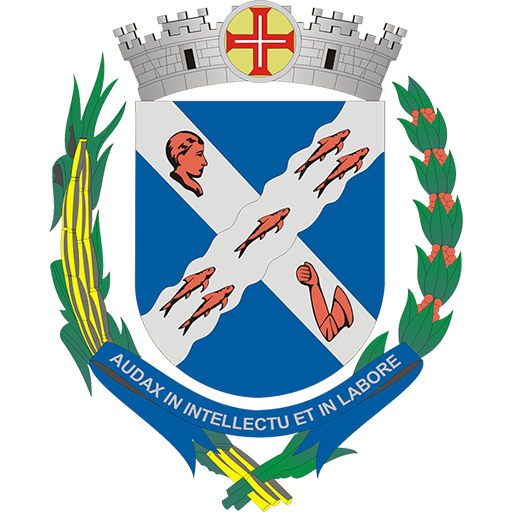
- Brasão de Piracicaba - SP.svg
- Settlement.image_flag
- Bandeira de Piracicaba - SP.svg
- Settlement.image_map
- SaoPaulo Municip Piracicaba.svg
- Settlement.map_caption
- Location in São Paulo
- Settlement.motto
- Audax in intellectu et in labore (Latin)Audacious in intelligence and at work
- Settlement.subdivision_type
- Country
- Settlement.subdivision_name
- Brazil
- Settlement.subdivision_type1
- Region
- Settlement.subdivision_name1
- Southeast
- Settlement.subdivision_type2
- State
- Settlement.subdivision_name2
- São Paulo
- Settlement.subdivision_type3
- Mesoregion
- Settlement.subdivision_type4
- Microregion
- Settlement.subdivision_type5
- Metrop. region
- Settlement.leader_party
- PSD
via Wikipedia infobox
Official website
Portal do Município de Piracicaba – O Portal do Município de Piracicaba é um site oficial da prefeitura que oferece uma ampla gama de serviços e informações para cidadãos, empresas e turistas.
O Portal do Município de Piracicaba é um site oficial da prefeitura que oferece uma ampla gama de serviços e informações para cidadãos, empresas e turistas.
piracicaba.sp.gov.br →Link to the official site · 18,929 chars · not written by Vinony
Wikidata facts
- Instance of
- big city
- Official name
- Piracicaba
- Demonym
- piracicabano
- Country
- Brazil
- Located in
- São Paulo
- Population
- 283833
- Area
- 1378.069
- Elevation
- 472
- Shares border with
- Santa Maria da Serra
- Official website
- www.piracicaba.sp.gov.br
- Image
- Piracicaba (3).jpg
- Dialing code
- 19
- Significant event
- town privileges
Show 10 more facts
- P12749
- province of Turkey
- category for people born here
- Category:Births in Piracicaba
- topic's main category
- Category:Piracicaba
- Commons category
- Piracicaba
- inception
- 1767-01-01
- category of associated people
- Category:People from Piracicaba
- Human Development Index
- 0.785
- native label
- Piracicaba
- electorate
- 298889
- twinned administrative body
- Santa Ana
Sources (6)
via Wikidata · CC0
~65 min read
Encyclopedic overview
37 sectionsContents
- Etymology
- History
- Pre-colonial period
- Settlement and creation of the municipality
- 20th and 21st centuries
- Geography
- Geomorphology and hydrography
- Climate
- Environment
- Demography
- Poverty and inequality
- Religion
- Roman Catholic Church
- Protestant churches
- Ethnic composition
- Politics and administration
- Subdivisions
- Economy
- Urban infrastructure
- Healthcare
- Education
- Science and technology
- Public safety and crime
- Housing, services, and communication
- Transport
- Culture
- Performing arts
- Cultural, architectural, and natural attractions
- Sports
- Media
- Holidays
- Notable people
- Sister cities
- See also
- Notes
- References
- External links
Piracicaba ( ) is a Brazilian municipality located in the interior of São Paulo state, in the Southeast Region of Brazil. It serves as the main city of the Metropolitan Region of Piracicaba (RMP) and is situated approximately northwest of the state capital, São Paulo. Covering an area of just over , with around classified as urban area, Piracicaba has a population of 438,827 inhabitants, making it the 13th most populous municipality in São Paulo state.
Established in 1767 along the banks of the Piracicaba River, a vital water source for the region, Piracicaba saw significant agricultural development during the 19th century, particularly in sugarcane and coffee cultivation. However, the early 20th century brought economic decline due to the collapse of the coffee cycle and falling sugar prices, a situation that persisted until the onset of industrialization.
Excerpted from Wikipedia’s “Piracicaba” article, available under the CC BY-SA 4.0 licence.
Gallery (53)
On the map
3 mapped locations