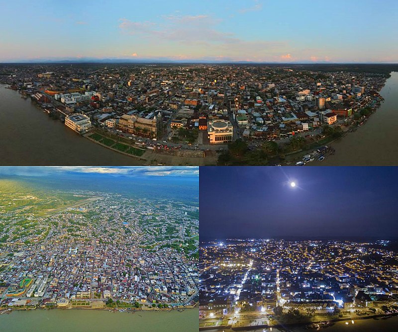
File:Ciudad_de_Quibdo.jpg · Wikimedia Commons · See Wikimedia Commons
Quibdó
Sign in to saveQuibdó () is the capital city of Chocó Department, in the Pacific Region of Colombia, and is located on the Atrato River. The municipality of Quibdó has an area of and a population of 129,237, predominantly Afro Colombian, including Zambo Colombians.
Key facts
- Settlement.name
- Quibdó
- Settlement.type
- Municipality and town
- Settlement.image_skyline
- Ciudad de Quibdo.jpg
- Settlement.imagesize
- 270px
- Settlement.image_caption
- Aerial views
- Settlement.image_flag
- Flag of Quibdó.svg
- Settlement.image_seal
- Escudo de quibdo.jpg
- Settlement.image_map
- Colombia - Chocó - Quibdó.svg
- Settlement.mapsize
- 250px
- Settlement.pushpin_map
- Colombia
- Settlement.pushpin_map_caption
- Location in Colombia
- Settlement.pushpin_relief
- yes
- Settlement.pushpin_label_position
- left
- Settlement.subdivision_type
- Country
- Settlement.subdivision_type1
- Region
- Settlement.subdivision_name1
- Pacific Region
- Settlement.subdivision_type2
- Department
- Settlement.subdivision_name2
- Chocó Department
via Wikipedia infobox
Wikidata facts
- Instance of
- big city
- Country
- Colombia
- Located in
- Chocó Department
- Population
- 130825
- Area
- 3337.5
- Elevation
- 43
- Body of water
- Atrato River
- Capital of
- Chocó Department
- Shares border with
- Alto Baudó
- Official website
- www.quibdo-choco.gov.co/index.shtml
- Image
- Ciudad de Quibdo.jpg
- Dialing code
- 4
- Patron saint
- Francis of Assisi
Show 6 more facts
- topic's main category
- Category:Quibdó
- Commons category
- Quibdó
- category for people born here
- Q9226630
- category of associated people
- Category:People from Quibdó
- inception
- 1648-00-00
- postal code
- 270009
Sources (9)
via Wikidata · CC0
~5 min read
Encyclopedic overview
8 sectionsContents
- History
- Climate
- Transportation
- Notable residents
- Gallery
- See also
- References
- External links
Quibdó () is the capital city of Chocó Department, in the Pacific Region of Colombia, and is located on the Atrato River. The municipality of Quibdó has an area of and a population of 129,237, predominantly Afro Colombian, including Zambo Colombians.
==History== In prehistoric times, the Chocó rainforest and mountains constituted a major barrier dividing the Mesoamerican and Andean civilizations. The high rainfall and the extremely humid climate did not attract the Spanish colonists. The Emberá people ceded much of their territory to the Spanish Franciscan order in 1648. Subsequent attacks on colonial outposts by hostile tribes discouraged attempts at settlement. Six years later, the Spanish began again to colonize the region, eventually establishing some lumber camps and plantations where they used enslaved Africans as workers.
Excerpted from Wikipedia’s “Quibdó” article, available under the CC BY-SA 4.0 licence.
Gallery (10)
On the map
3 mapped locations