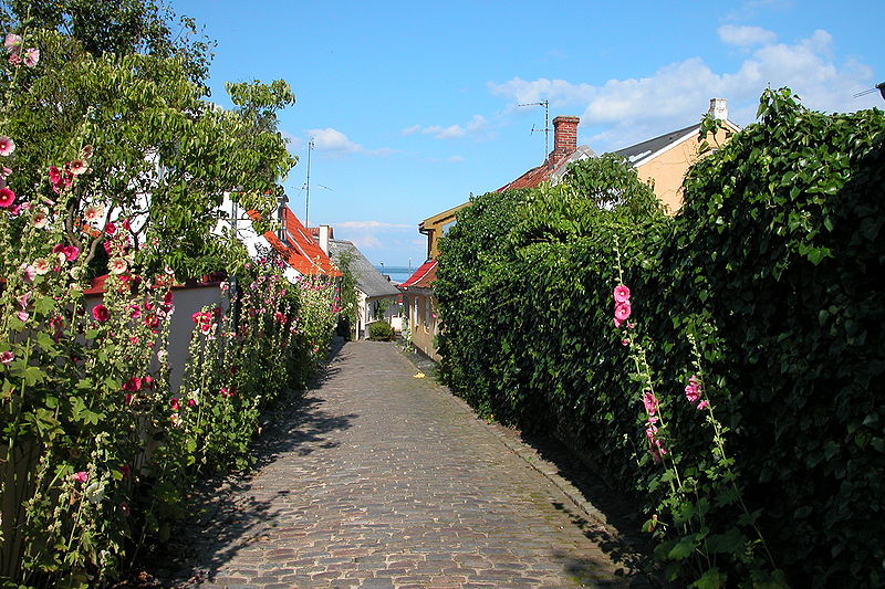
File:Marstal_Ærø.jpg · Wikimedia Commons · See Wikimedia Commons
thumb|Map of 1665 Ærø () is one of the Danish Baltic Sea islands, and part of the Southern Denmark Region.
Key facts
- Islands.name
- Ærø
- Islands.image_name
- Marstal Ærø.jpg
- Islands.image_caption
- Marstal, largest town on the island
- Islands.map_image
- Denmark location aero.svg
- Islands.location
- Baltic Sea
- Islands.area_km2
- 88
- Islands.country
- Denmark
- Islands.country_admin_divisions_title
- Region
- Islands.country_admin_divisions
- South Denmark Region
- Islands.country_admin_divisions_title_1
- Municipality
- Islands.country_admin_divisions_1
- Ærø Municipality
- Islands.country_largest_city
- Marstal
- Islands.country_largest_city_population
- 2,111
- Islands.population
- 5,956
- Islands.population_as_of
- 2020
- Islands.density_km2
- 67
via Wikipedia infobox
Wikidata facts
- Instance of
- island
- Part of
- South Funen Archipelago
- Country
- Denmark
- Located in
- Ærø Municipality
- Population
- 6170
- Area
- 88
- Body of water
- South Funen Archipelago
- Image
- Arroe by Blaeu 1665 (cropped).jpg
- Width
- 6
- Length
- 30
- Flag
- Flagge Ærøs
Show 4 more facts
- Commons category
- Ærø
- described by source
- Brockhaus and Efron Encyclopedic Dictionary
- Commons gallery
- Ærø
- different from
- Ærø Municipality
Sources (2)
via Wikidata · CC0
~9 min read
Encyclopedic overview
10 sectionsContents
- Geography
- History
- Politics
- Renewable energy and technology
- Transport
- Notable residents
- Cultural references
- See also
- References
- External links
thumb|Map of 1665 Ærø () is one of the Danish Baltic Sea islands, and part of the Southern Denmark Region.
Since 1 January 2006 all of Ærø has constituted a single municipality, known as Ærø Kommune. Before that date, there were two municipalities on the island: Ærøskøbing Kommune in the west and Marstal Kommune in the east. This merger was part of a reform of the public sector with the laws being effective as of 26 June 2005. This merger was allowed to happen one year before the other municipalities merged as there had already been an island-wide referendum with a majority of voters for the merger.
Excerpted from Wikipedia’s “Ærø” article, available under the CC BY-SA 4.0 licence.
Gallery (24)
On the map
3 mapped locations