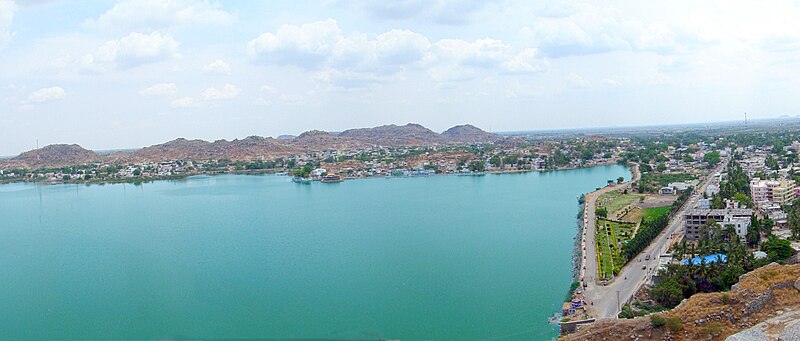
File:Lake_Aam_Talab,_Raichur.jpg · Wikimedia Commons · See Wikimedia Commons
Raichur
Sign in to saveAlso known as Raichuru, Rayachoor, Raichore
Key facts
- Settlement.name
- Raichur
- Settlement.native_name
- Rāyachūru
- Settlement.nickname
- Cotton City
- Settlement.settlement_type
- City
- Settlement.image_skyline
- 300px
- Settlement.image_caption
- Raichur City
- Settlement.map_caption
- Raichur in Karnataka
- Settlement.subdivision_type
- Country
- Settlement.subdivision_type1
- State
- Settlement.subdivision_name1
- Karnataka
- Settlement.subdivision_type3
- District
- Settlement.subdivision_name3
- Raichur
- Settlement.established_date
- 3rd Century BC
- Settlement.governing_body
- Municipal council
- Settlement.unit_pref
- Metric
- Settlement.area_total_km2
- 73.2
- Settlement.elevation_m
- 407
- Settlement.population_total
- 2,34,073
via Wikipedia infobox
Wikidata facts
- Country
- India
- Located in
- Raichur district
- Elevation
- 407
- Time zone
- UTC+05:30
- Capital of
- Raichur district
- Image
- Fort Hill Top.jpg
- Dialing code
- 8532
Show 4 more facts
- postal code
- 584101
- Commons category
- Raichur
- topic's main category
- Category:Raichur
- described by source
- Encyclopædia Britannica 11th edition
Sources (1)
via Wikidata · CC0
~6 min read
Encyclopedic overview
15 sectionsContents
- History
- Ancient History
- Recent History
- Geography
- Demographics
- Languages
- Transport
- Road
- Rail
- Airport
- Education
- Climate
- See also
- References
- External links
Raichur, also pronounced as Rāyachūru (formerly Raichore), is a city and headquarters of eponymous Raichur district in the Karnataka state of India. It is located between Krishna and Tungabhadra rivers.
==History== ===Ancient History=== 200px|thumb|left|Iron Cannon On Hill Top Raichur The recorded history of the district is traced as far back as the third century B.C.E. Three minor rock edicts of Ashoka are found in the district, one at Maski in the Lingasugur taluk and the other two near Koppal, which proves that this area was part of the dominions of the Mauryan emperor Ashoka. At that time, this region was under the governance of a Viceroy or Mahamatra of Ashoka. Thereafter, the district appears to have been a part of the kingdom of the Satavahanas. The Vakatakas, who reigned during the 3rd and 4th centuries CE, seems to have held sway over Raichur for some time, after which it appears to have been included in the Kadamba dominions. The next dynasty of importance, which ruled over this region, was that of the Chalukyas of Badami. According to an inscription from Aihole, Pulakeshin II having defeated the Pallavas, occupied this area and made it a province in his empire under the governance of his son Adityavarma. Later the whole of the present Raichur district was included in the dominions of the Rashtrakutas, who rose to power in the eighth century, as could be gathered from the inscriptions of that period found in this district. According to an inscription from Manvi taluk, Jagattunga, a subordinate ruler under the Rashtrakuta king Krishna-II, was ruling the province of Adedore Eradusavirapranta, i.e., the area constituting the present Raichur district. Amoghavarsha Nrupathunga I, a Rashtrakuta king, has described Koppal in his Kannada work, Kavirajamarga, as the great Kopananagara.
Excerpted from Wikipedia’s “Raichur” article, available under the CC BY-SA 4.0 licence.
Gallery (4)
On the map
4 mapped locations