File:Death-valley-sar.jpg · Wikimedia Commons · See Wikimedia Commons
remote sensing
Sign in to saveAlso known as remote sensing technology
acquisition of information about an object or phenomenon without making physical contact with the object, especially the Earth
Remote sensing is a way of gathering information about something—like the Earth's surface—without actually touching it or being physically present there. It matters because it lets scientists and organizations study large areas quickly and safely, monitoring things like weather patterns, land use, environmental changes, and natural disasters from a distance.
AI-generated from the Wikipedia summary — may contain errors.
Research
29,757 papers- Untethered Micro/Nanorobots for Remote Sensing: Toward Intelligent Platform.ReviewNano-micro letters · 2023Wang Q, Yang S, Zhang LDOI: 10.1007/s40820-023-01261-9
- Remote sensing and modeling fusion for investigating the ecosystem water-carbon coupling processes.ReviewThe Science of the total environment · 2019Sun P, Wu Y, Xiao J et al.DOI: 10.1016/j.scitotenv.2019.134064
- Remote Sensing Techniques for Water Quality Monitoring: A Review.ReviewSensors (Basel, Switzerland) · 2024Jaywant SA, Arif KMDOI: 10.3390/s24248041
- UAV remote sensing applications in marine monitoring: Knowledge visualization and review.ReviewThe Science of the total environment · 2022Yang Z, Yu X, Dedman S et al.DOI: 10.1016/j.scitotenv.2022.155939
- Optical Remote Sensing in Provisioning of Ecosystem-Functions Analysis-Review.ReviewSensors (Basel, Switzerland) · 2023Vyvlečka P, Pechanec VDOI: 10.3390/s23104937
- Remote Sensing Approaches for Meteorological Disaster Monitoring: Recent Achievements and New Challenges.ReviewInternational journal of environmental research and public health · 2022Ye PDOI: 10.3390/ijerph19063701
- Remote sensing for mapping algal blooms in freshwater lakes: a review.ReviewEnvironmental science and pollution research international · 2023Rolim SBA, Veettil BK, Vieiro AP et al.DOI: 10.1007/s11356-023-25230-2
- Remote sensing and GIS applications for municipal waste management.ReviewJournal of environmental management · 2019Singh ADOI: 10.1016/j.jenvman.2019.05.017
via PubMed
Described at
Fernerkundung (FE) - Lexikon der Fernerkundung
fe-lexikon.info →Link to a page describing this subject · 3,963 chars · not written by Vinony
Wikidata facts
- Image
- Remote Sensing Illustration.jpg
Show 2 more facts
- Commons category
- Remote sensing
- described at URL
- www.fe-lexikon.info/lexikon/fernerkundung
via Wikidata · CC0
~33 min read
Article
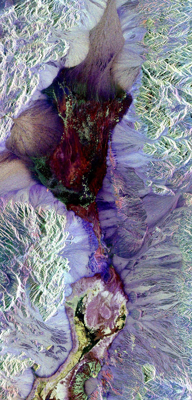
Synthetic aperture radar image of Death Valley colored using polarimetry
Remote sensing is the acquisition of information about an object or phenomenon without making physical contact with the object, in contrast to in situ or on-site observation. The term is applied especially to acquiring information about Earth and other planets. Remote sensing is used in numerous fields, including geophysics, geography, land surveying and most Earth science disciplines (e.g. exploration geophysics, hydrology, ecology, meteorology, oceanography, glaciology, geology). It also has military, intelligence, commercial, economic, planning, and humanitarian applications, among others.
Gallery (8)
Available in 64 languages
- Español
- Français
- Deutsch
- 中文
- 日本語
- Русский
- Português
- Italiano
- العربية
- हिन्दी
- Aragonese
- Armenian
- Assamese
- Asturian
- Awadhi
- Azerbaijani
- Bahasa Indonesia
- Bangla
Show 45 more
- Basque
- Belarusian
- Bhojpuri
- Bosnian
- Bulgarian
- Catalan
- Croatian
- Czech
- Danish
- Esperanto
- Estonian
- Finnish
- Galician
- Greek
- Hebrew
- Hungarian
- Icelandic
- Irish
- Kazakh
- Lithuanian
- Luxembourgish
- Malay
- Malayalam
- Minangkabau
- Nederlands
- Nepali
- Norwegian
- Occitan
- Polski
- Romanian
- Serbian
- Serbian (Latin)
- Sinhala
- Slovak
- Svenska
- Tamil
- Telugu
- Tiếng Việt
- Türkçe
- Ukrainian
- Wu Chinese
- zh_yue
- فارسی
- ไทย
- 한국어
via Wikidata sitelinks · CC0