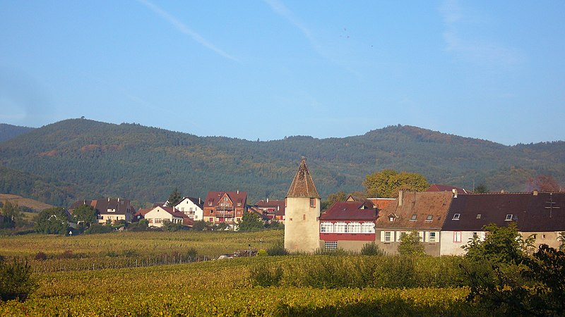
File:Saint-Hippolyte_007.JPG · Wikimedia Commons · See Wikimedia Commons
Saint-Hippolyte
Sign in to savecommune in Haut-Rhin, France
OverviewAI-generated
Saint-Hippolyte is a commune in France, situated within the Grand Est region. It lies in the canton of Ribeauvillé, the arrondissement of Colmar-Ribeauvillé, and the Upper Alsace area. The municipality shares borders with Zellenberg, Ribeauvillé, Bergheim, and Rorschwihr. Its postal code is 68590, and it is located within the Ballons des Vosges Regional Natural Park.
The commune covers an area of 17.86 square kilometers and has an elevation of 731 meters above sea level. Population figures vary by source, with one listing 1,029 residents (501 male and 465 female) and another citing 1,107. The associated electoral district is the canton of Sainte-Marie-aux-Mines.
Synthesized by Vinony from 36 facts across 6 sources: Wikidata, Openweathermap, OpenStreetMap, GeoNames, Vinony graph, Geo. Generated from structured data (not the Wikipedia text) and checked against those facts — may still contain errors.
Weather now
cached 16h ago7-day forecast
via Open-Meteo
Place details
- Locality
- Saint-Hippolyte
- Region
- Grand Est
- Country
- France
- Population
- 1,107
via OpenStreetMap · GeoNames
Key facts
- Country
- France
- Region
- Grand Est
- Department
- Haut-Rhin
- Arrondissement
- Colmar-Ribeauvillé
- Canton
- Sainte-Marie-aux-Mines
- Intercommunality
- Pays de Ribeauvillé
- Mayor 2020 2026
- Claude Huber
- Area
- 17.86 km (6.90 sq mi)
- Density
- 51.9/km (134/sq mi)
- Time zone
- UTC+01:00 ( CET )
- Summer dst
- UTC+02:00 ( CEST )
- Insee postal code
- 68296 /68590
- Elevation
- 170–731 m (558–2,398 ft)
via Wikipedia infobox
Wikidata facts
- Instance of
- commune of France
- Official name
- Saint-Hippolyte
- Country
- France
- Located in
- arrondissement of Ribeauvillé
- Continent
- Europe
- Population
- 927
- Area
- 17.86
- Elevation
- 346
- Time zone
- UTC+02:00
- Shares border with
- Guémar
- Official website
- www.saint-hippolyte-alsace.fr
- Image
- Saint-Hippolyte 039.JPG
Show 9 more facts
- Commons category
- Saint-Hippolyte (Haut-Rhin)
- postal code
- 68590
- different from
- Saint-Hippolyte
- associated electoral district
- canton of Sainte-Marie-aux-Mines
- male population
- 501
- female population
- 465
- located in protected area
- Ballons des Vosges Regional Natural Park
- email address
- mailto:[email protected]
- phone number
- +33-3-89-73-00-13
via Wikidata · CC0
~22 min read
Encyclopedic overview
Saint-Hippolyte ( French pronunciation: [sɛ̃.t‿ipɔlit] ; German: Sankt Pilt; Alsatian: Sàmpìlt) is a commune in the Haut-Rhin department in Grand Est in north-eastern France.
It is often said to be the birthplace of the 8th-century saint and abbot, Fulrad, who built a monastery there. Saint-Hippolyte is situated very close to the highly strategic castle of Haut-Koenigsbourg, and for many centuries the conflict centred on possession of the castle had a great influence, mostly destructive, on the history of the town.
Excerpted from Wikipedia’s “Saint-Hippolyte” article, available under the CC BY-SA 4.0 licence.