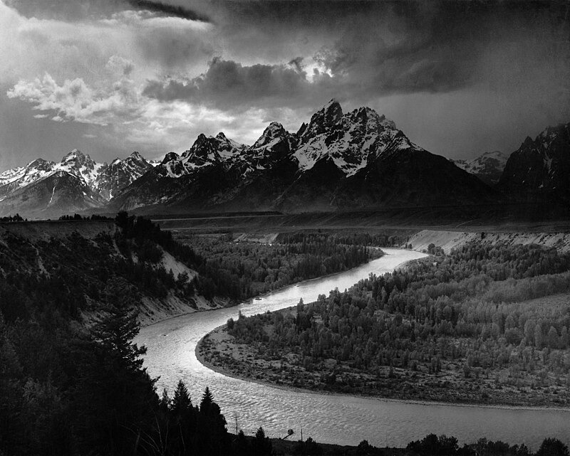
File:Adams_The_Tetons_and_the_Snake_River.jpg · Wikimedia Commons · See Wikimedia Commons
Snake River
Sign in to saveAlso known as Great Snake River, Kimeonim, Kimooenim, Kooskooskee River, Lewis Fork, Lewis River, Lewis and Clark's River, Louis River
major tributary of the Columbia River in the northwestern United States
The Snake River is a major tributary that flows into the Columbia River in the northwestern United States. It matters because it is one of the Columbia River's most important tributaries, playing a significant role in the region's water systems.
AI-generated from the Wikipedia summary — may contain errors.
Wikidata facts
- Instance of
- river
- Has part
- Shoshone Falls
- Country
- United States
- Located in
- Idaho
- Image
- U.S. Highway 93 bridge from within Snake River Canyon.jpeg
- Length
- 1735
Show 11 more facts
- Commons category
- Snake River
- mouth of the watercourse
- Columbia River
- topic's main category
- Category:Snake River
- category for the water basin
- Category:Snake River Basin
- described by source
- The Nuttall Encyclopædia
- Commons gallery
- Snake River
- watershed area
- 278450
- discharge
- 1550
- origin of the watercourse
- Yellowstone National Park
- basin country
- Wyoming
- Digital Atlas of Idaho URL
- digitalatlas.cose.isu.edu/geog/fishery/drainage/drain5.htm
via Wikidata · CC0
~40 min read
Encyclopedic overview
The Snake River is a major river in the interior Pacific Northwest region of the United States. About 1,080 miles (1,740 km) long, it is the largest tributary of the Columbia River, which is the largest North American river that empties into the Pacific Ocean. Beginning in Yellowstone National Park, western Wyoming, it flows across the arid Snake River Plain of southern Idaho, the rugged Hells Canyon on the borders of Idaho, Oregon and Washington, and finally the rolling Palouse Hills of southeast Washington. It joins the Columbia River just downstream from the Tri-Cities, Washington, in the southern Columbia Basin.
The river's watershed, which drains parts of six U.S. states, is situated between the Rocky Mountains to the north and east, the Great Basin to the south, and the Blue Mountains and Oregon high desert to the west. The region has a long history of volcanism; millions of years ago, Columbia River basalts covered vast areas of the western Snake River watershed, while the Snake River Plain was a product of the Yellowstone volcanic hotspot. The river was further altered by catastrophic flooding in the most recent Ice Age, which created such features as the Snake River Canyon and Shoshone Falls.
Excerpted from Wikipedia’s “Snake River” article, available under the CC BY-SA 4.0 licence.
Gallery (12)
On the map
14 mapped locations
Available in 59 languages
- Español
- Français
- Deutsch
- 中文
- 日本語
- Русский
- Português
- Italiano
- العربية
- Afrikaans
- Armenian
- azb
- Bahasa Indonesia
- Bangla
- Basque
- Belarusian
- Breton
- Bulgarian
Show 40 more
- Catalan
- Cebuano
- Chuvash
- Croatian
- Czech
- Danish
- Egyptian Arabic
- Esperanto
- Finnish
- Galician
- Greek
- Haitian Creole
- Hebrew
- Kazakh
- Kurdish
- Latin
- Latvian
- Lithuanian
- Malay
- Mingrelian
- Nederlands
- Norwegian
- Polski
- Romanian
- Scots
- Serbian
- Serbian (Latin)
- simple
- Slovenian
- Svenska
- Swahili
- Tiếng Việt
- Toki Pona
- Türkçe
- Ukrainian
- Urdu
- Uzbek
- Western Frisian
- فارسی
- 한국어
via Wikidata sitelinks · CC0