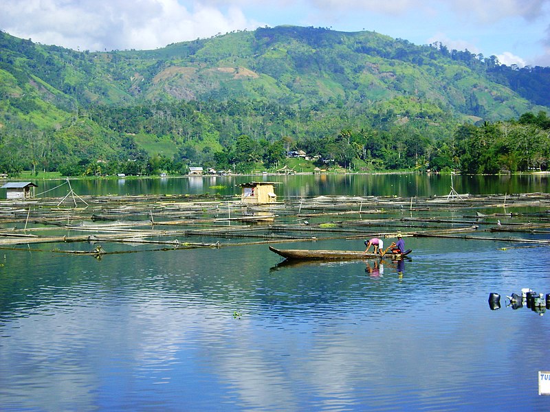
File:Lake_Sebu.JPG · Wikimedia Commons · See Wikimedia Commons
Key facts
- Jawi
- سلاتن كوتوات
- Country
- Philippines
- Region
- Soccsksargen
- Founded
- July 18, 1966
- Capital
- Koronadal
- Largest city
- General Santos *
- Type
- Sangguniang Panlalawigan
- Governor
- Reynaldo S. Tamayo Jr. ( PFP )
- Vice governor
- Arthur Y. Pingoy Jr. ( PFP )
- Legislature
- South Cotabato Provincial Board
- Total
- 3,935.95 km (1,519.68 sq mi)
- Rank
- 32nd out of 82
- Highest elevation mount matutum
- 2,286 m (7,500 ft)
- Density
- 256.611/km (664.620/sq mi)
- Demonym s
- South Cotabatnon , South Cotabateño
- Independent cities
- 1 General Santos *
- Component cities
- 1 Koronadal
- Municipalities
- 10 Banga Lake Sebu Norala Polomolok Santo Niño Surallah T'Boli Tampakan Tantangan Tupi
via Wikipedia infobox
Wikidata facts
- Instance of
- province of the Philippines
- Official name
- Kapuudan ka Cotabato Nabagatnan
- Country
- Philippines
- Located in
- Soccsksargen
- Contains
- Santo Niño
- Capital
- Koronadal
- Population
- 1010009
- Area
- 3935.95
- Time zone
- UTC+08:00
- Shares border with
- Sultan Kudarat
- Official website
- www.southcotabato.gov.ph
- Households
- 244987
- Dialing code
- 83
Show 12 more facts
- inception
- 1966-07-18
- topic's main category
- Category:South Cotabato
- postal code
- 9500–9513
- Commons category
- South Cotabato
- Köppen climate classification
- tropical rainforest climate
- electorate
- 997821
- language used
- Cebuano
- poverty incidence
- 12.80
- total assets
- 7878738203.85
- fiscal/tax revenue
- 3130371066.48
- total liabilities
- 1355957161.27
- total expenditure
- 2263050983.19
Sources (15)
via Wikidata · CC0
~16 min read
Encyclopedic overview
South Cotabato, officially the Province of South Cotabato, is a province in the Philippines located in the Soccsksargen region in Mindanao. Its capital is Koronadal (also the regional center of Soccsksargen), and it borders Sultan Kudarat to the north and west, Sarangani to the south and northeast, and Davao del Sur to the far northeast. To the southeast lies Sarangani Bay.
General Santos, the only coastal city/town located on the shores of Sarangani Bay, is the largest city in both the province and the region (by population), but is governed independently from the province. The province of Sarangani used to be part of South Cotabato until it was made an independent province in 1992.
Excerpted from Wikipedia’s “South Cotabato” article, available under the CC BY-SA 4.0 licence.
Gallery (12)
On the map
13 mapped locations