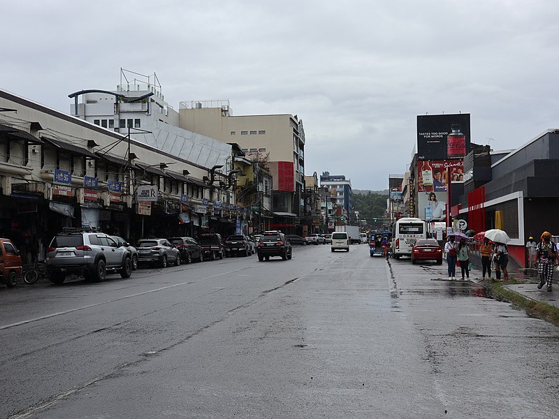
File:Tacloban_downtown,_Avenida_Rizal_(Tacloban,_Leyte;_09-08-2022).jpg · Wikimedia Commons · See Wikimedia Commons
تاکلوبان
Sign in to saveAlso known as Tacloban City, City of Tacloban, Tacloban, Leyte
Tacloban ( ; ), officially the City of Tacloban (; ), is a highly urbanized city on Leyte island in the Eastern Visayas region of the Philippines. According to the 2024 census, Tacloban has a population of 259,353, making it the most populous city in the Eastern Visayas. The city is located southeast of Manila.
Tacloban is a major city located on Leyte island in the Eastern Visayas region of the Philippines, situated southeast of Manila. With a population of 259,353 according to the 2024 census, it is the most populous city in its region.
AI-generated from the Wikipedia summary — may contain errors.
Key facts
- Settlement.image_caption
- From top, left to right: Avenida Rizal, Yolanda Shrine, Santo Niño Church, Justice Romualdez Street, Santo Niño Shrine and Heritage Museum, Prince Mansion, and aerial view of Downtown Tacloban
- Settlement.image_flag
- Flag_of_Tacloban,_Leyte.png
- Settlement.flag_size
- 120x80px
- Settlement.image_seal
- Tacloban City Seal.png
- Settlement.seal_size
- 100x80px
- Settlement.mapframe
- yes
- Settlement.pushpin_map
- Visayas#Philippines
- Settlement.pushpin_label_position
- right
- Settlement.pushpin_map_caption
- Location within the
- Settlement.subdivision_type
- Country
- Settlement.subdivision_name
- Philippines
- Settlement.subdivision_type1
- Region
- Settlement.subdivision_type2
- Province
- Settlement.subdivision_name2
- Leyte
- Settlement.motto
- City of Love, Beauty and Progresses
- Settlement.subdivision_type3
- District
- Settlement.established_title
- Founded
- Settlement.established_date
- 1770
via Wikipedia infobox
Wikidata facts
- Official name
- City of Tacloban
- Demonym
- Taclobanon
- Country
- Philippines
- Located in
- Leyte
- Population
- 259353
- Area
- 201.72
- Elevation
- 40
- Capital of
- Leyte
- Shares border with
- San Miguel
- Official website
- www.tacloban.gov.ph
- Image
- Tacloban, Philippines.jpg
- Households
- 57251
- Dialing code
- 53
Show 14 more facts
- twinned administrative body
- Fukuyama
- Commons category
- Tacloban
- topic's main category
- Category:Tacloban
- postal code
- 6500
- inception
- 2008-12-18
- Köppen climate classification
- tropical rainforest climate
- language used
- Tagalog
- poverty incidence
- 10.70
- electorate
- 146293
- described by source
- New International Encyclopedia
- total assets
- 4723376517.72
- total expenditure
- 1441460475.78
- total liabilities
- 4259125546.92
- fiscal/tax revenue
- 1914530137.51
Sources (15)
via Wikidata · CC0
Gallery (38)
On the map
Available in 76 languages
- Español
- Français
- Deutsch
- 中文
- 日本語
- Русский
- Português
- Italiano
- العربية
- Afrikaans
- Albanian
- Amharic
- Aragonese
- Bahasa Indonesia
- Basque
- Bikol
- Bulgarian
- Catalan
Show 57 more
- cbk_zam
- Cebuano
- Chuvash
- Croatian
- Czech
- Esperanto
- Estonian
- Faroese
- Filipino
- Finnish
- Galician
- Georgian
- Greek
- Gujarati
- Hebrew
- Hungarian
- Ido
- Iloko
- Interlingua
- Javanese
- Latin
- Latvian
- Lithuanian
- Lombard
- Low German
- Macedonian
- Malay
- Nederlands
- Norwegian
- Occitan
- Ossetic
- Pampanga
- Pangasinan
- Piedmontese
- Polski
- Romanian
- Scottish Gaelic
- Serbian
- Serbian (Latin)
- simple
- Sundanese
- Svenska
- Tatar
- Tiếng Việt
- Türkçe
- Turkmen
- Ukrainian
- Urdu
- Volapük
- Walloon
- Waray
- Wu Chinese
- Yiddish
- zh_yue
- فارسی
- ไทย
- 한국어
via Wikidata sitelinks · CC0