File:Torre_vigía_en_Torrelodones.jpg · Wikimedia Commons · See Wikimedia Commons
Torrelodones
Sign in to saveTorrelodones is a municipality in the northwest of the Autonomous Community of Madrid, Spain. It is situated 29 kilometers northwest from the city of Madrid. Because of its location between the Sierra de Guadarrama and the metropolitan area of the capital, it is linked to two districts in Madrid: the agricultural area of Guadarrama and the metropolitan area of Madrid.
Key facts
- Settlement.official_name
- Torrelodones
- Settlement.nickname
- Torre
- Settlement.settlement_type
- Municipality
- Settlement.image_skyline
- Torre vigía en Torrelodones.jpg
- Settlement.image_alt
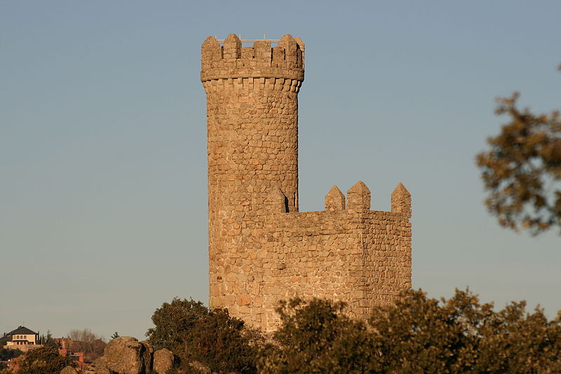
- Small stone watchtower on a hill, with a clear blue sky on the background
- Settlement.image_caption
- Watchtower of Torrelodones, gives the name to the municipality
- Settlement.image_flag
- Bandera de Torrelodones.svg
- Settlement.flag_alt
- A two color flag, divided equally in two, with the top left side blue and de bottom right yellow. The coat of arms is on the middle.
- Settlement.image_shield
- Coat of Arms of Torrelodones.svg
- Settlement.shield_alt
- A shield with a crown on top. The shield is divided in three parts, having the left part an image of the watchtower of Torrelodones, colored blue with a white background, the right side has two dragon looking yellow creatures facing each other over a blue background, and on the bottom part is a small green three with red fruits over a white background
- Settlement.image_map
- Torrelodones_en_la_Comunidad_de_Madrid.png
- Settlement.map_caption
- Location in the Community of Madrid, Spain
- Settlement.pushpin_map
- Spain Community of Madrid#Spain
- Settlement.coor_pinpoint
- Town Hall
- Settlement.subdivision_type
- Country
- Settlement.subdivision_name
- Spain
- Settlement.subdivision_type1
- Autonomous community
- Settlement.subdivision_name1
- Community of Madrid
via Wikipedia infobox
Wikidata facts
- Instance of
- municipality of Spain
- Official name
- Torrelodones
- Country
- Spain
- Located in
- Community of Madrid
- Continent
- Europe
- Population
- 25433
- Area
- 21
- Elevation
- 844
- Time zone
- UTC+02:00
- Shares border with
- Fuencarral-El Pardo
- Official website
- www.torrelodones.es
- Image
- Torrelodones. Plaza de la Constitución.jpg
- Licence plate code
- M
- Patron saint
- Mary
Show 7 more facts
- Commons category
- Torrelodones
- postal code
- 28250
- P8168
- Re-union
- twinned administrative body
- Grodzisk Wielkopolski
- Commons gallery
- Torrelodones
- male population
- 11465
- female population
- 12252
via Wikidata · CC0
~10 min read
Encyclopedic overview
13 sectionsContents
- Symbols
- Urban geography
- Boundaries
- Towns
- Urban habitat
- Climate
- Flora
- Wildlife
- Birds
- Mammals
- Reptiles and amphibians
- Invertebrates
- References
Torrelodones is a municipality in the northwest of the Autonomous Community of Madrid, Spain. It is situated 29 kilometers northwest from the city of Madrid. Because of its location between the Sierra de Guadarrama and the metropolitan area of the capital, it is linked to two districts in Madrid: the agricultural area of Guadarrama and the metropolitan area of Madrid.
It lies at an average altitude of 845 meters. According to the 2022 census, 24,775 people live in the municipality, distributed among seven towns.
Excerpted from Wikipedia’s “Torrelodones” article, available under the CC BY-SA 4.0 licence.
Gallery (20)
On the map
2 mapped locations